|
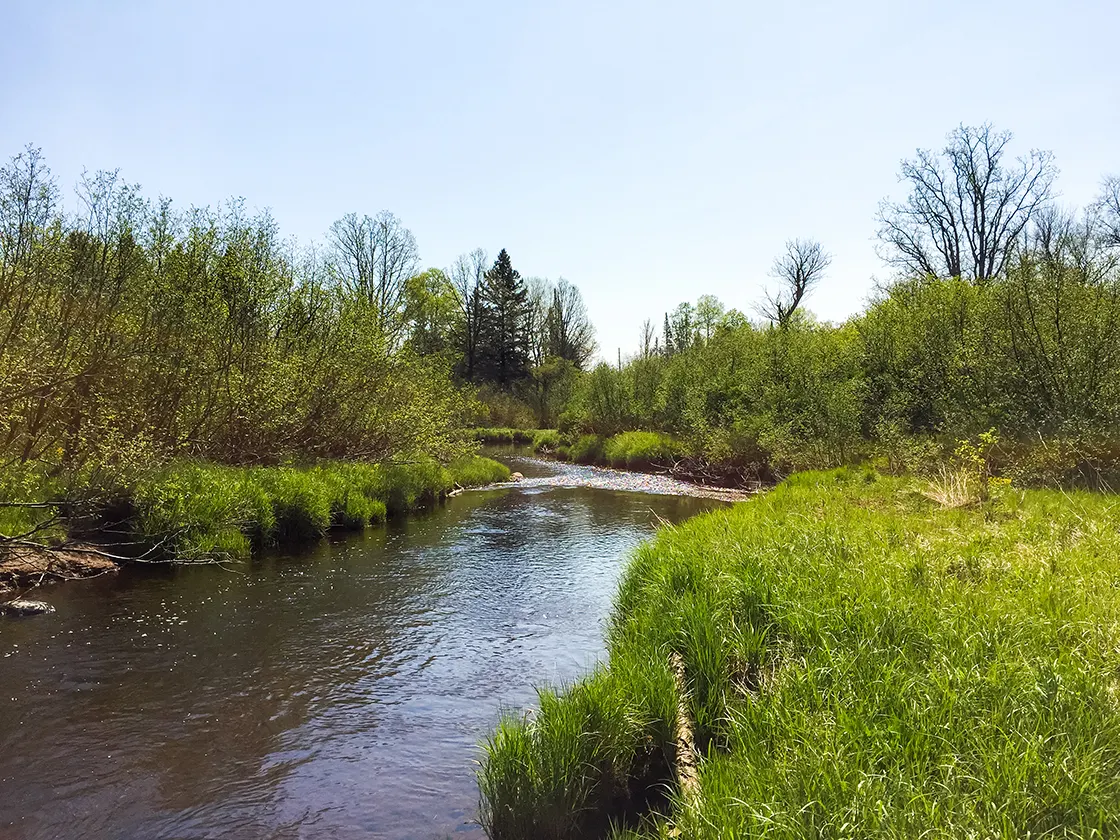
| Along the New Wood River on the Averill-Kelly Creek Wilderness Segment of the Ice Age National Trail |
The Averill Kelly Creek trail is a 4.5-mile segment of the Ice Age National Scenic Trail near Merrill WI. This trail is moderately difficult, without major hill climbs, but at times can become difficult. There are several swampy areas where the footpath becomes invisible. There are three stream/river crossings which require rock hops or fording.
This lightly traveled trail crosses through a privately held wilderness that is the home of the Averill-Kelly Gray Wolf Pack. Wolves, black bear, white tailed deer, and many other forest animals frequently haunt this area of trail. Standard wilderness hiking precautions are advised.
{tocify} $title={Table of Contents}
$ads={1}
advertisement

|
| Swampy sections of the Averill-Kelly Creek Wilderness Segment of the Ice Age National Trail |
I hope that my photos tell a thousand words about this trail. It is dense. Visually textured. Wet. Hot. Thick. A mosquito hell. A wood tick haven. Packed with large predators. You get the idea. This isn't a length of trail that people hike because of its scenic wonders or photogenic vistas. It is a length of trail that you must hike if you are through hiking or section hiking the complete Ice Age Trail.
In autumn this trail might be much better received. In winter it might be beautiful. But, in late spring and summer it is battle between hikers and the swarms of bugs which intend to devour all warm-blooded animals who enter this wilderness.
Aside from my complaints, there are a few highlights. There are two creek crossings and one river ford. The creek crossings may normally be jumped, or rock hopped. And crossing the gentle New Wood River is just deep enough that it is worth taking off the hiking shoes. Pack in sandals for the river ford if you are doing this as an out-and-back.
Wisconsin trails are usually so overbuilt that WI hikers don't often get a chance to be forced into fording a river - so it is an exciting change of pace on this trail. I propose the Ice Age Trail could add hundreds of miles of footpath if they didn't try to bridge every small creek.
But boardwalks over bogs, that's an amenity I longed for as I hiked the outwash area of the Kelly and Averill Creek. The swampy areas slowed my hike down to less than 1 mile per hour. However, much the Averill-Kelly Creek Wilderness Segment traverses a retired railbed where it was easy to pack in more miles quickly.
This trail is not like hiking the mild and heavily trafficked trails of southern Wisconsin, it is like hiking the wilderness trails of northern Wisconsin; and that makes even these flat and average miles at Averill Kelly pretty awesome.
This trail segment is on privately held hunting property and is closed for the entire November gun hunt. Also, portions of this trail area closed from October through December.

|
| Along the New Wood River on the Averill-Kelly Creek Wilderness Segment of the Ice Age National Trail |
Overview: Ice Age National Scenic Trail - Averill-Kelly Creek Wilderness Segment
COUNTYLINCOLN COUNTY
COMMUNITIES
MERRILL, IRMA
TOTAL MILES
4.5-MILE POINT-TO-POINT
DIFFICULTY
MODERATE
LOWEST ELEVATION
1360 AMSL
HIGHEST ELEVATION
1525 AMSL
TOTAL ELEVATION GAIN
377 FT
TOTAL ELEVATION LOST
-311 FT
CAMPING
Rustic camping anywhere in Lincoln County Forest across Burma Road from the east trailhead, recommended site in clearing near Turtle Rock trailhead on Burma Road. Absolutely no camping along the Averill-Kelly Creek Wilderness Segment - please be respectful of this private property whose owners so generously provided an easement for this footpath. POINTS OF INTEREST
Kelly Creek, Averill Creek, New Wood River
NEXT IAT SEGMENT EASTBOUND
TURTLE ROCK SEGMENT
NEXT IAT SEGMENT WESTBOUND
NEW WOOD SEGMENT
Directions and Trail Map
DOWNLOAD PRINTABLE PDF USGS TOPOGRAPHIC MAPGRANDFATHER FALLS QUADRANGLE
NATZKE CAMP QUADRANGLE
Click Map Image to load the full interactive map.
If viewing on a mobile device, open the trail map above to load into Google Maps App by touching the expand rectangle in the upper right corner
Nearest Address for your GPS: N5305 Burma Rd, Merrill, WI 54452
| coordinates: 45.288037, -89.888952 |
| From Milwaukee | 3.5 Hours |
| From Madison | 2.75 Hours |
| From Green Bay | 2 Hours |
| From Wausau | 40 Minutes |
| From Minneapolis | 3 Hours |
| From Chicago | 5 Hours |
Photos

|
| Fording the New Wood River on the Averill-Kelly Creek Wilderness Segment of the Ice Age National Trail |

|
| New Wood River crossing Averill-Kelly Creek Wilderness Segment of the Ice Age National Trail |

|
| Averill-Kelly Creek Wilderness Segment of the Ice Age National Trail |

|
| Kelly creek rock hop on the Averill Kelly Creek Wilderness Segment of the Ice Age Trail |

|
| Averill-Kelly Creek Wilderness Segment of the Ice Age National Trail |

|
| New Wood River on the Averill-Kelly Creek Wilderness Segment of the Ice Age National Trail |

|
| Troad hiking on the Averill-Kelly Creek Wilderness Segment of the Ice Age Trail |

|
| Deer on the road at the Averill-Kelly Creek Wilderness trailhead |

