

There is no shortage of opportunities for outdoor recreation in Madison. Several wildlife preserves are immediately accessible within the city. From the capital city it's a short drive to reach the beautiful Baraboo Hills, Wisconsin River Valley, and the undulating terrain of the Driftless Area. The Ice Age National Trail also passes through the area and even enters the City of Madison for a few miles on its 1200-mile journey across the state.
Hiking is an excellent low-impact athletic activity. And along the way you'll be immersed in nature and leave your cares behind.
This article reviews the most popular trails and hidden escapes in the Madison area.
{tocify} $title={Table of Contents}
$ads={1}
advertisement

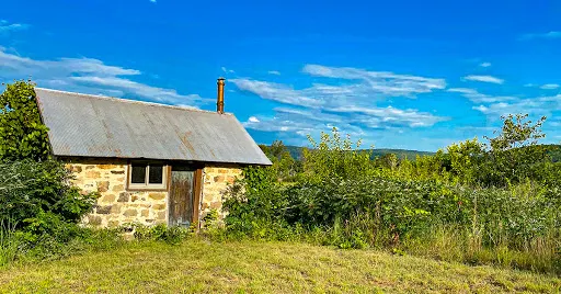
UW Lakeshore Preserve
COUNTYDANE
COMMUNITIES
MADISON
TOTAL MILES
12-MILES NETWORKED TRAILS
DIFFICULTY
EASY
The Lakeshore Preserve at the University of Wisconsin is a 300-acre forested shoreline on Lake Mendota with a network of trails that lead out to Picnic Point and beyond. The trails offer a chance to be immersed in varied environments from hardwood forest to tallgrass prairie. The most popular trail is the Howard Temin Lakeshore Path that runs between Memorial Union and Picnic Point. Other single track dirt paths extend a true hiking experience as you explore deeper into the preserve.
ARTICLE (WISCONSIN-EXPLORER)

UW Arboretum
COUNTYDANE
COMMUNITIES
MADISON
TOTAL MILES
20+-MILES NETWORKED TRAILS
DIFFICULTY
EASY
The Arboretum is a 1300-acre forest and wildlife preserve at the center of urban Dane County. A living classroom, the Arboretum is open to the public year-round to explore its 20+ miles of networked trails that navigate between various plant communities.
ARTICLE (WISCONSIN-EXPLORER)

Cherokee Marsh
COUNTYDANE
COMMUNITIES
MADISON
TOTAL MILES
2-MILE DOUBLE LOOP
DIFFICULTY
EASY
On Madison's North Side the Cherokee Marsh is a large lowland and wetland environment that is navigated along wide crushed stone paths and boardwalks. Trails approach several great fishing spots on the Yahara River.
ARTICLE (WISCONSIN-EXPLORER)

Hoyt Park
COUNTYDANE
COMMUNITIES
MADISON
TOTAL MILES
1-MILE LOOP
DIFFICULTY
EASY
On the West Side, Hoyt Park is one of Madison's first parks, an example of forward thinking civic planing. A path loops down into a stone ravine and through woodlands to picnic areas tucked into the woods. A pleasure drive circles through the park and features a stop at Sunset Point, an impressive view of Midtown.
ARTICLE (WISCONSIN-EXPLORER)

Governors Island Loop Trail
COUNTYDANE
COMMUNITIES
MADISON
TOTAL MILES
.75-MILE LOOP
DIFFICULTY
VERY EASY
Another North side escape is Governor's Island, a small island in Lake Mendota reached from a man made land bridge from the grounds of Mendota Mental Health Institute. A 3/4-mile loop circumnavigates the island which includes an old beach and several lookouts from surprisingly high bluff vantage points.
ARTICLE (WISCONSIN-EXPLORER)

Pheasant Branch Conservancy
COUNTYDANE
COMMUNITIES
MIDDLETON
TOTAL MILES
6.3-MILES NETWORKED TRAILS
DIFFICULTY
EASY
Middelton offers runners, bikers, and walkers a wonderful 3-mile loop around the springs that feed Lake Mendota at the Pheasant Branch Conservancy. Additional walking trails diverge from the main loop. This 500-acre green oasis on the far West side is a welcome retreat for those looking to relax in a woodland environment close to home.
ARTICLE (WISCONSIN-EXPLORER)

Governor Nelson State Park
COUNTYDANE
COMMUNITIES
WAUNAKEE
TOTAL MILES
10-MILES NETWORKED TRAILS
DIFFICULTY
EASY-TO-MODERATE
Governor Nelson State Park is locally known for hosting Madison's best beach with supporting beach and picnic facilities. Wide grass trails form large loops through field and forest. This is a popular trail running destination in Dane County. In Winter, the cross country ski trails are considered the best in the county. A state park sticker is required for vehicles at entry.
ARTICLE (WISCONSIN-EXPLORER)

Indian Lake County Park
COUNTYDANE
COMMUNITIES
CROSS PLAINS, WAUNAKEE
TOTAL MILES
2.8-MILES POINT-TO-POINT
DIFFICULTY
MODERATE
One of Dane County's premiere county parks, Indian Lake offers more challenging hill climbs along its 11-miles of networked hiking trails. The Ice Age National Scenic Trail includes a 3-mile route through Indian Lake County Park.
ARTICLE (WISCONSIN-EXPLORER)

(IAT) Madison Segment
COUNTYDANE COUNTY
COMMUNITIES
MADISON
TOTAL MILES
3.1-MILE POINT-TO-POINT
DIFFICULTY
EASY
The Ice Age National Scenic Trail is a 1200-mile trail in Wisconsin that traces the terminal moraine of Ice Age glaciers. A segment of this trail passes through the City of Madison on the far west side. The majority of the length of the Madison Segment passes through the University Ridge golf course before meeting up with the Verona Segment.
ARTICLE (WISCONSIN-EXPLORER)

(IAT) Valley View Segment
COUNTYDANE COUNTY
COMMUNITIES
MIDDLETON, MADISON, VERONA
TOTAL MILES
1.7-MILE POINT-TO-POINT
DIFFICULTY
EASY
Connected via roadways to the Madison Segment, the Valley View Segment of the Ice Age Trail is the next segment heading westbound on the IAT. The Valley View Trail descends into a valley through restored prairies and woodlands. Several loop trail options are available.
ARTICLE (WISCONSIN-EXPLORER)

(IAT) Verona Segment
COUNTYDANE COUNTY
COMMUNITIES
MADISON, VERONA
TOTAL MILES
6.3-MILE POINT-TO-POINT
DIFFICULTY
EASY
CAMPING
Disperse Camping Area in Badger Prairie County Park
The Verona Segment of the Ice Age National Trail connects directly to the Madison Segment. The IAT navigates through parkways and county parks, rolling over gentle hills with restored prairies and into a few shaded woodland areas.
ARTICLE (WISCONSIN-EXPLORER)

(IAT) Montrose Segment (Badger State Bike Trail)
COUNTYDANE COUNTY
COMMUNITIES
BASCO, MONTROSE
TOTAL MILES
7.5-MILE POINT-TO-POINT
DIFFICULTY
EASY
CAMPING
Disperse Camping Area
The next segment of the Ice Age National Trail heading eastbound after the Verona Segment is the Montrose Segment. a major portion of this trail is along the Badger State Bike Trail. But, a footpath cuts off from the trail and climbs hills through bucolic farmland. The trail then connects directly to the famous Brooklyn Wildlife Segment.
ARTICLE (WISCONSIN-EXPLORER)

(IAT) Brooklyn Wildlife Segment
COUNTYDANE COUNTY, GREEN COUNTY
COMMUNITIES
EXETER, DAYTON, BELLEVILLE, BROOKLYN
TOTAL MILES
3.7-MILE POINT-TO-POINT
DIFFICULTY
MODERATE
Continuing South towards Janesville, the Brooklyn Wildlife Segment is the next segment of the Ice Age Trail heading eastbound. This hummocky segment is a popular walking site for Madisonians. Many meetup groups make group hikes out of the network of looping and interconnected trails at the Brooklyn Wildlife Preserve.
ARTICLE (WISCONSIN-EXPLORER)

Blackhawk Unit of the Lower Wisconsin Riverway
COUNTYDANE COUNTY
COMMUNITIES
MAZOMANIE, SAUK CITY
TOTAL MILES
12-MILES NETWORKED TRAILS
DIFFICULTY
MODERATE
The Lower Wisconsin Riverway is a series of preserves and green spaces along the Wisconsin River from Portage to its confluence with the Mississippi River. One of the largest preserves in this chain is the Black Hawk Unit which includes the historic site of the Wisconsin Heights Battlefield where Chief Black Hawk was overtaken by militia in the Blackhawk Wars. A dozen miles of networked trails loop around the high mounds at Wisconsin Heights overlooking Sauk City and the Wisconsin River Valley.
ARTICLE (WISCONSIN-EXPLORER)

Morton Forest County Park
COUNTYDANE COUNTY
COMMUNITIES
MAZOMANIE
TOTAL MILES
3.5-MILES NETWORKED TRAILS
DIFFICULTY
MODERATE
A new 144-acre county park, and Dane County's first county forest, Morton Forest is a densely wooded area occupying two hills in the southwest corner of Dane County. Views from two overlooks reveal the undulating landscape of the driftless area to the west of Madison.
ARTICLE (WISCONSIN-EXPLORER)

(IAT) Springfield Hill Segment
COUNTYDANE COUNTY
COMMUNITIES
SPRINGFIELD CORNERS
TOTAL MILES
1.7-MILE POINT-TO-POINT
DIFFICULTY
EASY
CAMPING
Disperse Camping Area
Northwest of Madison the Ice Age Trail continues its route along the terminal moraines of ancient glaciation. The brief loop trail at Springfield Hill is a new addition to the national trail and features critical miles of the IAT between Lodi and Indian Lake.
ARTICLE (WISCONSIN-EXPLORER)

(IAT) Lodi Marsh Segment
COUNTYDANE COUNTY
COMMUNITIES
LODI
TOTAL MILES
1.7-MILE POINT-TO-POINT
DIFFICULTY
EASY
The next trail segment of the Ice Age National Trail heading westbound is the beginning of the Lodi Valley Chapter Trails. The short and easy loop trail at the West Lodi Marsh segment climbs a hill through grasslands and prairies.
ARTICLE (WISCONSIN-EXPLORER)

(IAT) Eastern Lodi Marsh Segment
COUNTYCOLUMBIA COUNTY, DANE COUNTY
COMMUNITIES
LODI
TOTAL MILES
7.3-MILE POINT-TO-POINT
DIFFICULTY
MODERATE-DIFFICULT
CAMPING
Disperse Camping Area
Next door to the West Lodi Marsh is one of my favorite hikes in the Madison Area, the East Lodi Marsh Segment of the Ice Age National Trail. This challenging linear hike climbs several hills and makes for an athletic hike with fairy-tale-like views. Definitely plan a sunset hike on this trail.
ARTICLE (WISCONSIN-EXPLORER)

(IAT) Fern Glen Segment
COUNTYCOLUMBIA COUNTY
COMMUNITIES
LODI
TOTAL MILES
1.3-MILE POINT-TO-POINT
DIFFICULTY
MODERATE
The Fern Glen Segment of the IAT is another beautiful section hike in the Lodi Valley. This segment was formerly known as the Groves-Pertzborn Segment and takes on a large hill climb in a woodland landscape.
ARTICLE (WISCONSIN-EXPLORER)

(IAT) Gibraltar Segment
COUNTYCOLUMBIA COUNTY
COMMUNITIES
WEST POINT, MERRIMAC, LODI
TOTAL MILES
4.6-MILE POINT-TO-POINT
DIFFICULTY
MODERATE-DIFFICULT
CAMPING
Disperse Camping Area
Gibraltar Rock State Natural Area is a one of the must-see scenic attractions nearby Madison. Just a half-hour's drive away from Madison, this unique flat-topped rock butte is the highest point in Columbia County and affords views of Lake Wisconsin and the Baraboo Hills. The Ice Age National Trail features a significant segment that spans from the Merrimac Ferry landing to the Rocks of Gibraltar SNA with several mountaineering rated climbs along the route.
ARTICLE (WISCONSIN-EXPLORER)

(IAT) Merrimac Segment
COUNTYSAUK COUNTY
COMMUNITIES
MERRIMAC
TOTAL MILES
3.6-MILE POINT-TO-POINT
DIFFICULTY
EASY
The Ice Age National Trail follows the Merrimac Segment through bucolic countryside between Devil's Lake State Park and the Merrimac Ferry landing. This quiet trail offers plenty of mileage and is much quieter than the nearby trails at Devil's Lake.
ARTICLE (WISCONSIN-EXPLORER)
Merrimac Preserve
COUNTYSAUK
COMMUNITIES
MERRIMAC
TOTAL MILES
9-MILE NETWORK
DIFFICULTY
EASY
ARTICLE (WISCONSIN-EXPLORER)

Devil's Lake State Park Trails
COUNTYSAUK
COMMUNITIES
BARABOO, MERRIMAC
TOTAL MILES
33-MILES COMBINED NETWORK
DIFFICULTY
RANGING FROM EASY TO VERY DIFFICULT
Within an hour's drive from Madison is one of the Midwest's most treasured parks, Devil's Lake State Park. Hiking trails here navigate a mountain-like landscape and offer Wisconsin's most challenging hiking. In addition to challenging climbs up the rock bluffs, there are dozens of miles of easy and moderate woodland hikes available. Check out this article that reviews each of Devil's Lake's extraordinary hiking trails.
ARTICLE (WISCONSIN-EXPLORER)

(IAT) Sauk Point Segment
COUNTYSAUK COUNTY
COMMUNITIES
MERRIMAC
TOTAL MILES
4-MILES POINT-TO-POINT
DIFFICULTY
DIFFICULT
Connecting Devil's Lake State Park to Parfrey's Glen State Natural Area, this difficult portion of the Ice Age Trail cuts through woodlands as it descends the Baraboo Hills. Of course, the return trip to Devil's Lake climbs this long and steep hill.
ARTICLE (WISCONSIN-EXPLORER)

Parfrey's Glen State Natural Area
COUNTYSAUK
COMMUNITIES
MERRIMAC
TOTAL MILES
1-MILE OUT AND BACK
DIFFICULTY
EASY
Parfrey's Glen is one of the most popular hikes in the Baraboo Hills area. This short 2-mile out-n-back starts off as a very easy walk alongside a babbling brook. As the trail leads further back into the glen it approaches a narrow stone-walled gorge where the trail becomes difficult to navigate. This impressive stone canyon will leave you with enduring lifetime memories.
ARTICLE (WISCONSIN-EXPLORER)

Pewit's Nest State Natural Area
COUNTYSAUK
COMMUNITIES
BARABOO, NORTH FREEDOM
TOTAL MILES
1-MILE OUT AND BACK
DIFFICULTY
MODERATE
Recently, Pewit's Nest State Natural Area has attracted the attention of national publications. This hidden gorge features Skillet Creek that cascades through a series of picturesque pools. It has long been a popular local swimming hole, but now has become a major scenic tourist attraction. This new-found attention has come to stress this important state natural area with foot traffic that is unusual for an SNA. Located in the Baraboo Hills near Devil's Lake, this scenic wonder may not be one that you've heard of before, but a place that you should check out while its still open to the public to explore.
ARTICLE (WISCONSIN-EXPLORER)

(IAT) Indian Lake Segment
COUNTYDANE COUNTY
COMMUNITIES
DANE, WAUNAKEE, BLACK EARTH
TOTAL MILES
2.8-MILE POINT-TO-POINT
DIFFICULTY
MODERATE
ARTICLE (WISCONSIN-EXPLORER)

(IAT) Table Bluff Segment
COUNTYDANE COUNTY
COMMUNITIES
CROSS PLAINS
TOTAL MILES
2.5-MILE POINT-TO-POINT
DIFFICULTY
MODERATE
ARTICLE (WISCONSIN-EXPLORER)

Ablemans Gorge
COUNTYSAUK
COMMUNITIES
ROCK SPRINGS
TOTAL MILES
.8-MILE LOOP
DIFFICULTY
EASY
Along the Baraboo River in Rock Springs is a geologic research site with a hiking trail into an old quarry. This state natural area is the birthplace of modern theories of metamorphic geology. The rocks here openly display evidence of how mountains are created and were studied by Charles Van Hise in the 1880's.
ARTICLE (WISCONSIN-EXPLORER)

White Mound Lake Trail
COUNTYSAUK COUNTY
COMMUNITIES
LOGANVILLE, PLAIN
TOTAL MILES
2.8-MILE LOOP
DIFFICULTY
EASY
ARTICLE (WISCONSIN-EXPLORER)

Spring Green Preserve
COUNTYSAUK COUNTY
COMMUNITIES
SPRING GREEN
TOTAL MILES
3.2-MILE OUT AND BACK
DIFFICULTY
MODERATE
Would you believe that there is a desert, complete with native cacti and tumbleweeds in Wisconsin? The Spring Green Preserve features a 1 1/2 mile linear hike (3-miles out-n-back) through a naturally occurring desert landscape and then up a steep bluff to an overlook of the Wisconsin River Valley.
ARTICLE (WISCONSIN-EXPLORER)

Trails at Tower Hill State Park
COUNTYIOWA COUNTY
COMMUNITIES
SPRING GREEN, WYOMING
TOTAL MILES
1.5-MILE TRAIL NETWORK
DIFFICULTY
MODERATE
ARTICLE (WISCONSIN-EXPLORER)

Flint Rock Trail at Blue Mound State Park
COUNTYIOWA COUNTY
COMMUNITIES
BLUE MOUNDS
TOTAL MILES
2-MILE LOOP
DIFFICULTY
EASY
ARTICLE (WISCONSIN-EXPLORER)

Trails at Governor Dodge State Park
COUNTYIOWA COUNTY
COMMUNITIES
DODGEVILLE
TOTAL MILES
40-MILES NETWORKED TRAILS
DIFFICULTY
EASY TO MODERATE
ARTICLE (WISCONSIN-EXPLORER)

Blachawk Lake Loop Trail
COUNTYIOWA COUNTY
COMMUNITIES
COBB, HIGHLAND
TOTAL MILES
7.5-MILE LOOP
DIFFICULTY
DIFFICULT
ARTICLE (WISCONSIN-EXPLORER)
Map of Hiking Trails Near Madison WI

Click Map Image to load the full interactive map.