White Mound Sauk County Park is a 1,100-acre park between Loganville and Plain Wisconsin in central Sauk County. The park offers hiking trails, bridle trails, camping, horse camping, swimming, boating, and fishing.
Hiking trails range from the very easy and brief Willie Walsh Nature Trail to the moderately difficult Lime Kiln Trail. The most popular hiking trail is the Lake Trail, a wide mowed grass two-track easy footpath that encircles White Mound Lake.
{tocify} $title={Table of Contents}
$ads={1}
advertisement

|
| Lake Trail |
White Mound Park is a lesser-known recreation area in the Madison Area, but it is an extraordinary destination for a quick and easy get-away. It is about 40-minutes from the West Side of Madison and a beautiful drive through Driftless Valleys.
A manmade reservoir lake is set into a deep valley surrounded by forested driftless area mounds - steep rounded-top hills that define the topography of Southwestern Wisconsin. Far from interstate highways, and nestled into its own valley, hardly a sound of a car or motor can be heard. This quiet backdrop provides for crisp songbird calls.
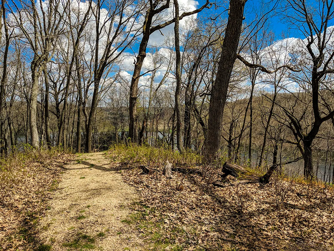
I hiked all of the trails at this park, starting by parking in a small lot by the campground at the Willie Walsh Nature Trail. The nature trail was a very easy and brief trail that promenades out along the top of a narrow ridge. Views of the entire lake and valley below are afforded in the leaf-off seasons.
From the end of the nature trail, I quickly descended into the main hub of the park where there is a popular swimming beach and canoe launch. A new pavilion has been constructed by the beach with grand windows overlooking the lake. A wedding reception was taking place as I passed the pavilion.
I tackled the Lime Kiln trail which began with a long steep climb. There is a pile of rubble fenced in within the forest that is the remains of an old Lime Kiln - nothing really noteworthy to see.
Circling back from the Lime Kiln trail I continued around the lake on the easy Lake Trail which hugs the perimeter of the lake and rolls along its gentle route. The Lake Trail features a mix of shaded hardwood forest, pine forest, and open prairie.
In addition to the Lake Trail, I took the bifurcation called the Ridge Trail. Another steep long climb led to the top of a mound where the ridge trail lazily meanders on a relatively flat track. The ridge trail joins an ATV route and rapidly descends to a park road leading to the boat launch. In total, I logged 8.5-miles by hiking all of the trails which included a total of 3 steep climbs from the lake valley to the tops of mounds. It took approximately 3.5 hours to hike all of the trails in a single outing.
In addition to the hiking trails, hikers may also take the horse trails which total 12-miles. The horse trail loop includes many abrupt inclines and declines and makes for a difficult and athletic hike. Be aware of and respectful of horseback riders if choosing to hike the horse trails.
I drove through the campground which was nearly full on the first weekend of May, suggesting that this is a very popular camping location. The campground includes flush toilets, showers, and laundry.

|
| View from Lake Trail |
COUNTY
SAUK
COMMUNITIES
LOGANVILLE, PLAIN
2.8-MILE LOOP
DIFFICULTY
EASY
LOWEST ELEVATION
914 AMSL
HIGHEST ELEVATION
950 AMSL
TOTAL ELEVATION GAIN
590 FT
1.8-POINT-TO-POINT
DIFFICULTY
MODERATE
LOWEST ELEVATION
924 AMSL
HIGHEST ELEVATION
1112 AMSL
TOTAL ELEVATION GAIN
526 FT
1.3-MILE LOLLIPOP
DIFFICULTY
MODERATE
LOWEST ELEVATION
924 AMSL
HIGHEST ELEVATION
1098 AMSL
TOTAL ELEVATION GAIN
484 FT
1/2-MILE POINT-TO-POINT
DIFFICULTY
EASY
LOWEST ELEVATION
933 AMSL
HIGHEST ELEVATION
1060 AMSL
TOTAL ELEVATION GAIN
110 FT
SAUK
COMMUNITIES
LOGANVILLE, PLAIN
White Mound Lake Trail
TOTAL MILES2.8-MILE LOOP
DIFFICULTY
EASY
LOWEST ELEVATION
914 AMSL
HIGHEST ELEVATION
950 AMSL
TOTAL ELEVATION GAIN
590 FT
White Mound Ridge Trail
TOTAL MILES1.8-POINT-TO-POINT
DIFFICULTY
MODERATE
LOWEST ELEVATION
924 AMSL
HIGHEST ELEVATION
1112 AMSL
TOTAL ELEVATION GAIN
526 FT
Lime Kiln Trail
TOTAL MILES1.3-MILE LOLLIPOP
DIFFICULTY
MODERATE
LOWEST ELEVATION
924 AMSL
HIGHEST ELEVATION
1098 AMSL
TOTAL ELEVATION GAIN
484 FT
Willie Walsh Nature Trail
TOTAL MILES1/2-MILE POINT-TO-POINT
DIFFICULTY
EASY
LOWEST ELEVATION
933 AMSL
HIGHEST ELEVATION
1060 AMSL
TOTAL ELEVATION GAIN
110 FT
Directions and Trail Map
Click Map Image to load the full interactive map.
If viewing on a mobile device, open the trail map above to load into Google Maps App by touching the expand rectangle in the upper right corner.
Address for your GPS: S7995 Whitemound Dr, Hill Point, WI 53937
| coordinates: 43.355429, -90.095174 |
| From Milwaukee | 2 Hours |
| From Madison | 1 Hour |
| From Green Bay | 3 Hours |
| From Wausau | 2.5 Hours |
| From Minneapolis | 4 Hours |
| From Chicago | 3.5 Hours |
Photos

|
| Lake Trail |

|
| Willie Walsh Nature Trail |

|
| Willie Walsh Nature Trail |

|
| Lake Trail |

|
| Lime Kiln Trail |

|
| Willie Walsh Nature Trail |


