

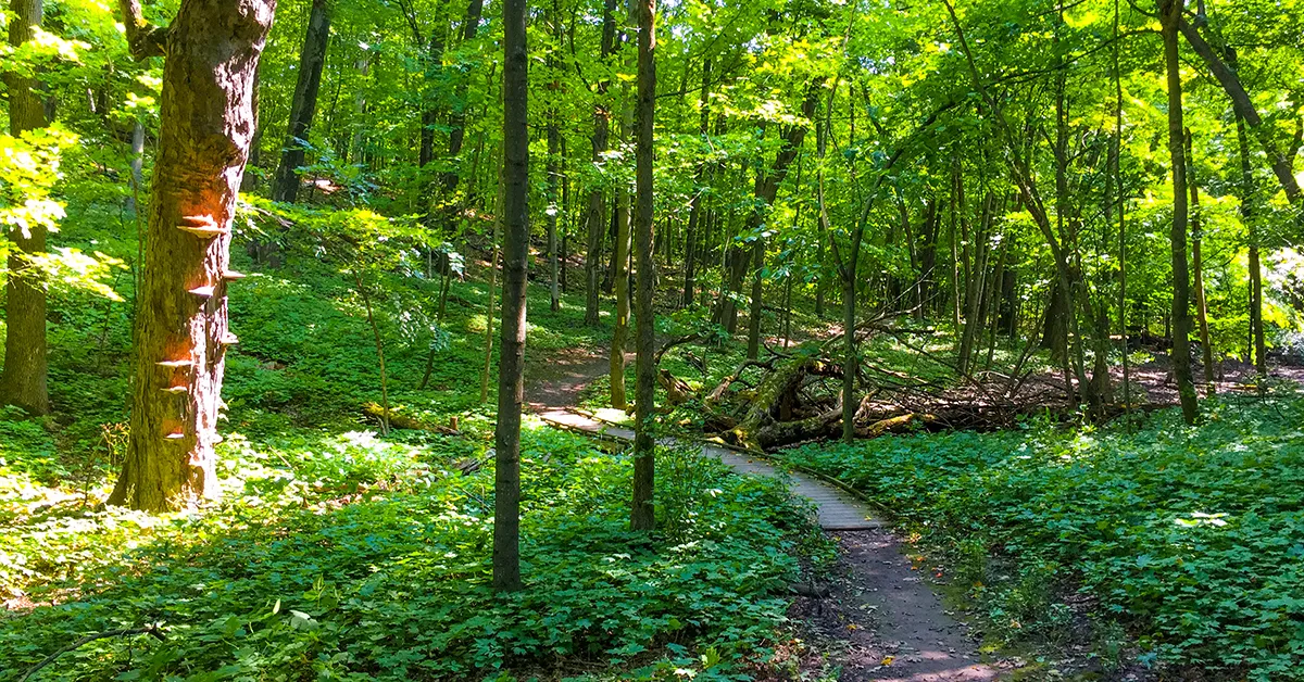
The Ice Age Trail is a National Scenic Trail tracing the terminal glacial moraine of the last Ice Age in Wisconsin. Backpackers may one day hike through this route of 1200 linear miles without stepping off the trail. Today, roughly half of the route's miles are footpath that are certified as national trail.
Ray Zillmer first proposed the idea of the Ice Age Trail and began to plot its course in 1958. By 1980 his original endeavor drew the attention of congress who in turn designated the IAT as one of eleven National Scenic Trails.
The route of the trail is blazed with segments that are close to the entire population of Wisconsin. Many segments run through trail towns where hikers can get off the trail to experience communities, museums, and take advantage of key services like laundromats and grocery stores. Being a back yard trail - most hikers experience the IAT in short section hikes close to home.
{tocify} $title={Table of Contents}
$ads={1}
advertisement
Ice Age Trail Segments List and Directory
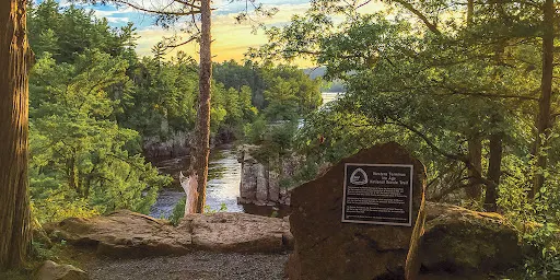
(IAT) St Croix Falls Segment
COUNTYPOLK COUNTY
COMMUNITIES
ST CROIX FALLS
TOTAL MILES
7.8-MILES POINT-TO-POINT
DIFFICULTY
MODERATE
CAMPING
Interstate State Park, St. Croix National Scenic River Site S55.3
ARTICLE (WISCONSIN-EXPLORER)

(IAT) Gandy Dancer Segment (State Bike Trail)
COUNTYPOLK COUNTY
COMMUNITIES
ST CROIX FALLS, CENTURIA, MILLTOWN, LUCK
TOTAL MILES
15-MILE POINT-TO-POINT
DIFFICULTY
VERY EASY
CAMPING
Dispersed Camping Area, Big Butternut Lake County Park
ARTICLE (WISCONSIN-EXPLORER)
(IAT) Trade River Segment
COUNTYPOLK COUNTY
COMMUNITIES
LUCK
TOTAL MILES
4.22-MILE POINT-TO-POINT
DIFFICULTY
EASY
ARTICLE (WISCONSIN-EXPLORER)

(IAT) Straight Lake Segment
COUNTYPOLK COUNTY
COMMUNITIES
LUCK
TOTAL MILES
3.65-MILE POINT-TO-POINT
DIFFICULTY
EASY-MODERATE
CAMPING
Disperse Camping Areas along trail, Rustic campsites at Straight Lake State Park
ARTICLE (WISCONSIN-EXPLORER)

(IAT) Straight River Segment
COUNTYPOLK COUNTY
COMMUNITIES
LUCK
TOTAL MILES
3.3-MILE POINT-TO-POINT
DIFFICULTY
EASY
CAMPING
Disperse Camping Areas (2)
ARTICLE (WISCONSIN-EXPLORER)

(IAT) Pine Lake Segment
COUNTYPOLK COUNTY
COMMUNITIES
FREDERICK, LUCK
TOTAL MILES
2.9-MILE POINT-TO-POINT
DIFFICULTY
EASY
ARTICLE (WISCONSIN-EXPLORER)

(IAT) McKenzie Creek Segment
COUNTYPOLK COUNTY
COMMUNITIES
INDIAN CREEK, CLAM FALLS, FREDERICK, BARONETTE
TOTAL MILES
9.4-MILE POINT-TO-POINT
DIFFICULTY
MODERATE
ARTICLE (WISCONSIN-EXPLORER)

(IAT) Indian Creek Segment
COUNTYPOLK COUNTY
COMMUNITIES
CLAM FALLS, INDIAN CREEK
TOTAL MILES
5.3-MILE POINT-TO-POINT
DIFFICULTY
MODERATE
ARTICLE (WISCONSIN-EXPLORER)

(IAT) Sand Creek Segment
COUNTYPOLK COUNTY, BURNETT COUNTY
COMMUNITIES
SAND CREEK, TIMBERLAND
TOTAL MILES
5.7-MILE POINT-TO-POINT
DIFFICULTY
MODERATE
ARTICLE (WISCONSIN-EXPLORER)

(IAT) Timberland Hills Segment
COUNTYPOLK COUNTY, BURNETT COUNTY, WASHBURN COUNTY
COMMUNITIES
TIMBERLAND
TOTAL MILES
10.6-MILES POINT-TO-POINT
DIFFICULTY
MODERATE
ARTICLE (WISCONSIN-EXPLORER)

(IAT) Grassy Lake Segment
COUNTYWASHBURN COUNTY
COMMUNITIES
SARONA
TOTAL MILES
8.3-MILE POINT-TO-POINT
DIFFICULTY
EASY
ARTICLE (WISCONSIN-EXPLORER)

(IAT) Bear Lake Segment
COUNTYBARRON COUNTY
COMMUNITIES
BARONETT
TOTAL MILES
5.4-MILES POINT-TO-POINT
DIFFICULTY
EASY
ARTICLE (WISCONSIN-EXPLORER)

(IAT) Hemlock Creek Segment
COUNTYBARRON COUNTY, RUSK COUNTY
COMMUNITIES
BIRCHWOOD
TOTAL MILES
6.4-MILES POINT-TO-POINT
DIFFICULTY
MODERATE
CAMPING
Murphy Flowage Recreational Area
ARTICLE (WISCONSIN-EXPLORER)

(IAT) Northern Blue Hills Segment
COUNTYRUSK COUNTY
COMMUNITIES
HORSEMAN
TOTAL MILES
8.8-MILES POINT-TO-POINT
DIFFICULTY
MODERATE
CAMPING
Murphy Flowage Recreational Area, Rusk County Forest Primitive Camping
ARTICLE (WISCONSIN-EXPLORER)

(IAT) Southern Blue Hills Segment
COUNTYRUSK COUNTY
COMMUNITIES
HORSEMAN, WEYERHAUSER, STRICKLAND
TOTAL MILES
6-MILES POINT-TO-POINT
DIFFICULTY
MODERATE
CAMPING
North Lake Remote Campsite, Rusk County Forest Primitive Camping
ARTICLE (WISCONSIN-EXPLORER)

(IAT) Chippewa Moraine Segment
COUNTYCHIPPEWA COUNTY
COMMUNITIES
NEW AUBURN, BIRCH CREEK
TOTAL MILES
7.3-MILE POINT-TO-POINT
DIFFICULTY
MODERATE
CAMPING
Disperse Camping Areas (2), Disperse camping allowed anywhere in the Chippewa County Forest 50' from the trail.
ARTICLE (WISCONSIN-EXPLORER)

(IAT) Harwood Lakes Segment
COUNTYCHIPPEWA COUNTY
COMMUNITIES
NEW AUBURN, CORNELL
TOTAL MILES
5.4-MILE POINT-TO-POINT
DIFFICULTY
MODERATE
CAMPING
Rustic site at Harwood Lakes and Dispersed Camping Area at Picnic Lake, Dispersed Camping anywhere int the Chippewa County Forest
ARTICLE (WISCONSIN-EXPLORER)

(IAT) Firth Lake Segment
COUNTYCHIPPEWA COUNTY
COMMUNITIES
CORNELL
TOTAL MILES
6.5-MILE POINT-TO-POINT
DIFFICULTY
MODERATE
CAMPING
Anywhere in the Chippewa County Forest. Primitive Site 1/4-mile southwest of 256th Ave.
ARTICLE (WISCONSIN-EXPLORER)

(IAT) Chippewa River Segment
COUNTYCHIPPEWA COUNTY
COMMUNITIES
CORNELL
TOTAL MILES
1.8-MILE POINT-TO-POINT
DIFFICULTY
EASY
ARTICLE (WISCONSIN-EXPLORER)

(IAT) Lake Eleven Segment
COUNTYTAYLOR COUNTY
COMMUNITIES
FORD, PERKINSTOWN, GILLMAN, MEDFORD
TOTAL MILES
15.5-MILES POINT-TO-POINT
DIFFICULTY
DIFFICULT
CAMPING
2 hiker's campsites at Lake Eleven, Dispersed camping anywhere in the Chequamegon National Forest
ARTICLE (WISCONSIN-EXPLORER)

(IAT) Jerry Lake Segment
COUNTYTAYLOR COUNTY
COMMUNITIES
PERKINSTOWN, MEDFORD
TOTAL MILES
15.2-MILES POINT-TO-POINT
DIFFICULTY
DIFFICULT
CAMPING
hiker's campsites at Jerry Lake South Fork Yellow River, Sailor River, Hemlock Esker, White Birch Trail, and Chippewa Lobe Loop Trail; Dispersed camping anywhere along this route 50 feet from the trail.
ARTICLE (WISCONSIN-EXPLORER)

(IAT) Mondeaux Esker Segment
COUNTYTAYLOR COUNTY
COMMUNITIES
WESTBORO, MEDFORD
TOTAL MILES
11.4-MILES POINT-TO-POINT
DIFFICULTY
DIFFICULT
CAMPING
Campsites at Picnic Point, West Point, Spearhead Point, Eastwood, and North Twin Lake, Dispersed camping in the Chequamegon National Forest outside of the recreational area
ARTICLE (WISCONSIN-EXPLORER)

(IAT) Pine Line Segment
COUNTYTAYLOR COUNTY
COMMUNITIES
WESTBORO
TOTAL MILES
.9-MILE POINT-TO-POINT
DIFFICULTY
MODERATE
CAMPING
Dispersed Campsite near midpoint of trail
ARTICLE (WISCONSIN-EXPLORER)

(IAT) East Lake Segment
COUNTYTAYLOR COUNTY
COMMUNITIES
RIB LAKE, WESTBORO
TOTAL MILES
6.5-MILE POINT-TO-POINT
DIFFICULTY
MODERATE
CAMPING
Primitive site at East Lake. Dispersed Camping along most of the trail in the Taylor County Forest - 50 feet from a trail or road
ARTICLE (WISCONSIN-EXPLORER)

(IAT) Rib Lake Segment
COUNTYTAYLOR COUNTY
COMMUNITIES
RIB LAKE
TOTAL MILES
2 MILES POINT-TO-POINT
DIFFICULTY
EASY
CAMPING
Stille Nacht Campground in the Rusch Preserve
ARTICLE (WISCONSIN-EXPLORER)

(IAT) Wood Lake Segment
COUNTYTAYLOR COUNTY
COMMUNITIES
RIB LAKE, WESTBORO
TOTAL MILES
13.5 MILES POINT-TO-POINT
DIFFICULTY
MODERATE
CAMPING
Wood Lake County Park, Primitive Camping anywahere in the Taylor County Forest 100 ft from trail
ARTICLE (WISCONSIN-EXPLORER)

(IAT) Timberland Wilderness Segment
COUNTYLINCOLN COUNTY
COMMUNITIES
TIPOLI, CORNING, RIB LAKE
TOTAL MILES
3.7-MILE POINT-TO-POINT
DIFFICULTY
EASY
ARTICLE (WISCONSIN-EXPLORER)

(IAT) Camp 27 Segment
COUNTYLINCOLN COUNTY
COMMUNITIES
CORNING, HARDING, MERRILL
TOTAL MILES
2.8-MILE POINT-TO-POINT
DIFFICULTY
MODERATE
ARTICLE (WISCONSIN-EXPLORER)

(IAT) New Wood Segment
COUNTYLINCOLN COUNTY
COMMUNITIES
HARDING, MERRILL
TOTAL MILES
6.5-MILE POINT-TO-POINT
DIFFICULTY
MODERATE-DIFFICULT
CAMPING
Primitive Camping in the Lincoln County Forest
ARTICLE (WISCONSIN-EXPLORER)

(IAT) Averill-Kelly Creek Wilderness Segment
COUNTYLINCOLN COUNTY
COMMUNITIES
MERRILL, IRMA
TOTAL MILES
4.5-MILE POINT-TO-POINT
DIFFICULTY
MODERATE
ARTICLE (WISCONSIN-EXPLORER)

(IAT) Turtle Rock Segment
COUNTYLINCOLN COUNTY
COMMUNITIES
MERRILL, IRMA
TOTAL MILES
5-MILE POINT-TO-POINT
DIFFICULTY
MODERATE-TO-DIFFICULT
ARTICLE (WISCONSIN-EXPLORER)

(IAT) Grandfather Falls Segment
COUNTYLINCOLN COUNTY
COMMUNITIES
MERRILL, IRMA
TOTAL MILES
3.9-MILE POINT-TO-POINT
DIFFICULTY
MODERATE
CAMPING
New Wood County Park Campground
ARTICLE (WISCONSIN-EXPLORER)

(IAT) Underdown Segment
COUNTYLINCOLN COUNTY
COMMUNITIES
GLEASON, IRMA
TOTAL MILES
6.3-MILE POINT-TO-POINT
DIFFICULTY
DIFFICULT
CAMPING
Dog Lake Shelter, Horn Lake Primitive Site, Dispersed Campsite, Underdown Recreational Area Drive-in Campground, Lincoln County Forest Primitive Camping
ARTICLE (WISCONSIN-EXPLORER)

(IAT) Alta Junction Segment
COUNTYLINCOLN COUNTY
COMMUNITIES
IRMA
TOTAL MILES
1.2-MILE POINT-TO-POINT
DIFFICULTY
EASY
ARTICLE (WISCONSIN-EXPLORER)

(IAT) Harrison Hills Segment
COUNTYLINCOLN COUNTY
COMMUNITIES
GLEASON, PARRISH
TOTAL MILES
14.5-MILE POINT-TO-POINT
DIFFICULTY
DIFFICULT
CAMPING
Campsite at Bus Lake, Dispersed Campsite at Unnamed Lake, Two (2) Primitive Sites at Chain Lakes, Primitive Camping in Lincoln County Forest along trail 50' from trail and water features
ARTICLE (WISCONSIN-EXPLORER)

(IAT) Parish Hills Segment
COUNTYLANGLADE COUNTY
COMMUNITIES
PARRISH, SUMMIT LAKE
TOTAL MILES
11.5-MILE POINT-TO-POINT
DIFFICULTY
DIFFICULT
CAMPING
Primitive Camping in Langlade County Forest 50' from trail and water features (no camping at or around ATV Shelter north of Five Cent Road)
ARTICLE (WISCONSIN-EXPLORER)

(IAT) Highland Lakes Western Segment
COUNTYLANGLADE COUNTY
COMMUNITIES
SUMMIT LAKE
TOTAL MILES
6-MILE POINT-TO-POINT
DIFFICULTY
EASY
CAMPING
Primitive Camping in Langlade County Forest 50' from trail and water features (no camping on Private Land owned by Knights Templar)
ARTICLE (WISCONSIN-EXPLORER)

(IAT) Highland Lakes Eastern Segment
COUNTYLANGLADE COUNTY
COMMUNITIES
PARRISH
TOTAL MILES
3.4-MILE POINT-TO-POINT
DIFFICULTY
EASY
ARTICLE (WISCONSIN-EXPLORER)

(IAT) Summit Moraine Segment
COUNTYLANGLADE COUNTY
COMMUNITIES
SUMMIT LAKE
TOTAL MILES
12.2-MILE POINT-TO-POINT
DIFFICULTY
EASY TO MODERATE
CAMPING
Jack Lake Campground, Dispersed Camping Area
ARTICLE (WISCONSIN-EXPLORER)

(IAT) Lumbercamp Segment
COUNTYLANGLADE COUNTY
COMMUNITIES
BRYANTE
TOTAL MILES
12-MILES POINT-TO-POINT
DIFFICULTY
EASY TO MODERATE
CAMPING
Hillbilly Hilton Shelter, Norem Lumber Camp
ARTICLE (WISCONSIN-EXPLORER)

(IAT) Kettlebowl Segment
COUNTYLANGLADE COUNTY
COMMUNITIES
BRYANTE
TOTAL MILES
9.9-MILES POINT-TO-POINT
DIFFICULTY
DIFFICULT
ARTICLE (WISCONSIN-EXPLORER)

(IAT) Plover River Segment
COUNTYMARATHON COUNTY
COMMUNITIES
ELMHURST, BIRNAWOOD
TOTAL MILES
5.5-MILE POINT-TO-POINT
DIFFICULTY
EASY TO MODERATE
CAMPING
Jack Lake Campground, Dispersed Camping Area
ARTICLE (WISCONSIN-EXPLORER)

(IAT) Dells of the Eau Claire Segment
COUNTYMARATHON COUNTY
COMMUNITIES
ANTIGO, ANIWA
TOTAL MILES
3.6-MILE POINT-TO-POINT
DIFFICULTY
EASY
CAMPING
Dells of the Eau Claire County Park - drive in sites/self registration
ARTICLE (WISCONSIN-EXPLORER)

(IAT) Thornapple Creek Segment
COUNTYMARATHON COUNTY
COMMUNITIES
ANIWA, RINGLE
TOTAL MILES
3.9-MILE POINT-TO-POINT
DIFFICULTY
MODERTE
ARTICLE (WISCONSIN-EXPLORER)

(IAT) Ringle Segment
COUNTYMARATHON COUNTY
COMMUNITIES
RINGLE, HATLEY
TOTAL MILES
9.4-MILE POINT-TO-POINT
DIFFICULTY
MODERTE
ARTICLE (WISCONSIN-EXPLORER)

(IAT) New Hope - Iola Segment
COUNTYMARATHON COUNTY
COMMUNITIES
PERU, NEW HOPE, IOLA
TOTAL MILES
5.7-MILE POINT-TO-POINT
DIFFICULTY
DIFFICULT
CAMPING
Shelter at Winter Sports Club
ARTICLE (WISCONSIN-EXPLORER)

(IAT) Skunk and Foster Lakes Segment
COUNTYPORTAGE COUNTY
COMMUNITIES
AMHERST, SCANDINAVIA, SHERIDAN
TOTAL MILES
3.7-MILE POINT-TO-POINT
DIFFICULTY
MODERATE
ARTICLE (WISCONSIN-EXPLORER)

(IAT) Waupaca River Segment
COUNTYPORTAGE COUNTY
COMMUNITIES
WAUPACA
TOTAL MILES
1.5-MILE POINT-TO-POINT
DIFFICULTY
MODERATE
CAMPING
Shelter with space to sleep two in loft and 1 on first level platform, first-come-first-serve; tent camping adjacent to shelter
ARTICLE (WISCONSIN-EXPLORER)

(IAT) Hartman Creek Segment
COUNTYPORTAGE COUNTY
COMMUNITIES
WAUPACA
TOTAL MILES
6.8-MILE POINT-TO-POINT
DIFFICULTY
EASY
CAMPING
Hartman Creek State Park
ARTICLE (WISCONSIN-EXPLORER)

(IAT) Emmons Creek Segment
COUNTYPORTAGE COUNTY
COMMUNITIES
WAUPACA
TOTAL MILES
1.7-MILE POINT-TO-POINT
DIFFICULTY
EASY
CAMPING
Hartman Creek State Park
ARTICLE (WISCONSIN-EXPLORER)

(IAT) Deerfield Segment
COUNTYWAUSHARA COUNTY
COMMUNITIES
HANCOCK, DEERFIELD
TOTAL MILES
3.5-MILE POINT-TO-POINT
DIFFICULTY
EASY
ARTICLE (WISCONSIN-EXPLORER)

(IAT) Bohn Lake Segment
COUNTYWAUSHARA COUNTY
COMMUNITIES
HANCOCK, DEERFIELD
TOTAL MILES
1.2-MILE POINT-TO-POINT
DIFFICULTY
EASY
ARTICLE (WISCONSIN-EXPLORER)

(IAT) Greenwood Segment
COUNTYWAUSHARA COUNTY
COMMUNITIES
HANCOCK
TOTAL MILES
4.6-MILE POINT-TO-POINT
DIFFICULTY
MODERATE
ARTICLE (WISCONSIN-EXPLORER)

(IAT) Mecan River Segment
COUNTYWAUSHARA COUNTY
COMMUNITIES
RICHFORD
TOTAL MILES
7.7-MILE POINT-TO-POINT
DIFFICULTY
EASY
CAMPING
Disperse Camping Area
ARTICLE (WISCONSIN-EXPLORER)

(IAT) Wedde Creek Segment
COUNTYWAUSHARA COUNTY
COMMUNITIES
COLOMA
TOTAL MILES
1.2-MILE POINT-TO-POINT
DIFFICULTY
EASY
CAMPING
Disperse Camping Area
ARTICLE (WISCONSIN-EXPLORER)

(IAT) Chaffe Creek Segment
COUNTYWAUSHARA COUNTY, MARQUETTE
COMMUNITIES
WAUSHARA COUNTY, MARQUETTE
TOTAL MILES
2.5-MILE POINT-TO-POINT
DIFFICULTY
EASY
CAMPING
Disperse Camping Area
ARTICLE (WISCONSIN-EXPLORER)

(IAT) John Muir Segment
COUNTYMARQUETTE COUNTY
COMMUNITIES
MONTELLO, BUFFALO
TOTAL MILES
1.8-MILE LOOP
DIFFICULTY
EASY
ARTICLE (WISCONSIN-EXPLORER)

(IAT) Portage Canal Segment
COUNTYCOLUMBIA COUNTY
COMMUNITIES
PORTAGE
TOTAL MILES
4-MILES POINT-TO-POINT
DIFFICULTY
VERY EASY
CAMPING
Veteran's Memorial Fields and Columbia County Fairgrounds ARTICLE (WISCONSIN-EXPLORER)

(IAT) Sauk Point Segment
COUNTYSAUK COUNTY
COMMUNITIES
MERRIMAC
TOTAL MILES
4-MILES POINT-TO-POINT
DIFFICULTY
DIFFICULT
ARTICLE (WISCONSIN-EXPLORER)

(IAT) Devil's Lake Segment
COUNTYSAUK COUNTY
COMMUNITIES
BARABOO, MERRIMAC
TOTAL MILES
10.8-MILE POINT-TO-POINT
DIFFICULTY
DIFFICULT
ARTICLE (WISCONSIN-EXPLORER)

(IAT) Merrimac Segment
COUNTYSAUK COUNTY
COMMUNITIES
MERRIMAC
TOTAL MILES
3.6-MILE POINT-TO-POINT
DIFFICULTY
EASY
ARTICLE (WISCONSIN-EXPLORER)

(IAT) Gibraltar Segment
COUNTYCOLUMBIA COUNTY
COMMUNITIES
WEST POINT, MERRIMAC, LODI
TOTAL MILES
4.6-MILE POINT-TO-POINT
DIFFICULTY
MODERATE-DIFFICULT
CAMPING
Disperse Camping Area
ARTICLE (WISCONSIN-EXPLORER)

(IAT) Fern Glen Segment
COUNTYCOLUMBIA COUNTY
COMMUNITIES
LODI
TOTAL MILES
1.3-MILE POINT-TO-POINT
DIFFICULTY
MODERATE
ARTICLE (WISCONSIN-EXPLORER)

(IAT) Lodi Segment
COUNTYCOLUMBIA COUNTY
COMMUNITIES
LODI
TOTAL MILES
4.2-MILE POINT-TO-POINT
DIFFICULTY
VERY EASY
ARTICLE (WISCONSIN-EXPLORER)

(IAT) Eastern Lodi Marsh Segment
COUNTYCOLUMBIA COUNTY, DANE COUNTY
COMMUNITIES
LODI
TOTAL MILES
7.3-MILE POINT-TO-POINT
DIFFICULTY
MODERATE-DIFFICULT
CAMPING
Disperse Camping Area
ARTICLE (WISCONSIN-EXPLORER)

(IAT) Lodi Marsh Segment
COUNTYDANE COUNTY
COMMUNITIES
LODI
TOTAL MILES
1.7-MILE POINT-TO-POINT
DIFFICULTY
EASY
ARTICLE (WISCONSIN-EXPLORER)

(IAT) Springfield Hill Segment
COUNTYDANE COUNTY
COMMUNITIES
SPRINGFIELD CORNERS
TOTAL MILES
1.7-MILE POINT-TO-POINT
DIFFICULTY
EASY
CAMPING
Disperse Camping Area
ARTICLE (WISCONSIN-EXPLORER)

(IAT) Indian Lake Segment
COUNTYDANE COUNTY
COMMUNITIES
DANE, WAUNAKEE, BLACK EARTH
TOTAL MILES
2.8-MILE POINT-TO-POINT
DIFFICULTY
MODERATE
ARTICLE (WISCONSIN-EXPLORER)

(IAT) Table Bluff Segment
COUNTYDANE COUNTY
COMMUNITIES
CROSS PLAINS
TOTAL MILES
2.5-MILE POINT-TO-POINT
DIFFICULTY
MODERATE
ARTICLE (WISCONSIN-EXPLORER)

(IAT) Cross Plains Segment
COUNTYDANE COUNTY
COMMUNITIES
CROSS PLAINS
TOTAL MILES
2.8-MILE POINT-TO-POINT
DIFFICULTY
MODERATE
CAMPING
Disperse Camping Area
ARTICLE (WISCONSIN-EXPLORER)

(IAT) Valley View Segment
COUNTYDANE COUNTY
COMMUNITIES
MIDDLETON, MADISON, VERONA
TOTAL MILES
1.7-MILE POINT-TO-POINT
DIFFICULTY
EASY
ARTICLE (WISCONSIN-EXPLORER)

(IAT) Madison Segment
COUNTYDANE COUNTY
COMMUNITIES
MADISON
TOTAL MILES
3.1-MILE POINT-TO-POINT
DIFFICULTY
EASY
ARTICLE (WISCONSIN-EXPLORER)

(IAT) Verona Segment
COUNTYDANE COUNTY
COMMUNITIES
MADISON, VERONA
TOTAL MILES
6.3-MILE POINT-TO-POINT
DIFFICULTY
EASY
CAMPING
Disperse Camping Area in Badger Prairie County Park
ARTICLE (WISCONSIN-EXPLORER)

(IAT) Montrose Segment (Badger State Bike Trail)
COUNTYDANE COUNTY
COMMUNITIES
BASCO, MONTROSE
TOTAL MILES
7.5-MILE POINT-TO-POINT
DIFFICULTY
EASY
CAMPING
Disperse Camping Area
ARTICLE (WISCONSIN-EXPLORER)

(IAT) Brooklyn Wildlife Segment
COUNTYDANE COUNTY, GREEN COUNTY
COMMUNITIES
EXETER, DAYTON, BELLEVILLE, BROOKLYN
TOTAL MILES
3.7-MILE POINT-TO-POINT
DIFFICULTY
MODERATE
ARTICLE (WISCONSIN-EXPLORER)

(IAT) Monticello Segment (Badger State Trail)
COUNTYGREEN COUNTY
COMMUNITIES
EXETER, MONTICELLO
TOTAL MILES
7.3-MILE POINT-TO-POINT
DIFFICULTY
VERY EASY
ARTICLE (WISCONSIN-EXPLORER)

(IAT) Albany Segment (Sugar River State Trail)
COUNTYGREEN COUNTY, ROCK COUNTY
COMMUNITIES
NEW GLARUS, EXETER, MONTICELLO, ALBANY, BROADHEAD
TOTAL MILES
9-MILES POINT-TO-POINT
DIFFICULTY
VERY EASY
CAMPING
New Glarus Woods State Park, Minihaha Campground
ARTICLE (WISCONSIN-EXPLORER)

(IAT) Arbor Ridge Segment
COUNTYROCK COUNTY
COMMUNITIES
JANESVILLE
TOTAL MILES
2.1-MILE POINT-TO-POINT
DIFFICULTY
EASY
ARTICLE (WISCONSIN-EXPLORER)

(IAT) Devil's Staircase Segment
COUNTYROCK COUNTY
COMMUNITIES
JANESVILLE
TOTAL MILES
1.8-MILE POINT-TO-POINT
DIFFICULTY
MODERATE
ARTICLE (WISCONSIN-EXPLORER)

(IAT) Janesville Segment
COUNTYROCK COUNTY
COMMUNITIES
JANESVILLE
TOTAL MILES
10.4-MILE POINT-TO-POINT
DIFFICULTY
EASY
ARTICLE (WISCONSIN-EXPLORER)

(IAT) Janesville to Milton Segment
COUNTYROCK COUNTY
COMMUNITIES
JANESVILLE, MILTON
TOTAL MILES
3.2-MILE POINT-TO-POINT
DIFFICULTY
VERY EASY
ARTICLE (WISCONSIN-EXPLORER)

(IAT) Milton Segment
COUNTYROCK COUNTY
COMMUNITIES
MILTON
TOTAL MILES
4.2-MILE POINT-TO-POINT
DIFFICULTY
VERY EASY
ARTICLE (WISCONSIN-EXPLORER)

(IAT) Storrs Lake Segment
COUNTYROCK COUNTY
COMMUNITIES
MILTON
TOTAL MILES
1.7-MILE POINT-TO-POINT
DIFFICULTY
EASY
ARTICLE (WISCONSIN-EXPLORER)

(IAT) Clover Valley Segment
COUNTYROCK COUNTY, WALWORTH COUNTY
COMMUNITIES
MILTON, WHITEWATER
TOTAL MILES
1.6-MILE POINT-TO-POINT
DIFFICULTY
EASY
ARTICLE (WISCONSIN-EXPLORER)

(IAT) Whitewater Segment
COUNTYWALWORTH COUNTY
COMMUNITIES
WHITEWATER
TOTAL MILES
4.8-MILE POINT-TO-POINT
DIFFICULTY
MODERATE
CAMPING
Whitewater Lake Campground
ARTICLE (WISCONSIN-EXPLORER)

(IAT) Blackhawk Segment
COUNTYWALWORTH COUNTY
COMMUNITIES
LA GRANGE
TOTAL MILES
8-MILE POINT-TO-POINT
DIFFICULTY
MODERATE
CAMPING
Hiker's Shelter and disperse camp area
ARTICLE (WISCONSIN-EXPLORER)

(IAT) Blue Spring Lake Segment
COUNTYJEFFERSON COUNTY
COMMUNITIES
PALMYRA
TOTAL MILES
6.5-MILE POINT-TO-POINT
DIFFICULTY
DIFFICULT
CAMPING
Horserider's Campground
ARTICLE (WISCONSIN-EXPLORER)

(IAT) Stony Ridge Segment
COUNTYWAUKESHA COUNTY
COMMUNITIES
EAGLE
TOTAL MILES
3-MILE POINT-TO-POINT
DIFFICULTY
EASY
CAMPING
Shelter 2, McMiller Trails Shelter
ARTICLE (WISCONSIN-EXPLORER)
(IAT) Eagle Segment
COUNTYWAUKESHA COUNTY
COMMUNITIES
EAGLE
TOTAL MILES
5.3-MILE POINT-TO-POINT
DIFFICULTY
EASY
ARTICLE (WISCONSIN-EXPLORER)

(IAT) Scuppernog Segment
COUNTYWAUKESHA COUNTY
COMMUNITIES
EAGLE, OTTAWA
TOTAL MILES
5.6-MILE POINT-TO-POINT
DIFFICULTY
MODERATE
CAMPING
Shelter #1, Pinewoods State Campground (On the Trail), Ottawa Lake Recreational Area (nearby to trail)
ARTICLE (WISCONSIN-EXPLORER)

(IAT) Waterville Segment
COUNTYWAUKESHA COUNTY
COMMUNITIES
WATERVILLE
TOTAL MILES
2-MILE POINT-TO-POINT
DIFFICULTY
EASY
ARTICLE (WISCONSIN-EXPLORER)

(IAT) Lapham Peak Segment
COUNTYWAUKESHA COUNTY
COMMUNITIES
DELAFIELD
TOTAL MILES
8.4-MILE POINT-TO-POINT
DIFFICULTY
MODERATE
CAMPING
Hikers Campsite - area for multiple hikers - register at Park Office
ARTICLE (WISCONSIN-EXPLORER)

(IAT) Delafield Segment (Lake Country Bike Trail)
COUNTYWAUKESHA COUNTY
COMMUNITIES
DELAFIELD
TOTAL MILES
2.8-MILE POINT-TO-POINT
DIFFICULTY
VERY EASY
ARTICLE (WISCONSIN-EXPLORER)

(IAT) Hartland Segment
COUNTYWAUKESHA COUNTY
COMMUNITIES
HARTLAND
TOTAL MILES
6.8-MILE POINT-TO-POINT
DIFFICULTY
VERY EASY
CAMPING
Naga-Waukee County Park
ARTICLE (WISCONSIN-EXPLORER)

(IAT) Merton Segment (Bugline Trail)
COUNTYWAUKESHA COUNTY
COMMUNITIES
MERTON
TOTAL MILES
2.9-MILE POINT-TO-POINT
DIFFICULTY
VERY EASY
ARTICLE (WISCONSIN-EXPLORER)
(IAT) Monches Segment
COUNTYWAUKESHA COUNTY
COMMUNITIES
MONCHES, MERTON
TOTAL MILES
3-MILE POINT-TO-POINT
DIFFICULTY
MODERATE
ARTICLE (WISCONSIN-EXPLORER)

(IAT) Loew Lake Segment Segment
COUNTYWASHINGTON COUNTY
COMMUNITIES
MONCHES, ERIN
TOTAL MILES
4.8-MILE POINT-TO-POINT
DIFFICULTY
MODERATE
ARTICLE (WISCONSIN-EXPLORER)

(IAT) Holy Hill Segment
COUNTYWASHINGTON COUNTY
COMMUNITIES
HUBERTUS, ACKERVILLE, HARTFORD
TOTAL MILES
7-MILE POINT-TO-POINT
DIFFICULTY
MODERATE
ARTICLE (WISCONSIN-EXPLORER)

(IAT) Pike Lake Segment
COUNTYWASHINGTON COUNTY
COMMUNITIES
HARTFORD, SLINGER
TOTAL MILES
2.3-MILE POINT-TO-POINT
DIFFICULTY
MODERATE
CAMPING
3 hikers campsites on trail. Drive in camping located in park along connecting trails.
ARTICLE (WISCONSIN-EXPLORER)

(IAT) Slinger Segment
COUNTYWASHINGTON COUNTY
COMMUNITIES
SLINGER
TOTAL MILES
2-MILE POINT-TO-POINT
DIFFICULTY
VERY EASY
ARTICLE (WISCONSIN-EXPLORER)
(IAT) Cedar Lakes Segment
COUNTYWASHINGTON COUNTY
COMMUNITIES
SLINGER
TOTAL MILES
2-MILE POINT-TO-POINT
DIFFICULTY
EASY
ARTICLE (WISCONSIN-EXPLORER)

(IAT) West Bend Segment
COUNTYWASHINGTON COUNTY
COMMUNITIES
WEST BEND
TOTAL MILES
6.5-MILE POINT-TO-POINT
DIFFICULTY
MODERATE
ARTICLE (WISCONSIN-EXPLORER)
(IAT) Kewaskum Segment
COUNTYWASHINGTON, FOND DU LAC
COMMUNITIES
KEWASKUM
TOTAL MILES
2.1-MILE POINT-TO-POINT
DIFFICULTY
MODERATE
CAMPING
Disperse Camping Area in Otten Preserve
ARTICLE (WISCONSIN-EXPLORER)

(IAT) Milwaukee River Segment
COUNTYWASHINGTON, FOND DU LAC
COMMUNITIES
KEWASKUM, NEW FANE
TOTAL MILES
6.8-MILE POINT-TO-POINT
DIFFICULTY
MODERATE
CAMPING
Shelter #1
ARTICLE (WISCONSIN-EXPLORER)

(IAT) Parnell Segment
COUNTYFOND DU LAC
COMMUNITIES
PARNELL, KEWASKUM
TOTAL MILES
13.9-MILE POINT-TO-POINT
DIFFICULTY
MODERATE
CAMPING
Shelter #3, Shelter #4, Mauthe Lake State Park, Crooked Lake Campground
ARTICLE (WISCONSIN-EXPLORER)

(IAT) Greenbush Segment
COUNTYSHEBOYGAN COUNTY
COMMUNITIES
GREENBUSH, GLENBEULAH, PLYMOUTH
TOTAL MILES
8.4-MILE POINT-TO-POINT
DIFFICULTY
DIFFICULT
CAMPING
Group Camp, Shelter #5
ARTICLE (WISCONSIN-EXPLORER)

(IAT) Labudde Creek Segment
COUNTYSHEBOYGAN COUNTY
COMMUNITIES
ELKHART LAKE
TOTAL MILES
3.3-MILE POINT-TO-POINT
DIFFICULTY
EASY
ARTICLE (WISCONSIN-EXPLORER)

(IAT) Walla Hi Segment
COUNTYMANITOWOC COUNTY
COMMUNITIES
ROCKVILLE
TOTAL MILES
2.3-MILE POINT-TO-POINT
DIFFICULTY
DIFFICULT
ARTICLE (WISCONSIN-EXPLORER)

(IAT) Manitowoc Segment
COUNTYMANITOWOC COUNTY
COMMUNITIES
MANITOWOX
TOTAL MILES
7.3-MILE POINT-TO-POINT
DIFFICULTY
EASY
ARTICLE (WISCONSIN-EXPLORER)

(IAT) Dunes Segment
COUNTYMANITOWOC COUNTY
COMMUNITIES
TWO RIVERS
TOTAL MILES
2.7-MILE POINT-TO-POINT
DIFFICULTY
EASY
ARTICLE (WISCONSIN-EXPLORER)

(IAT) Two Rivers Segment
COUNTYMANITOWOC COUNTY
COMMUNITIES
TWO RIVERS
TOTAL MILES
2.8-MILE POINT-TO-POINT
DIFFICULTY
EASY
ARTICLE (WISCONSIN-EXPLORER)

(IAT) Point Beach Segment
COUNTYMANITOWOC COUNTY
COMMUNITIES
TWO RIVERS
TOTAL MILES
10-MILE POINT-TO-POINT
DIFFICULTY
EASY
CAMPING
Point Beach State Forest Campground, Rahr School Forest
ARTICLE (WISCONSIN-EXPLORER)

(IAT) Mishicot and East Twin River Segments
COUNTYMANITOWOC COUNTY
COMMUNITIES
MISHICOT
TOTAL MILES
5-MILE POINT-TO-POINT
DIFFICULTY
EASY
CAMPING
Dispersed Camp Area
ARTICLE (WISCONSIN-EXPLORER)

(IAT) Tisch Mills Segment
COUNTYMANITOWOC COUNTY, KEWAUNEE COUNTY
COMMUNITIES
TISCH MILLS
TOTAL MILES
2.8-MILE POINT-TO-POINT
DIFFICULTY
EASY
CAMPING
Dispersed Camp Area
ARTICLE (WISCONSIN-EXPLORER)
(IAT) Kewaunee River Segment (Ahnapee State Bike Trail)
COUNTYKEWAUNEE COUNTY
COMMUNITIES
KEWAUNEE, RYANS CORNERS, CASCO, LUXEMBURG
TOTAL MILES
11.7-MILE POINT-TO-POINT
DIFFICULTY
EASY
CAMPING
Kewaunee RV Campgournd, Cedar Valley Campgrounds
ARTICLE (WISCONSIN-EXPLORER)
(IAT) Forestville Segment (Ahnapee State Bike Trail)
COUNTYDOOR COUNTY, KEWAUNEE COUNTY
COMMUNITIES
FORESTVILLE, ALGOMA, STURGEON BAY
TOTAL MILES
9.8-MILE POINT-TO-POINT
DIFFICULTY
EASY
CAMPING
Timber Trails Campground, Ahnapee River Trails Campground
ARTICLE (WISCONSIN-EXPLORER)

(IAT) Sturgeon Bay Segment
COUNTYDOOR COUNTY
COMMUNITIES
STURGEON BAY, MAPLEWOOD
TOTAL MILES
13.8-MILE POINT-TO-POINT
DIFFICULTY
MODERATE
CAMPING
Potawatomi State Park
ARTICLE (WISCONSIN-EXPLORER)
Ice Age Trail FAQs
Where is the Ice Age Trail? Where doe the Ice Age Trail begin and end?
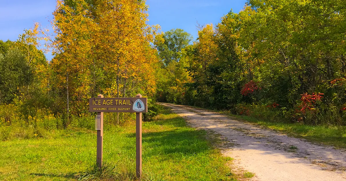
The Ice Age Trail is a designated national trail. The trail is only within the
borders of Wisconsin. The western trailhead is at Interstate State Park in St.
Croix Falls WI and the East trailhead is at Potawatomi State Park in Sturgeon
Bay WI. The trail meanders along the terminal moraine of the last Ice Age. It
courses through every region of Wisconsin including the northern forests,
central sands, driftless area, south central Wisconsin and Kettle Moraine
State Forests of Eastern Wisconsin from Whitewater in the south to Door County
in the North. The trail can be found in 30 Wisconsin counties on federal,
state, local community and private land.
A bifurcation is planned around the historic edge of Glacial Lake Wisconsin, but trail segments are not yet established in the bifurcation aside from the Baraboo Segment.
A bifurcation is planned around the historic edge of Glacial Lake Wisconsin, but trail segments are not yet established in the bifurcation aside from the Baraboo Segment.
Interactive Ice Age Trail Map (2022)

Click Map Image to load the full interactive map.
Or Click here to open Interactive Map in Google Maps App
How long is the Ice Age Trail?
The Ice Age Trail is roughly halfway complete. The planned route will be
approximately 1200 miles from terminus to terminus. Closer to 700-miles of
footpath are designated as Ice Age Trail segments which are currently
connected by connecting-road-routes.
How long does it take to walk the Ice Age Trail?
A through-hike of the full length of the Ice Age Trail takes between 10-16
weeks for most through-hikers.
How many segments are on the Ice Age Trail?
The Ice Age Trail is made up of 124 named segments as of 2024 with each
segment ranging from one to 15.5-miles. Most hikers will hike these segments
individually or even just parts of a segment as day hikes. So the range of
times to complete your hike varies. Most hikers spend less than an hour
hiking on the IAT in a single outing.
Which is the best segment of the Ice Age Trail?
Of course, that depends on what kind of hike you are searching for. A hiker
looking for an easy breezy walk in the sun may think the Clover Valley
Segment is the best. A hiker looking for lots of athletic hill climbs may
think that the Harrison Hills Segment is the best. A weekend backpacker
looking for wilderness camping along the trail will probably think that the
Lake Eleven Segment is the best.
Which is the most scenic segment of the Ice Age Trail?
This also depends on your idea of scenic. The St Croix Falls Segment
features postcard perfect views of the St Croix River. The Devils Lake
Segment is the most popular and most photographed segment - featuring
stunning views of rock formations in the talus slopes along the lake. The
Point Beach Segment features long stretches of sandy beaches on Great Lake
Michigan and is a contender for most scenic segment as well. If you scroll
through the Ice Age Trail Segments list below, you'll find a highlight
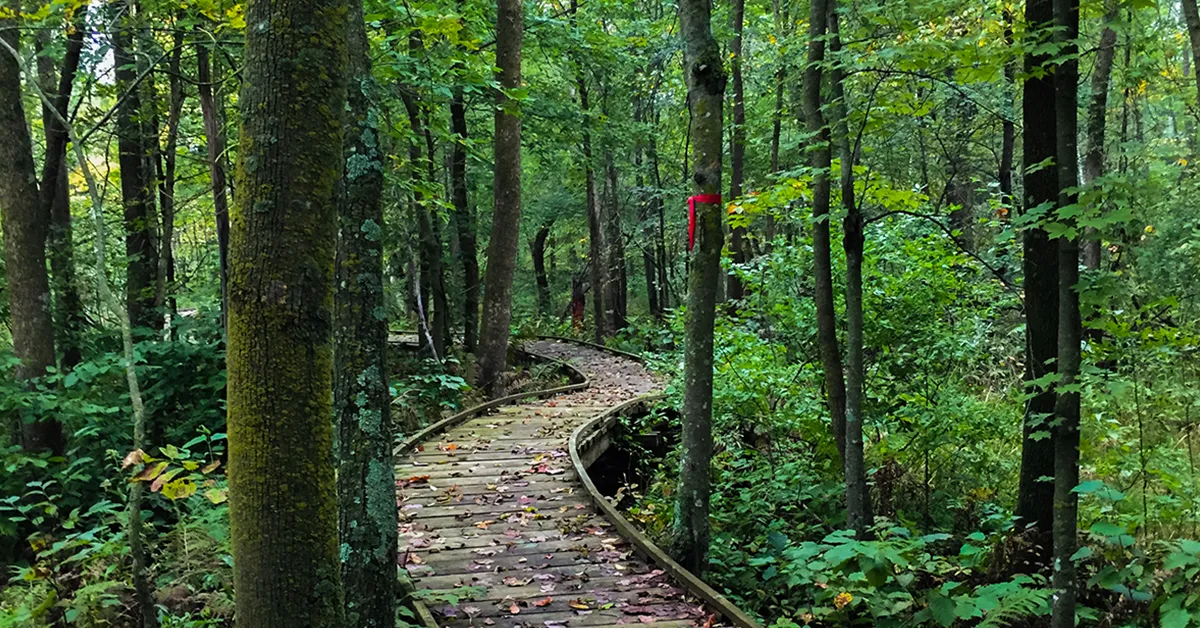
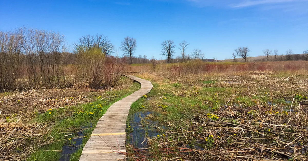
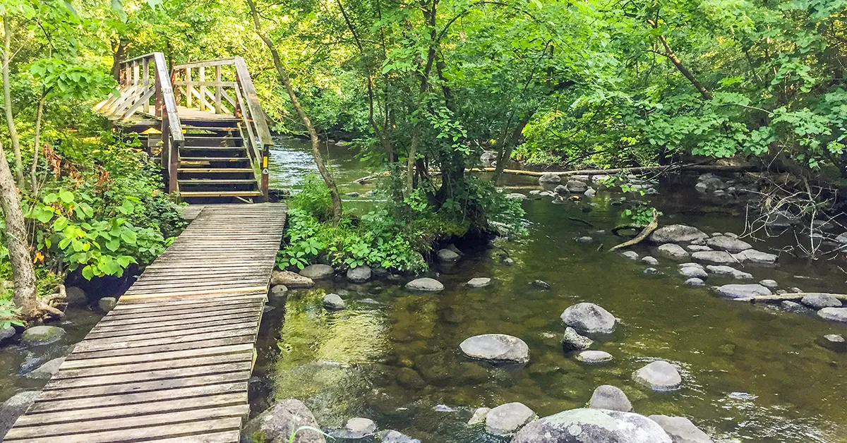
image of each segment and you can decide which is the most scenic.
Is there a fee or does it cost anything to hike the Ice Age Trail?
There is no use fee or permit to hike the Ice Age Trail.
Like highways, waterways, and other transit in the US, the Ice Age Trail
is supported by taxpayer dollars as well as donations.
You may find that a parking lot you wish to use to access the trail is
within a National Forest or Wisconsin State Park where you will need to
purchase a state park sticker to access the park with your motorized
vehicle.
Do you need a permit to hike the Ice Age Trail?
No permit is required to hike the Ice Age Trail.
Can I bike the Ice Age Trail?
Some segments of the Ice Age Trail are designated multi-use trails.
Otherwise, the trail is mostly restricted to foot traffic only - with
motorized vehicles, bikes of any kind, and horseback forbidden.
Which is the best direction to through-hike the Ice Age Trail?
The Ice Age Trail guidebooks describe the segments as running from the
Western Terminus to the Eastern Terminus. As a result, most believe this
to be the direction one is supposed to hike it. But the trail is
bookended by terminals, and there is no true starting and end point. No
particular direction.
Depending on the season you plan to hike it and how long you expect to
be on the trail it could be advantageous to hike it from East to West.
Consider a 4-month plan for hiking the trail beginning in June. If you
begin your journey in Door County, you'll be hiking through the eastern
and southern part of the state when biting bugs in the northern and
western part of the state are at their worst. In other words, you'll be
avoiding the worst of the mosquito swarm by starting in the East. The
segments in the North central and western part of Wisconsin are
generally more difficult and remote. By beginning on the easier and
flatter trail segments in the East you'll be building your strength
before facing the more difficult segments Up North. Another
consideration is rain. Spring and mid-summer tend to be wetter months in
Wisconsin. The trail segments in the northern region also have a
tendency to flood, so it can be advantageous to hike those segments in
the later Summer and Fall. And, finally, while Fall colors are brilliant
along the full length of the trail the segments in the north tend to be
the most forested and you'll be finishing your hike in peak color up
north. For all these reasons it seems best to hike the IAT from East to
West.
Can I camp along the Ice Age Trail?
You cannot disperse camp along most of the Ice Age Trail as you might on
other national trails. There are some designated Dispersed Camping Areas
on some IAT segments. You are limited to one night of camping and no
campfires are allowed at DCA's. In the Northern and Western regions the
Ice Age Trail often flows through national, state, and county forests
where you can disperse camp along the trail. Regulations, permitting,
and boundaries vary wildly between properties on the Ice Age Trail, and
it is difficult to plan for dispersed camping.
Many segments flow through State and County Parks where designated and
reservable campsites are available. Other private campgrounds are located
within a few miles of an Ice Age Trail trailhead.