The Tisch Mills segment of the Ice Age Trail is an easy footpath through outstanding scenery in the crossroads trail town of Tisch Mills on the Kewaunee and Manitowoc County line. This short segment packs in wonderous natural encounters in a short 2.6-mile course that is easygoing and nearly flat in elevation. There is a parking lot at the North trailhead on Nuclear Road and another next to the baseball diamond on Mills Road. A dispersed camping area is tucked into a hemlock grove along the Tisch Mills Creek in Weber’s Woods.
{tocify} $title={Table of Contents}
$ads={1}
advertisement

|
| The Ice Age Trail Tisch Mills Segment along the East Twin River at dawn |
Tisch Mills grew from the site of a grain elevator and depot on East Twin River. To find the Ice Age Trail segment, I parked beside the ball diamond and local fire department and walked along Mill Lane past that old elevator. At the end of the lane, a footpath continues, and before long, it takes a path directly on the riverbanks – one drink away from being submerged in it.
I woke early, hoping to catch some magic as the sun rose, and I got it on this icy spring morning. A hoarfrost encased branches and grass blades in a delicate sparkling ice that steamed away as a warm sun rose over the far bank. The rays of the sun felt like pure energy poured down onto a dreaming world.
At the end of this part of the trail, I circled back along the roads past roosters, cows, and farms down B back into town and turned towards the second part of this trail at Weber’s Woods. Across from the Hunner Preserve, the trail through Weber’s woods was surprisingly dark this bright morning. A thick grove of hemlock and pine-shaded a shallow ravine down to Tisch Mills Creek. To continue to the end of this trail, you’ll need to splash across the creek; there’s no bridge and no need for one, but your feet will be wet.
Short as the trail is, it’s a morning stroll I’ll never forget.

|
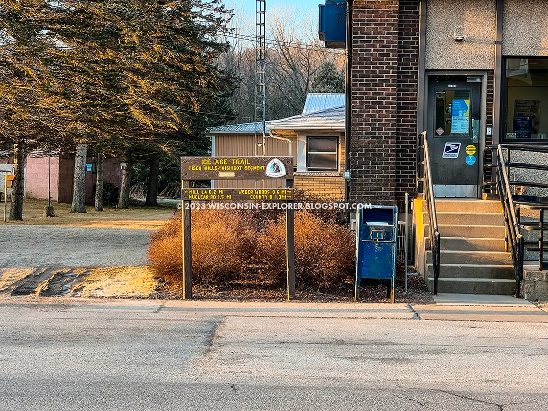
| Tisch Mills Post Office. The small town features a town park, post office, a few bars, yoga studio, dinner theatre, and grain elevator. |
Ice Age Trail Tisch Mills Segment
COUNTY
KEWAUNEE, MANITOWOC
COMMUNITIES
TISCH MILLS, CARSON
TOTAL MILES
2.8-MILE LOOP
DIFFICULTY
EASY
LOWEST ELEVATION
631 AMSL
HIGHEST ELEVATION
729 AMSL
TOTAL ELEVATION GAIN
300 FT
NEXT SEGMENT EASTBOUND
KEWAUNEE RIVER SEGMENT
NEXT SEGMENT WESTBOUND
EAST TWIN RIVER / MISCHICOT SEGMENT
CAMPING
DISPERSED CAMPING AREA
Directions and Trail Map
Click Map Image to load the full interactive map.
Address for your GPS: N110 Co Rd B, Kewaunee, WI 54216
| coordinates: 44.328405, -87.623463 |
| From Milwaukee | 1.5 Hours |
| From Madison | 2.5 Hours |
| From Green Bay | 1/2 Hour |
| From Wausau | 2 Hours |
| From Minneapolis | 5 Hours |
| From Chicago | 3.25 Hours |
Photos

|
| The old grain elevator in Tisch Mills |

|
| Tisch Mills Historic Marker |

|
| The trail runs off the road and heads north keeping close to the meandering East Twin River |

|
| Scenic views of the East Twin River are abundant along this north section of the trail. |

|
| A frosty view of sunrise over the East Twin River |

|
| The trail can get very soggy along the river, but it was frozen just enough to support my weight as passed through |

|
| lookatme4 A glistening frost coated the tree branches on an early April morning |

|
| looatme5 The trail follows a snowmobile route for a short distance to the next road and northern terminus of the Tisch Mills Segment |

|
| lookatme6 South of Tisch Mills the trail cuts through the Weber Preserve and Natural Area along Tisch Mills Creek. |

|
| lookatme7 Weber's Woods hosts a very nice Dispersed Camp Area and dense forest along the Tisch Mills Creek. |

|
| lookatme8 Hikers need to wade through the creek to ford across to the continue on the trail |

|
| lookatme9 Another view of the creek ford along the trail |

|
| lookatme11 The Dispersed Camp Area is on the banks of the Tisch Mills Creek beneath dense pines. |

|
| lookatme13 Another view of the Dispersed Camping Area looking towards the creek. |


