|
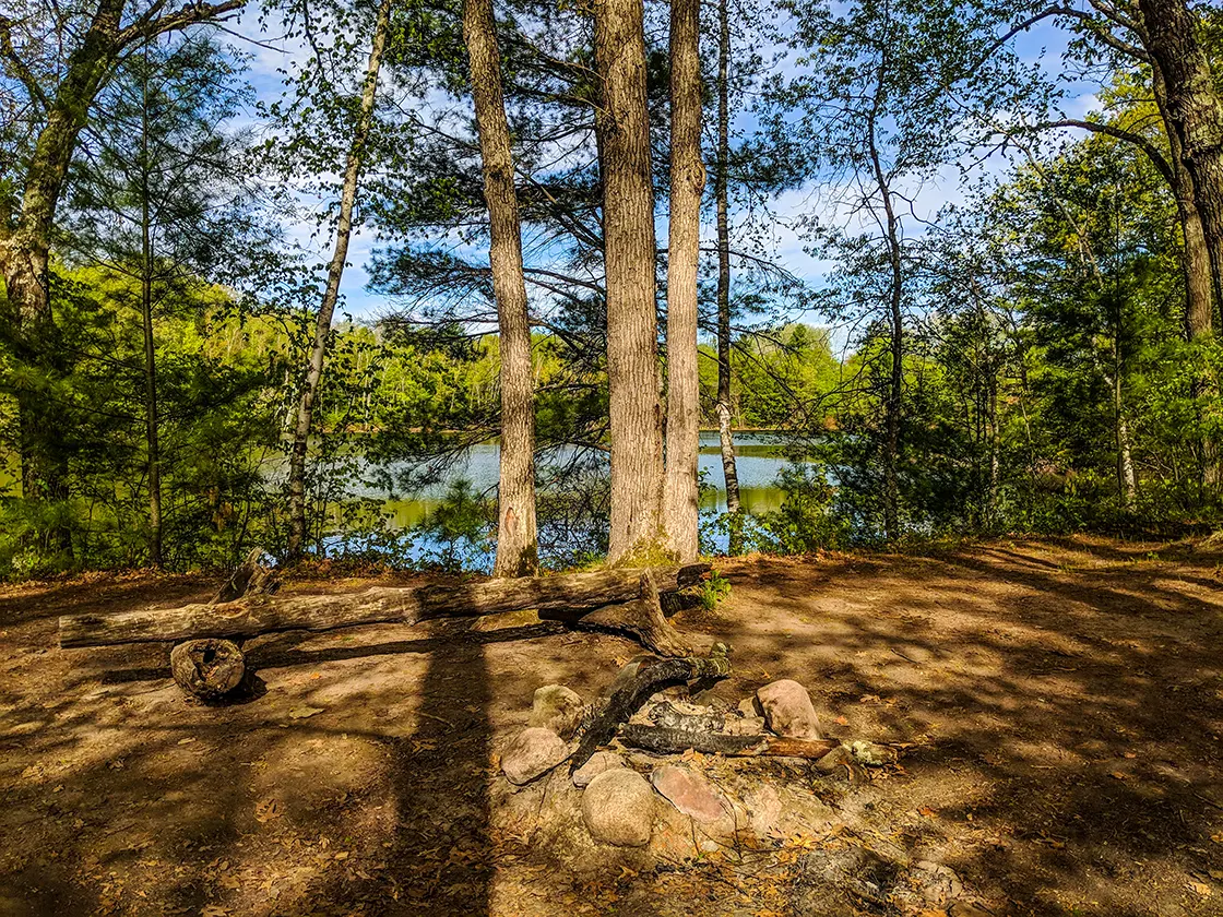
| Disperse Campsite at Harwood Lakes on the Ice Age Trail |
The Harwood Lakes trail is a 5-mile segment of the Ice Age National Trail in New Auburn WI. This segment connects directly to the Chippewa Moraine Segment and is separated by about 1 mile of road walking to the Firth Lake Segment.
Hikers enjoy rustic wilderness along this route as it passes through the Chippewa Moraine Lakes State Natural Area and Chippewa County Forest. A number of lakes, beaver ponds, wetlands, and streams punctuate this extremely beautiful section of the IAT. Two campsites are available for distance hikers - one on an isthmus between the Harwood Lakes and a disperse camping area at Picnic Lake. Camping is also allowed anywhere in the Chippewa County Forest minimum of 50ft from the trail.
{tocify} $title={Table of Contents}
$ads={1}
advertisement

|
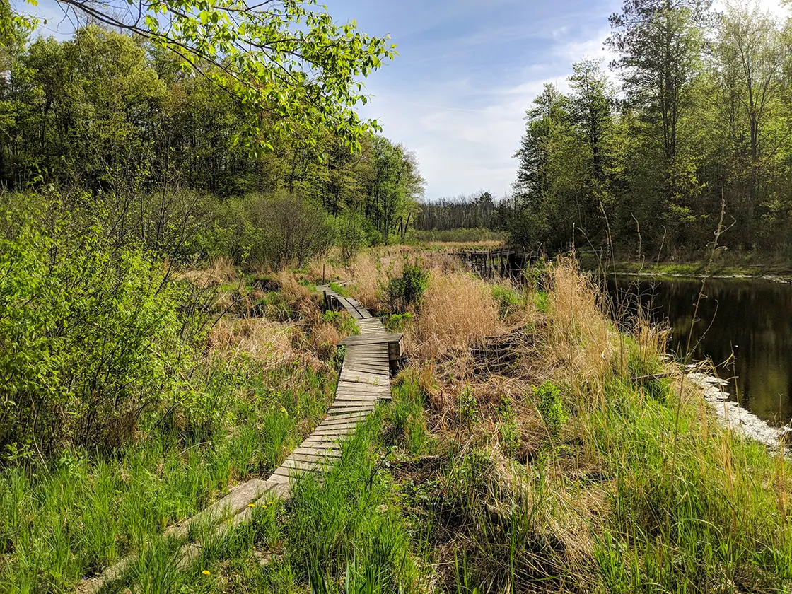
| Boardwalk on the Harwood Lakes Segment of the Ice Age Trail |
After setting up camp at nearby Brunet Island State Park I set out for my first big hike of the 2018 season on the Harwood Lakes Segment. I began the trail at Plummer Lake where I found one awkward parking spot on a turn around drive at the Plummer Lake boat launch.
The day was sunny, blue-skied, and cool with breezes, and this kept the mosquitos and biting bugs at bay. The number of wetlands and dark and damp areas along this trail would seem to be a haven for bugs and ticks.
Initially, the trail covered flat ground through light and young forest. I reached the first scenic overlook at Hardood Lakes which is just west of the spur trail to a rustic campsite. The campsite between Harwood Lakes is ideal and I will return to camp there. Positioned on a high isthmus between the two lakes the views are hard to argue with. It would be a great place to drop in a fishing line and let the time pass by beside a campfire. Campsites of this quality are rare on the IAT; weekend backpackers should take note that the Chippewa County IAT segments are some of the best miles for backpacking on this national trail.
Following my stop at Harwood Lakes, the trail closed in by the denser county forest and the route became more hilly and interesting. The Chippewa Forest is not over-logged and has that old growth feel that makes this trail feel like a backcountry hike. The photogenic Mud Brook Valley opened up before me with the trail leading over a precarious boardwalk that has heaved from freezing and thaws of the wetlands surrounding Mud Brook. The scenery in this valley and for the remaining portion of the hike cemented my notion that this trail is one of the finest that the IAT has to offer.
The best place for parking on this trail is where it crosses Deerfly Trail; a large flattened grassy area can receive several vehicles. From Deerfly Trial the hiking rolls over hummocky terrain past a large erratic and over beaver dams that have created postcard perfect ponds. The trail ends at a Girl Scout Camp on Picnic Lake where a dispersed camping area is available.
If you happen to find yourself camping in Chippewa County and are looking for a real hiker's hike then look no further than the Harwood Lakes Segment.

|
| Harwood Lakes Segment of the Ice Age Trail |
Ice Age National Scenic Trail - Harwood Lakes Segment
COUNTYCHIPPEWA COUNTY
COMMUNITIES
NEW AUBURN, CORNELL
TOTAL MILES
5.4-MILE POINT-TO-POINT
DIFFICULTY
MODERATE
LOWEST ELEVATION
1080 AMSL
HIGHEST ELEVATION
1286 AMSL
TOTAL ELEVATION GAIN
1322 FT
TOTAL ELEVATION LOST
1162 FT
CAMPING
Rustic site at Harwood Lakes and Dispersed Camping Area at Picnic Lake, Dispersed Camping anywhere int the Chippewa County Forest
POINTS OF INTEREST
Plummer Lake, Chippewa Moraine Lakes State Natural Area, Chippewa County Fores, Harwood Lakes, Picnic Lake, Camp Nawakwa
NEXT IAT SEGMENT EASTBOUND
FIRTH LAKE SEGMENT
NEXT IAT SEGMENT WESTBOUND
CHIPPEWA MORAINE SEGMENT
Directions and Trail Map
DOWNLOAD PRINTABLE PDF USGS TOPOGRAPHIC MAPBOB LAKE QUADRANGLE 2015
Click Map Image to load the full interactive map.
If viewing on a mobile device, open the trail map above to load into Google Maps App by touching the expand rectangle in the upper right corner.
Address for your GPS: 25239 167th St New Auburn, WI 54757
| coordinates: 45.216772, -91.341260 |
| From Milwaukee | 4 Hours |
| From Madison | 3.5 Hours |
| From Green Bay | 3 Hours |
| From Wausau | 2 Hours |
| From Minneapolis | 2 Hours |
| From Chicago | 5.5 Hours |
Photos

|
| Beaver pond on the Harwood Lakes Segment of the Ice Age Trail |

|
| Harwood Lakes Segment of the Ice Age Trail |

|
| Harwood Lakes Segment of the Ice Age Trail |

|
| Harwood Lakes Segment of the Ice Age Trail |

|
| Harwood Lakes Segment of the Ice Age Trail |

|
| Harwood Lakes Segment of the Ice Age Trail |

|
| Harwood Lakes Segment of the Ice Age Trail |

|
| Disperse Campsite at Harwood Lakes on the Harwood Lakes Segment of the Ice Age Trail |

|
| Mud Brook Valley on Harwood Lakes Segment of the Ice Age Trail |

|
| Beaver pond on the Harwood Lakes Segment of the Ice Age Trail |

|
| Harwood Lakes Segment of the Ice Age Trail |

|
| Harwood Lakes Segment of the Ice Age Trail |

|
| Large erratic on the Ice Age Trail Harwood Lakes Segment |

|
| Kims Crossing on the Harwood Lakes Segment of the Ice Age Trail |

