

The McKenzie Creek Segment of the Ice Age Trail is a 9.4-mile single-track footpath in Polk County, Wisconsin. It is moderately difficult, with frequent small hill climbs. This hiking trail crosses the sprawling McKenzie Creek State Wildlife Area beside McKenzie Creek and past McKenzie and Dinger Lakes.
The McKenzie Creek Segment connects directly to the Indian Creek Segment at its east trailhead and via a short road connection from its southwest trailhead to the Pine Lake Segment.
Dispersed camping on this segment is limited to a small area near the east trailhead at 50th Street.
Parking areas are frequent, with five large lots providing direct access to the trail and a few others serving access to the Wildlife Area.
{tocify} $title={Table of Contents}
$ads={1}
advertisement
 |
| McKenzie Creek on the McKenzie Creek Segment of the Ice Age Trail |
I’ve been chipping away at parts of the McKenzie Creek Segment for years. The Polk County segments are the farthest drive from my home near Madison.
To address the many connected segments in Polk County, I’ve made a tradition of camping in early May at Straight Lake State Park, one of my favorite state campgrounds. I’ve invited friends to join me camping there who were not quite as ambitious in crushing long lengths of IAT miles. Nevertheless, they would join me for scenic shuttle hikes.
The Mckenzie Creek Segment is easy to shuttle hike by car or bike, as it has five good parking lots with direct access to the trail. Shuttling means leaving one car at a lot, driving a second car down to another lot, and hiking back to the first. It’s a way to avoid dreaded out-and-back hikes on longer segments like Mckenzie Creek.
Overall, I’ve found this trail to be exhilarating. Its frequent small hill climbs are enough to get my heart pumping without being so long as to require breaks to catch my breath. These hills also change your perspective of the scenery. You’ll be a few steps from being submerged in the babbling creek in one moment. A moment later, you will be looking down on the creek valley and will be able to see its course meandering through steep woodland banks.
I love the look of these small creeks. In the coming years, I’ll probably enjoy them even more as I develop an interest in fly fishing. The McKenzie Creek Segment is a Class I trout stream, meaning that its trout population is self-sustaining. There are innumerable perches and fishing spots along the length of the stream, and the Ice Age Trail helps anglers find their way down the banks to them.
Speaking of fly fishing – it makes perfect sense here – the flies and biting bugs swarm in the tight creek valleys. You might find your hiking pace on this segment is quite fast as you seek refuge from the bugs. Choose a breezy day to hike this segment.
 |
| McKenzie Creek on the McKenzie Creek Segment of the Ice Age Trail |
Ice Age National Trail McKenzie Creek Segment
COUNTY
POLK
COMMUNITIES
INDIEAN CREEK, CLAM FALLS, BARRONETT
TOTAL MILES
9.4-MILES POINT-TO-POINT
DIFFICULTY
MODERATE
LOWEST ELEVATION
1035AMSL
HIGHEST ELEVATION
1300 AMSL
TOTAL CUMMULATIVE ELEVATION GAIN
1850 FT
NEXT IAT SEGMENT EASTBOUND
IAT INDIAN CREEK SEGMENT
NEXT IAT SEGMENT WESTBOUND
PINE LAKE SEGMENT
Directions and Trail Map
If viewing on a mobile device, open the trail map above to load into Google Maps App by touching the expand rectangle in the upper right corner.
Address for your GPS: Ice Age National Scenic Trail, Frederic, WI 54837
| coordinates: 45.59705743848346, -92.29688845411067 |
| From Milwaukee | 5 Hours |
| From Madison | 4 Hours |
| From Green Bay | 4 Hours |
| From Wausau | 2.5 Hours |
| From Minneapolis | 1.5 Hours |
| From Chicago | 6 Hours |
Photos
 |
| The typical look of this segment in spring. The trail is a single track through underbrush. Trilliums carpet the forest floor. |
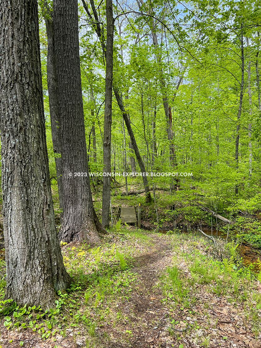 |
| Bridges over the creek are frequent |
 |
| McKenzie Creek seems almost too small to support a fishery |
 |
| Some kettles and moraines remind hikers this a glacial defined landscape |
 |
| McKenzie Lake in the distance |
 |
| McKenzie Lake is a good lake for paddling around |
 |
| Trees near McKenzie Lake are gigantic and gestural |
 |
| There are plenty of wetlands, and plenty of old boardwalks to get you through them |
 |
| Areas of the creek begin to widen out |
 |
| The creek is always in view from the trail. The trail is either in the valley next to it or on a high hill above it. Meaning: there are lots of hill climbs |
 |
| A little later in spring the vegetation begins to thicken up |


 |
| An example of how close the trail comes to the creek |


 |
| Dinger Lake on the McKenzie Creek Segment of the Ice Age Trail |
 |
| Dinger Lake on the McKenzie Creek Segment of the Ice Age Trail |
 |
| Dinger Lake on the McKenzie Creek Segment of the Ice Age Trail |
 |
 |
| A huge parking lot on the Clam Falls end of the segment. |