|
| Ice Age Trail Greenbush Segment |
{tocify} $title={Table of Contents}
$ads={1}
advertisement

|
| Shelter #5 Hikers Shelter on the Greenbush Segment of the Ice Age Trail |
Contents:
Description
Overview and Statistics
Trail Map and Directions
Photos
Video
Links
Related Posts
Rugged, rocky, and rolling the Greenbush Segment delivers mountain-like hiking
in the Northern Kettle Moraine, a series of glacial land forms that rise
dramatically out of the gentle rolling landscape of eastern Wisconsin.
Backpackers love this trail and the trails south of it including the Parnell and
Milwaukee River segments.Description
Overview and Statistics
Trail Map and Directions
Photos
Video
Links
Related Posts
I began this trail on at the northern trail head on County Highway P in Glenbeulah and hiked it south to the southern trail head at Highway 67 outside of Parnell. From the northern trail head the trail climbed and climbed winding around around the rims of vast kettles. The hard packed rocky trail bed was uneven and at times slippery well worn stones.
Hardwood forest gave way to managed forest and pine plantations as I approached Highway 23. The 23 crossing was difficult. I had to wait nearly 15 minutes before an adequate opening in the traffic cleared for me to get across. The IAT follows along the Old Plank Road for a mile or so on the southern side of 23. The sound of pumpkin cannons from a nearby bar and grill that hosting a pumpkin chuck festival. I stopped in for a beer and a few Johnsonville brats before getting back on the trail.
The trail cut back into the forest onto a narrower more rugged footpath. A couple miles south of 23 a side trail diverts off to the town of Greenbush and the Historic Wade House Museum - a popular destination in the area.
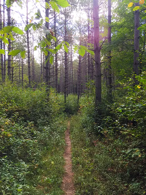
South of the trail intersection the trail rolls along a high ridge avoiding difficult climbs. The next rest stop was at the Group Camp Parking area where water and restrooms are available. A mile south of the group camp is a picnic area that offers water and restrooms as well. The landscape of the trail calms down south of the picnic area becoming an easy to moderate trail as it descends toward Parnell.
Near the end of this trail I came on a water pump and Shelter #5 which is sited in wooded valley. There is ample room for tent camping surrounding the shelter. The shelter itself could fit 12-20 hikers while the camping area around the shelter can accommodate large groups of tent campers.
The Greenbush Segment ends unceremoniously at Highway 67 where the Parnell Segment begins.

|
| Ice Age Trail Greenbush Segment |
Overview: Ice Age National Scenic Trail Greenbush Segment
COUNTYSHEBOYGAN COUNTY
COMMUNITIES
GREENBUSH,GLENBEULAH, PLYMOUTH
TOTAL MILES
8.4-MILE POINT-TO-POINT
DIFFICULTY
DIFFICULT
LOWEST ELEVATION
940 AMSL
HIGHEST ELEVATION
1230 AMSL
TOTAL ELEVATION GAIN
1310 FT
TOTAL ELEVATION LOST
-1450 FT
CAMPING
Group Camp, Shelter #5
NEXT IAT SEGMENT EASTBOUND
LABUDDE CREEK SEGMENT
NEXT IAT SEGMENT WESTBOUND
PARNELL SEGMENT
Directions and Trail Map
Click Map Image to load the full interactive map.
Address for your GPS: 5802 Kettle Moraine Dr, Greenbush, WI 53023
| coordinates: 43.750964, -88.101880 |
| From Milwaukee | 1 Hour |
| From Madison | 1 Hours 45 minutes |
| From Green Bay | 1 Hour |
| From Wausau | 2.5 Hours |
| From Minneapolis | 5 Hours |
| From Chicago | 2.5 Hours |
Photos

|
| Ice Age Trail Greenbush Segment |

|
| Ice Age Trail Greenbush Segment |

|
| Ice Age Trail Greenbush Segment |

|
| Ice Age Trail Greenbush Segment |

|
| Ice Age Trail Greenbush Segment |

|
| Ice Age Trail Greenbush Segment |

|
| Ice Age Trail Greenbush Segment |

|
| Ice Age Trail Greenbush Segment |

|
| Ice Age Trail Greenbush Segment |

|
| Ice Age Trail Greenbush Segment |

|
| Ice Age Trail Greenbush Segment |

|
| Shelter #5 Hikers Shelter on the Greenbush Segment of the Ice Age Trail |
Video
Links
Ice Age National Trail AllianceIce Age National Trail - National Parks Service
Northern Kettle Moraine State Forest
Old Wade House Museum


