

|
| Ice Age Trail Slinger Segment |
The Ice Age National Trail has been intentionally routed through the heart of historical town centers. These "Trail Towns" offer long distance hikers a chance to recharge, clean laundry, and stop in at a tavern for a burger and a beer. The Slinger Segment routes hikers between the Pike Lake and Cedar Lakes Segment through downtown Slinger. It is a 2 mile route that mainly follows roads and sidewalks. A short wooded hill climb on the between Highway 60 and Howard Avenue.
{tocify} $title={Table of Contents}
$ads={1}
advertisement

|
| Ice Age Trail Slinger Segment |
Slinger is a picturesque village near the bottom of a valley between wooded kames. Church steeples rise above quiet tree lined streets. Little Switzerland Ski Hill marks the eastern ridge of the village center. Across from Little Switzerland the Slinger Speedway roars with combustion energy.
Hikers begin this trail at the intersection of Highway 60 and County Road CC. A short footpath descends a hill and spills out onto a quiet residential road. You'll then follow Hartford Road behind some industrial complexes clustered by an intersection of two important railroads before joining up with Kettle Moraine Drive which is Slinger's main street.
There are only a few shops and restaurants in downtown Slinger. For now the village center lacks inns or hotels which would be well located here for long distance hikers. The main intersection in town is where Highway 175 crosses Kettle Moraine Drive. Highway 175 in Slinger was formerly the route of the Yellowstone Trail - America's first coast-to-coast automobile road which connected Plymouth Mass to Seattle Washington.
The next segment of the IAT, The Cedar Lakes Segment, begins at the intersection of Cedar Creek Road and Kettle Moraine Drive.

|
| Ice Age Trail Slinger Segment |
Ice Age National Scenic Trail - Slinger Segment
COUNTYWAUKESHA COUNTY
COMMUNITIES
SLINGER
TOTAL MILES
2-MILE POINT-TO-POINT
DIFFICULTY
VERY EASY
LOWEST ELEVATION
1040 AMSL
HIGHEST ELEVATION
1106 AMSL
TOTAL ELEVATION GAIN
130 FT
TOTAL ELEVATION LOST
-110 FT
POINTS OF INTEREST
Little Switzerland Ski Area, Slinger Speedway, Slinger Community Park
NEXT IAT SEGMENT EASTBOUND
CEDAR LAKES SEGMENT
NEXT IAT SEGMENT WESTBOUND
PIKE LAKE SEGMENT
Directions and Trail Map
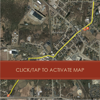
Click Map Image to load the full interactive map.
Address for your GPS: 5304 Kettle View Ct, Slinger, WI 53086
| coordinates: 43.325276, -88.299373 |
| From Milwaukee | 1/2 Hours |
| From Madison | 1.5 Hours |
| From Green Bay | 1.5 Hours |
| From Wausau | 2.5 Hours |
| From Minneapolis | 4.5 Hours |
| From Chicago | 2 Hours |
Photos

|
| Ice Age Trail Slinger Segment |

|
| Ice Age Trail Slinger Segment |

|
| Slinger Speedway on the Ice Age Trail Slinger Segment |

|
|
Ice Age Trail Slinger Segment - Highway 175 in Slinger is the former
route of the Yellowstone Trail America's first coast to coast highway. |

|
| Ice Age Trail Slinger Segment |
Links
Ice Age National Trail AllianceIce Age National Trail - National Parks Service
Yellowstone Trail