|
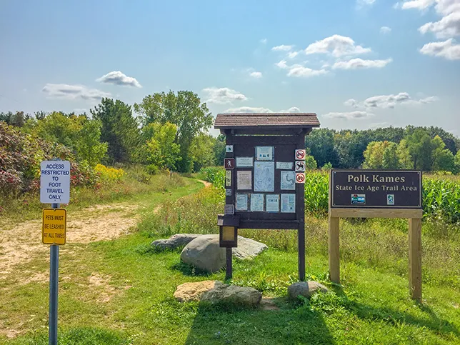
There's a lot of future trail development required before the Cedar Lakes Segment will connect between the Slinger and West Bend Segments. For now the Cedar Lakes Segment is a 2 mile long linear easy footpath that cuts through valleys between the Polk Kames outside Slinger. You'll find a large parking lot off County Highway NN. The trail area includes two other trails so you can make this hike into a 4 mile lollipop.
{tocify} $title={Table of Contents}
$ads={1}
advertisement

|
| Ice Age Trail Cedar Lakes Segment |
The sound of traffic and speeding cars roars through the forest at Polk Kames State Ice Age Trail Area. The trail area butts up against the busy I41 and is just across the freeway from the Slinger Speedway - an active racetrack. In spite of the distant noise the parking lot off NN was full and there were plenty of dog walkers and hikers out for a Sunday morning stroll before the big Packers game.
The trail starts out cutting through a few corn fields but then dashes into a deep forest. The forest is old growth and typical of the native forests which once shaded this region: birch, oak, maple. The trail does not catch too much elevation, preferring to stay between the kames rather than climb them. But, a few gentle rollers twist through this ancient feeling forest.
This is a great easy weekend walk for locals who seem to know it well. It offers easier hiking and a bit more privacy than the nearby Pike Lake State Park. While short on long scenic views, this remains a gem of a hike in Washington County.

|
| Ice Age Trail Cedar Lakes Segment |
Ice Age National Scenic Trail - Cedar Lakes Segment
COUNTYWASHINGTON COUNTY
COMMUNITIES
SLINGER
TOTAL MILES
2-MILE POINT-TO-POINT
DIFFICULTY
EASY
LOWEST ELEVATION
1100 AMSL
HIGHEST ELEVATION
1210 AMSL
TOTAL ELEVATION GAIN
280 FT
TOTAL ELEVATION LOST
-270 FT
POINTS OF INTEREST
Polk Kames
NEXT IAT SEGMENT EASTBOUND
WEST BEND SEGMENT
NEXT IAT SEGMENT WESTBOUND
SLINGER SEGMENT
Directions and Trail Map
Click Map Image to load the full interactive map.
Address for your GPS: 4704-4898 Arthur Rd, Slinger, WI 53086
| coordinates: 43.353114, -88.271140 |
| From Milwaukee | 1/2 Hour |
| From Madison | 1.5 Hours |
| From Green Bay | 1.5 Hours |
| From Wausau | 2.5 Hours |
| From Minneapolis | 5 Hours |
| From Chicago | 2 Hours |
Photos

|
| Ice Age Trail Cedar Lakes Segment |

|
| Ice Age Trail Cedar Lakes Segment |

|
| Ice Age Trail Cedar Lakes Segment |

|
| Ice Age Trail Cedar Lakes Segment |

|
| Ice Age Trail Cedar Lakes Segment |

|
| Ice Age Trail Cedar Lakes Segment |

|
| Ice Age Trail Cedar Lakes Segment |

