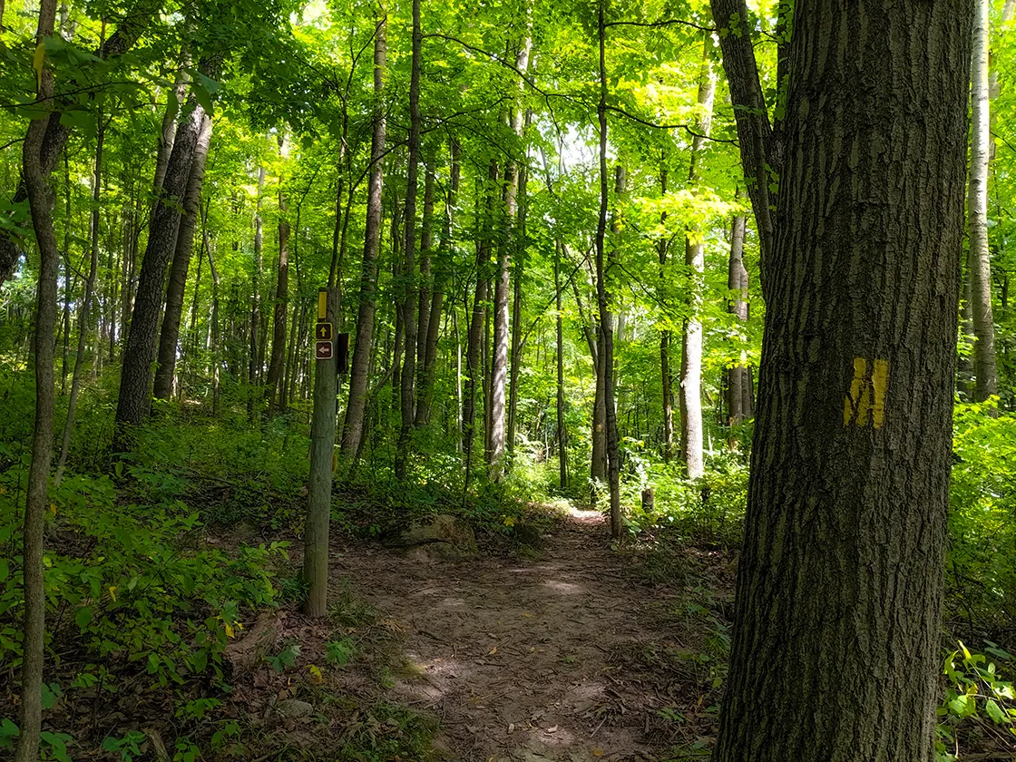
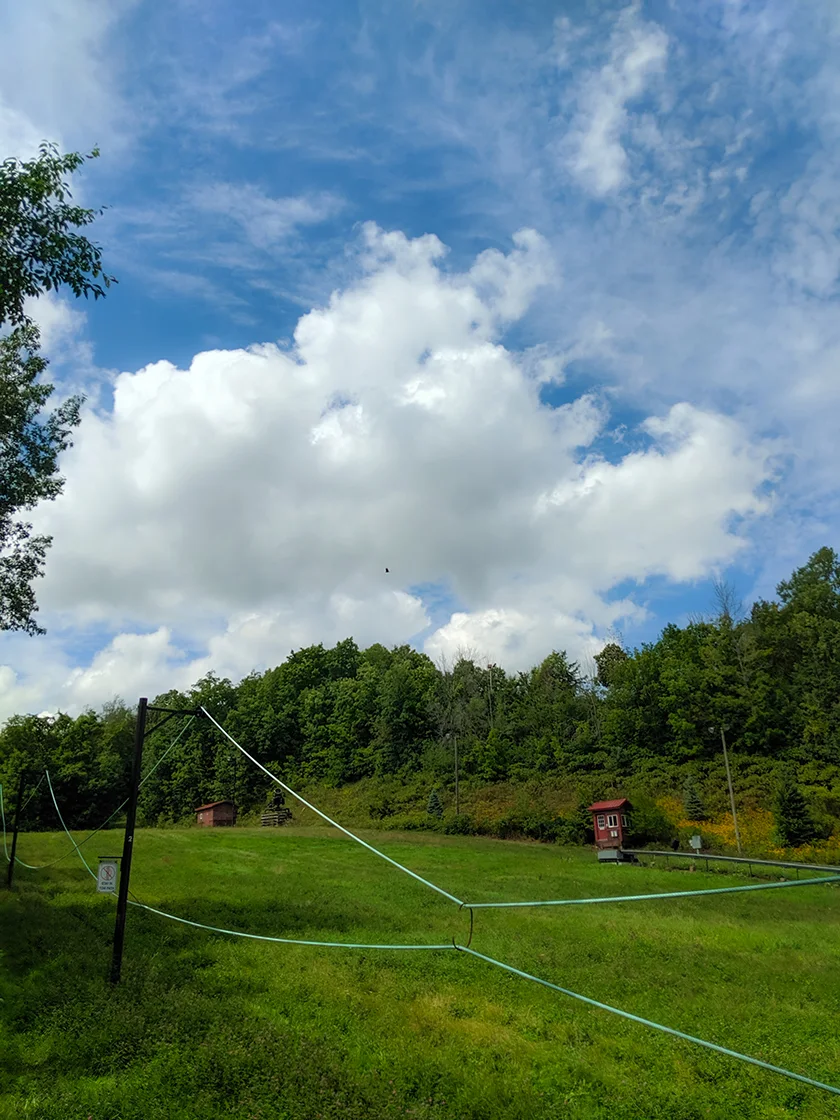
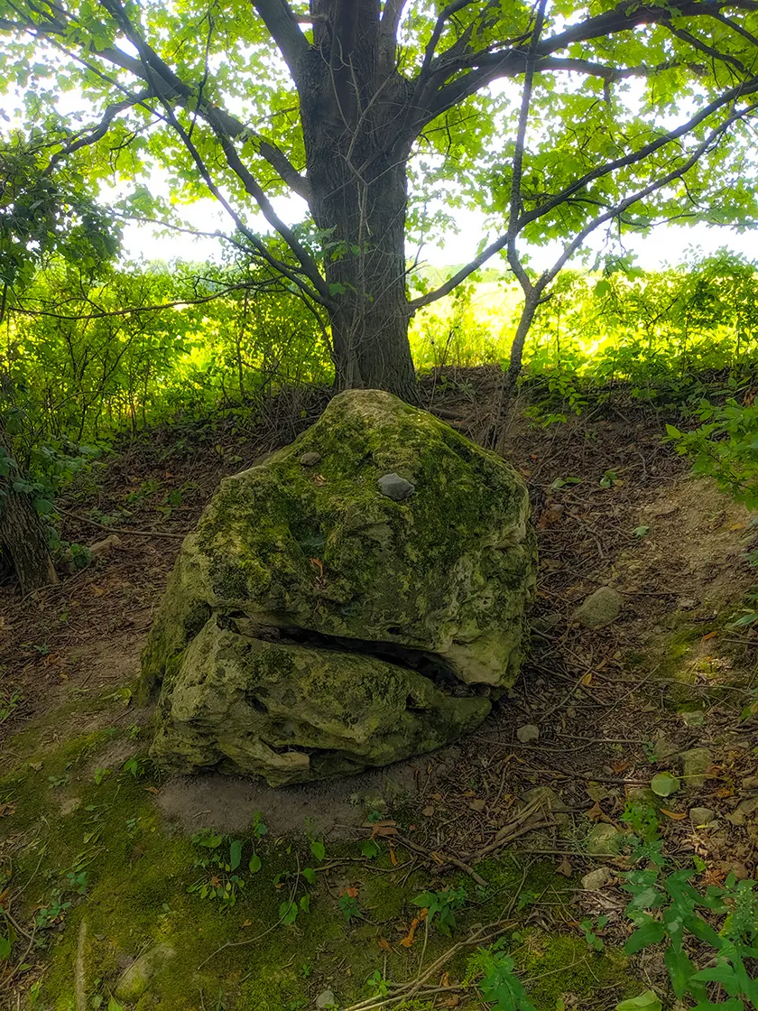
The Kewaskum Segment of the Ice Age Trail is a 2.1-mile point-to-point footpath cutting through the Otten Preserve and Sunburst Ski Area between West Bend and Kewaskum. This moderately difficult trail is easy to follow on a well worn single track footpath.
There is a parking area for the trail and Otten Preserve on Ridge Road, and long distance hikers will find a place to rest at a dispersed camp area about 1/2-mile up the hill from the parking area. An additional pair of trails blazed blue and white create loops through the preserve.
Leaving the Otten Preserve, hikers progressing on to the Milwaukee Segment will have to walk down the bunny hill at Sunburst Ski Area and along prospect drive before catching the last portion of the footpath which leads towards I45 and under it via a tunnel underpass.
The Kewaskum Segment intersects the Eisenbahn State Trail before connecting to the Milwaukee Segment trail head when heading Eastbound. Heading westbound, the Kewaskum Segment is separated by 2.2-miles of connecting roads to the Southern Kewaskum Segment, which is a very short 1/4-mile cut between Wildwood Drive and Friendly Road. The West Bend Segment then extends south from Friendly Drive at Kettle Moraine Scenic Drive (CTY D).
{tocify} $title={Table of Contents}
$ads={1}
advertisement

|
| Sunburst Ski Area on the Kewaskum Segment of the Ice Age Trail |
As often happens in Wisconsin, there are divergent origin stories for where the name Kewaskum came from and why it was attributed to this area along the Milwaukee River between West Bend and Fond du Lac. Nearly all the murky tales seem to have settled on some relationship to a leader of a band of Potawatomi who dwelt in the Kettle Moraine areas.
The larger Potawatomi Nation was driven from Wisconsin by the 1830 Removal Act. But some bands remained, mostly unharassed by the local European settlers. They continued their tradition of moving seasonally between Spring, Summer, and Winter camps. Due to this movement there are recordings of Kewaskum's band settled around Pike Lake, on the Rock River, and suggestions of settlements on kames near to Milwaukee River. One such location is a high ground in Kewaskum referred to as Indian Hill where it is said a long house or wigwam once stood on top of.
At this time, Kewaskum would have been known as Myer's Mill or North Bend. Kewaskum was later adopted by Jesse Myers and William Barnes who founded the Village of Kewaskum, though they gave no reason for their decision. In the early 1900's Chief Kewaskum's band, among other Potawatomi remaining in Wisconsin, were awarded fees for their earlier treaties and used the funds to purchase land in Forest County. They have since been referred to as the Forest County Potawatomi.
As one hikes through the Otten Preserve on the high forest covered kame it is easier to imagine Kewaskum and his band choosing this location as a winter camp. As you descend the kame past Sunburst Ski area you will be looking out over a large wetland that is crossed by I-45. Wetlands such as these provide emergency food sources during the winter months. If stores fail during an especially long winter, then reeds can be extracted from wetlands, the roots of which are packed with sugars and nutrition.
The Kewaskum Segment trail is brief and doesn't provide a whole lot of time to imagine the history of this area or to become immersed in a natural setting. There is the ever-present noise of the nearby highways intruding. The best part of the Kewaskum Trail is that it connects directly to the Milwaukee River Segment, which begins a long procession of uninterrupted footpath stretching between Kewaskum and Greenbush to the north. As such, the Kewaskum segment is the southernmost segment of the Northern Kettle Moraine.
Two additional trails, one blazed blue and the other white add some depth to this trail. Multiple loops are formed, and hikers can day hike the Otten Preserve in a double loop from the parking area.
For me, the Otten Preserve parking area is where I turned around on my long out-and-back which started near New Fane.

|
| Trails through the Otten Preserve |
Ice Age Trail Kewaskum Segment
COUNTYWASHINGTON, FOND DU LAC
COMMUNITIES
KEWASKUM
TOTAL MILES
2.1-MILE POINT-TO-POINT
DIFFICULTY
MODERATE
LOWEST ELEVATION
928 AMSL
HIGHEST ELEVATION
1136 AMSL
TOTAL ELEVATION GAIN
349 FT
TOTAL ELEVATION LOST
159 FT
CAMPING
Disperse Camping Area in Otten Preserve
NEXT IAT SEGMENT HEADING EASTBOUND
MILWAUKEE SEGMENT - WASHINGTON COUNTY
NEXT IAT SEGMENT HEADING WESTBOUND
WEST BEND SEGMENT
Directions and Trail Map
DOWNLOAD PRINTABLE PDF USGS TOPOGRAPHIC MAPWEST BEND QUADRANGLE 2015
Click Map Image to load the full interactive map.
If viewing on a mobile device, open the trail map above to load into Google Maps App by touching the expand rectangle in the upper right corner.
Address for your GPS: 3975 Ridge Rd Kewaskum, WI 53040
| coordinates: 43.485001, -88.235293 |
| From Milwaukee | 40 Minutes |
| From Madison | 1.5 Hours |
| From Green Bay | 2 Hours |
| From Wausau | 2.5 Hours |
| From Minneapolis | 5 Hours |
| From Chicago | 2.5 Hours |
Photos

|
| Boardwalk on the Milwaukee River Segment of the Ice Age Trail |

|
| Road on the Milwaukee River Segment of the Ice Age Trail |

|
| The Official trailhead for the Kewaskum Segment at Sunburst Ski Area |

|
| Sunburst Ski Area Tow Rope |

|
| Ice Age Trail follows the tow rope on the bunny hill |

|
| Ice Age Trail Kewaskum Segment |

|
| Ice Age Trail Kewaskum Segment |

|
| Trail humor on the Ice Age Trail Kewaskum Segment |

|
| Under Pass Tunnel connecting to the Milwaukee River Segment |

|
| Eisenbaum State Trail |
Links
Otten PreserveIce Age National Trail Alliance
Ice Age National Trail - National Parks Service


