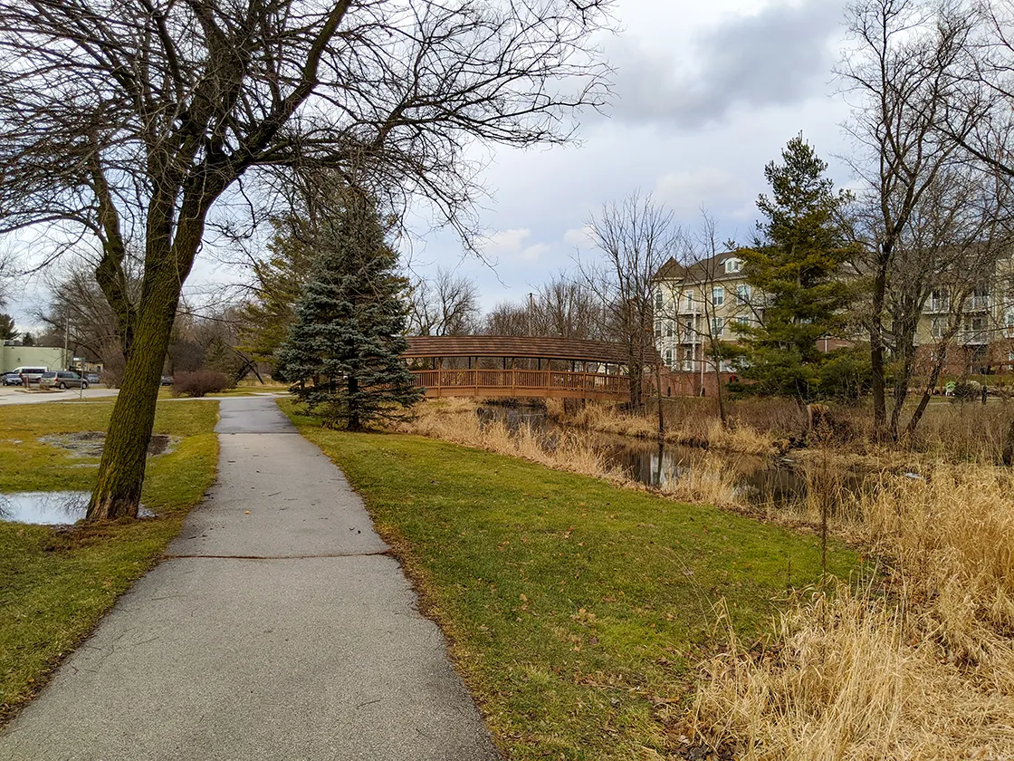
The Hartland segment of the Ice Age National Scenic Trail is a 6.8-mile course of various trail types including sidewalks, asphalt paved bike trails, and footpaths spanning between the Delafield Segment to the south and the Merton Segment to the north. These easy trails take hikers and bikers through neighborhoods, parks, and downtown Hartland besides creeks and the Bark River.
{tocify} $title={Table of Contents}
$ads={1}
advertisement

|
|
Hartland Marsh on the Ice Age Trail Hartland Segment |
I am ambitious at the start of every winter to put on my insulated layers and get outside and active no matter the conditions. But then, early in December we are hit by a two weeklong polar vortex where temperatures drop to -20 and I am persuaded to give up my hopes and settle myself in the comforts of the indoors.
Just as there are weeks of frigid cold in Wisconsin winters, there are also winter gifts of a week or a few days of exceptional warmth which break through. You’ll see all sorts of Wisconsinites take to the streets and sidewalks in sandals and shorts to bask in an unseasonable 50-degree weekend in January. We happened to have one of those breaks in early 2020 that coincided with a weekend, so I made use of it by filling the air in my bike tires and heading out to Hartland for a ride.
I started at a church parking lot not far from the Delafield/Hartland trailhead and walked the brief footpath beside the golf course. Nothing interesting to report from this area of the trail save for the sound of cars on Highway 83 and I94.
Following the brief stroll, I moved my car over to a small lot at Hartland Marsh on County Highway E. Here I walked an out and back through the marsh over boardwalks and through the bushes on a single-track trail. Bike treads outnumbered the footprints, so I probably could have got away with biking this section even through it reserved for foot traffic.
When I returned to my car, I unloaded my bike and set off down the road following the yellow trail blazes of the Ice Age Trail. After a few blocks, the trail left the road and joined a paved asphalt bike trail that led to Nixon Park. Gliding downhill along the park road I hooked back up with the bike trail that follows the Bark River through downtown Hartland.
I never knew that hartland had a downtown, but it does, and it is just like any other small town with a library and post office, restaurants, shops, and city parks. The trail quickly exited the downtown area and kept tracing the banks of the river. The trail gets interesting in this last section as it crosses boardwalks and asphalt within spitting distance of the river through a scenic glen and then into a large park. At the end of the park the segment ends where a connecting route to the Merton Segment begins.
There are some excellent restaurants along this route, so plan an afternoon with friends or family walking or biking this route and build your plan around a breakfast or lunch for a serenely pleasant and laid back day out on the IAT.
If you are long-distance hiking, there is a campground at Naga-Waukee County Park across Highway 83. There are plenty of places to refill with water and use public restrooms along the route. Each of the parks include flush restrooms.

|
| Bark River on the Ice Age Trail Hartland Segment |
Ice Age Trail Hartland Segment
COUNTYWaukesha
COMMUNITIES
Hartland
TOTAL MILES
6.8-MILE POINT-TO-POINT
DIFFICULTY
VERY EASY
LOWEST ELEVATION
900 AMSL
HIGHEST ELEVATION
1020 AMSL
TOTAL ELEVATION GAIN
300 FT
NEXT IAT SEGMENT EASTBOUND
MERTON SEGMENT
NEXT IAT SEGMENT WESTBOUND
DELAFIELD SEGMENT
POINTS OF INTEREST
Bark River, Hartland Marsh, Nixon Park, Bark park, Hartbrook Park, Centennial Park
CAMPING
Naga-Waukee County Park
Directions and Trail Map
Click Map Image to load the full interactive map.
If viewing on a mobile device, open the trail map above to load into Google Maps App by touching the expand rectangle in the upper right corner.
Address for your GPS: 900 Cottonwood Ave Hartland, WI 53029
| coordinates: 43.088174, -88.350199 |
| From Milwaukee | 30-Minutes |
| From Madison | 1 Hour |
| From Green Bay | 2 Hours |
| From Wausau | 3 Hours |
| From Minneapolis | 5 Hours |
| From Chicago | 2 Hours |
Photos

|
| Hartland Marsh on the Ice Age Trail Hartland Segment |

|
| Hartland Marsh on the Ice Age Trail Hartland Segment |

|
| Hartland Marsh on the Ice Age Trail Hartland Segment |

|
| Hartland Marsh on the Ice Age Trail Hartland Segment |

|
|
Nixon Park on the Ice Age Trail Hartland Segment |

|
| Nixon Park on the Ice Age Trail Hartland Segment |

|
| Nixon Park on the Ice Age Trail Hartland Segment |

|
|
Downtown Hartland on the Ice Age Trail Hartland Segment |

|
|
Follow the yellow Ice Age Trail blazes to stay on the trail |

|
| Along the Ice Age Trail Hartland Segment north of Capitol Drive |

|
|
Entering Hartbrook Park on the Ice Age Trail Hartland Segment |

|
|
The Bark River on the Ice Age Trail Hartland Segment |

|
|
Along the Ice Age Trail south of Hartland Marsh |


