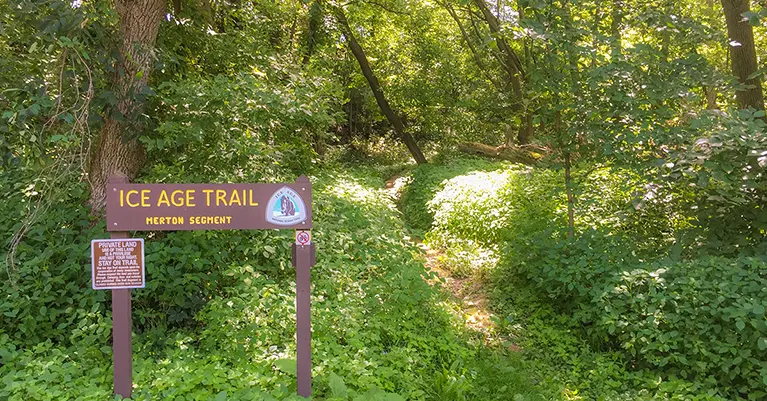
The Merton Segment of the Ice Age National Trail is roughly 3 miles of trail and 2 miles of precarious roadside walking. A short footpath follows the Bark River and then connects to the Bugline trail via Dorn Road. Most of the miles are on the paved Bugline Trail. Another short footpath cuts along next to the Oconomowoc River. Some scenic views are offered along the Bark River, but otherwise this trail is a here-to-there incomplete connection between the Hartland Trail and Monches Segment.
{tocify} $title={Table of Contents}
$ads={1}
advertisement

|
| Ice Age Trail Merton Segment along the Bugline Trail |
There's not much going on along this trail. The official IAT guidebook calls this a 5.2 mile trail. But, let's examine the word "trail" very closely here. The official trailhead is in Centennial Park in Hartland. The first two miles of this "trail" is along precarious roadways before you duck into a forest along the Bark River for something like a 1/2 mile.
When you return to Dorn Road there is at least a bike lane that gives some level of protection to hikers before reaching the Bugline Recreational Trail. The IAT existed here before the Bugline was extended on this corridor. So, you will find remnants of the old IAT trail to the left and right of the right-of-way. My advice, just stay on paved Bugline Trail; the side trails are weed and bug infested.
The portion of the Bugline Trail that the Merton Segment follows is long and boring. One highlight is a view of the Milwaukee Polo Club fields. I was lucky enough to be passing during a match. So, that was cool. Otherwise, the Merton Segment was a bust. It's only necessary to hike this trail if you are like me and are trying to knock off each segment of the IAT. Otherwise, opt for the beautiful Monches Segment next door.

|
| Ice Age Trail Merton Segment |
Ice Age National Scenic Trail - Merton Segment
COUNTYWAUKESHA COUNTY
COMMUNITIES
MERTON
TOTAL MILES
2.9-MILE POINT-TO-POINT
DIFFICULTY
VERY EASY
LOWEST ELEVATION
910 AMSL
HIGHEST ELEVATION
1000 AMSL
TOTAL ELEVATION GAIN
180 FT
TOTAL ELEVATION LOST
-200 FT
NEXT IAT SEGMENT EASTBOUND
MONCHES SEGMENT
NEXT IAT SEGMENT WESTBOUND
HARTLAND SEGMENT
Directions and Trail Map
Click Map Image to load the full interactive map.
Address for your GPS: N78W30778 Funk Rd, Merton, WI 53029
| coordinates: 43.161503, -88.357518 |
| From Milwaukee | 1/2 Hour |
| From Madison | 1 Hour |
| From Green Bay | 2 Hours |
| From Wausau | 3 Hours |
| From Minneapolis | 5 Hours |
| From Chicago | 2 Hours |


