

This segment is a difficult 6.3-mile hike through the Underdown Recreation Area, which is within the Lincoln County Forest, and among my favorite hikes on the Ice Age National Trail. The hike is closer to 8-miles if you include the Alta Junction Segment.
There are abundant opportunities for camping in the Underdown and this is a magical woodland to spend an evening camping in a backcountry site.
{tocify} $title={Table of Contents}
$ads={1}
advertisement
My introduction to the Underdown was in the winter of 2020 when me and a friend use the extensive network of snowshoe trails to access the shelter at Dog Lake, which we used as our base for an evening of winter camping. We hiked a major portion of the Ice Age Trail on that snowy adventure weekend.
I came back in the summer of 2021 for the summer experience. I was joined by a friend, and we stopped in to shuttle hike the extent of the Underdown Segment while breaking up a drive to a weekend camping adventure in Vilas County.
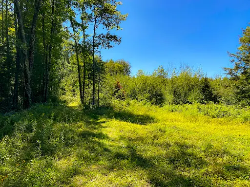
We started at the Alta Junction trail parking lot, completed the Alta Junction Segment, and then walked beside the roads to the east trailhead of the Underdown Segment. The trails in the Underdown are single track and cut through deep forest. Occasionally these trails run concurrent with mountain bike trails, ski trails, and horseback riding trails.
There are many trails in the Underdown, and as a result there are many trail intersections which can be confusing. The Ice Age Trail is well marked but even with its frequent yellow blazes it’s still easy to become lost in conversation and find that you’ve hiked off down a wrong trail. This happened to us one time and we followed our maps app back to the Ice Age Trail with relative ease. There were a few moments where we had vigorous conversation a trail intersection before determining which path to continue on.
The Underdown Segment is said to be among the hilliest segments of the Ice Age Trail. If that is true, I must have been enjoying my hike thoroughly as I didn’t notice severe elevation changes in the first half of the trail. There are several bogs and wetlands to view along the first portion of this trail. The latter half of this trail snakes past a few small fishing lakes.
You’ll find the first backcountry campsite beside Dog Lake where a new shelter has been constructed. The shelter is protected within a dense grove of pine trees and holds the high ground on a knoll overlooking the lake. There is space for a few tents in the area and plenty of trees to tie up a hammock. Three benches surround a stone fire ring. Having the three-walled shelter is a welcome amenity to a backcountry campsite. In a storm this shelter would provide a bit more confidence in avoiding being clobbered by fallen tree branches and it is a dry place to spread out. In winter, this dry platform provides shelter from the wind and a place to make meals and kick off your boots.
The trail does become noticeably more hilly heading westbound from Dog Lake. There is a series of large hills that the trail circles and climbs. On the downslope of one of these hills is another backcountry campsite. It is difficult to spot this site but there is a sign reading “Campsite”. We were looking vigilantly for the site to market on our maps and we nearly bypassed it. Walking into the site I noticed a small fire ring that hadn’t been used in years. And as I surveyed the land around this site, I realized that there was the potential to set up a tent in a couple of places. In summer, camping on this hilltop might be a good idea to catch some breezes that might clear away the bugs.
Continuing west, the trail climbs a couple hills and then settles at Mist Lake. We found a group of horseback riders at the lake edge watering their horses. There is a picnic area with a picnic table, fire ring, and hitching post beside Mist Lake. In the summer months this area may be used as a campsite for horseback riders. In winter this campsite is directly adjacent to the snowshoe trails and would make a nice winter campsite for hikers.
There are a few more hills headed west from Mist Lake, but the trail topography is mild. You’ll enter a section of two track trail through a beautiful pine forest beside a wetland. This area is called the Enchanted Forest. I noticed that many of the bike trails in the underdown are named after the sights that they pass. For example, the homestead trail passes the foundations of an old homestead. The old car trail passes the abandoned wreck of a classic car. These evocative names provide a sense of mystery and story to your walk through the Underdown.
From the Enchanted Forest there is a long and gradual uphill climb to reach the west trailhead near Horn Lake. Following the gravel road down to Horn Lake you’ll find a large parking area at a boat ramp and two unmarked primitive campsites. These campsites are popular as they are drive in and can fit RV´s. Both were occupied on that Saturday afternoon when we walked through. But there was plenty of additional room for us to park a car at this end of the trail.
If you’d like to camp in the area at a more formal campground the Underdown Recreation Area has a drive-in campground that is popular with horseback riders. There are many sites here which will accommodate an RV or tent as well as restroom and water facilities.
Sometimes a place just has a special feel. I’m not sure what it is that’s so great about the Underdown. But I have been there twice, and each trip left warm and positive memories. And I am heading there for a third time this winter for an overnight of winter camping. If you are interested in learning more about winter camping and snowshoeing check out my separate article on snowshoeing the Underdown linked here.

|
| Fire ring at Dog Lake Sheter |
Ice Age Trail Underdown Segment
COUNTY
LINCOLN
COMMUNITIES
GLEASON
TOTAL MILES
7.6-MILE POINT TO POINT
DIFFICULTY
DIFFICULT
LOWEST ELEVATION
1445 AMSL
HIGHEST ELEVATION
1610 AMSL
TOTAL ELEVATION GAIN
1440 FT
NEXT IAT SEGMENT EASTBOUND
ALTA JUNCTION SEGMENT
NEXT IAT SEGMENT WESTBOUND
GRANDFATHER FALLS SEGMENT
CAMPING
Underdown Drive-in Campground, Dog Lake Shelter, Dispersed Camp Area, Horn Lake Campsite
Directions and Trail Map

Click Map Image to load the full interactive map.
If viewing on a mobile device, open the trail map above to load into Google Maps App by touching the expand rectangle in the upper right corner.
Address for your GPS: W3221 Copper Lake Ave, Gleason, WI 54435
| coordinates: 45.32994675204681, -89.58632067708386 |
| From Milwaukee | 3.25 Hours |
| From Madison | 2.5 Hour |
| From Green Bay | 2 Hours |
| From Wausau | 40 Minutes |
| From Minneapolis | 3.5 Hours |
| From Chicago | 4.5 Hours |
Photos

|
| Horn Lake Parking Lot and primitive campsites |

|
| Horn Lake Boat Ramp |

|
| Alta Junction Trailhead. Parking for the east end of the Underdown Segment is down the road and at Alta Junction |

|
| A short and easy road connection between Alta Junction Parking Lot and the Underdown Segment |

|
| The east trailhead for the Underdown Segment follows a bike trail indicated by a gear symbol |

|
| Along the Underdown Segment |

|
| Wide two-track trail intersection that is confusingly marked. no discernable blaze for the IAT |
|
| Trail blazes for the IAT can be hard to come by |

|
| The wreck of an old car on the Old Car Mountain Bike Trail |

|
| Going west from Dog Lake the Underdown Segment becomes more rugged and hilly |

|
| The forest is also deeper and older west of Dog Lake |

|
| There is wide variety of forest cover, mostly hardwood on the east end and more pine forest on the west end of the Underdown Segment |

|
| A bench beside the shore of Dog Lake |

|
| Lilly pads on Dog Lake |

|
| The Ice Age Trail Underdown Segment |

|
| The trail is rougher and hillier between Dog Lake and Mist Lake |

|
| An easy to miss sign for the dispersed camp area between Dog Lake and Mist Lake on the Underdown Segment |

|
| The Dispersed Campsite between Dog Lake and Mist Lake is part way up a steep hill. |

|
| The picnic area at Mist Lake |

|
| View of Mist Lake in the Underdown Recreation Area |
|
|
| Entering the Enchanted Forest at the west end of the IAT Underdown Segment |

|
| Some shrooms in the Enchanted Forest |

|
| The West Trailhead of the IAT Underdown Segment |

|
| One of the primitive drive-in campsites at Horn Lake parking lot and boat ramp |

|
| The Dog Lake trail shelter and campsite has a shelter, several tent pads, a fire ring, chairs, a table, and a bench. It is elevated on a knoll beneath hemlocks overlooking Dog Lake |
Links
Underdown Recreation AreaUnderdown Snowshoe Trail Map
Ice Age Trail - Underdown Segment Map
Lincoln County Forest Primitive Camping Information