The Grandfather Falls Segment is one of the most loved section hikes of the
Ice Age Trail. It is a moderately difficult 4 mile linear hiking trail along
the banks of the Wisconsin River in Lincoln County. This historic trail was
established by American Indians and used by French voyageurs as a portage
around Grandfather Falls.
Grandfather Falls today may look more like a rapids than a waterfall, but the series of cascades that hikers can observe add up to an 89 foot drop extended over the distance of 1 mile; the highest waterfall on the Wisconsin River. Today, the flow of the Wisconsin at Grandfather Falls is tamed by a system of dams and dykes. The miles of Ice Age Trail at Grandfather Falls are steeped in history, geology, and scenery.
Grandfather Falls today may look more like a rapids than a waterfall, but the series of cascades that hikers can observe add up to an 89 foot drop extended over the distance of 1 mile; the highest waterfall on the Wisconsin River. Today, the flow of the Wisconsin at Grandfather Falls is tamed by a system of dams and dykes. The miles of Ice Age Trail at Grandfather Falls are steeped in history, geology, and scenery.
{tocify} $title={Table of Contents}
$ads={1}
advertisement

|
| Grandfather Dam on the Grandfather Falls Segment of the Ice Age National Trail |
Section and day hikers usually begin the Grandfather Falls Segment at Camp New Wood County Park, though there are parking lots dispersed along the the northern length of the trail. Camp New Wood is the site of a Civilian Conservation Corps encampment for companies 3649 and 1608 who were responsible for constructing Rib Mountain State Park and features at Council Grounds State Park. Today a campgrounds remains with 7 sites - each with direct access to the Wisconsin River. There is also a water pump, playground, picnic shelters, vault toilet, and boat launch at Camp New Wood.
Camp New Wood is sited at a midpoint of the Grandfather Falls Segment. Hikers beginning here can choose to continue northbound along the River or cross into the deep Merrill School Woods. The trail is currently incomplete and the tail of this trail which heads into the Merrill School Woods is the only length of the Ice Age Trail which must be completed as an out-and-back hike by thru-hikers. Currently, the trail ends at Ripley Creek, but will eventually head out towards Tug Lake Recreational Area.

|
| Campsite 1 at Camp New Wood County Park |
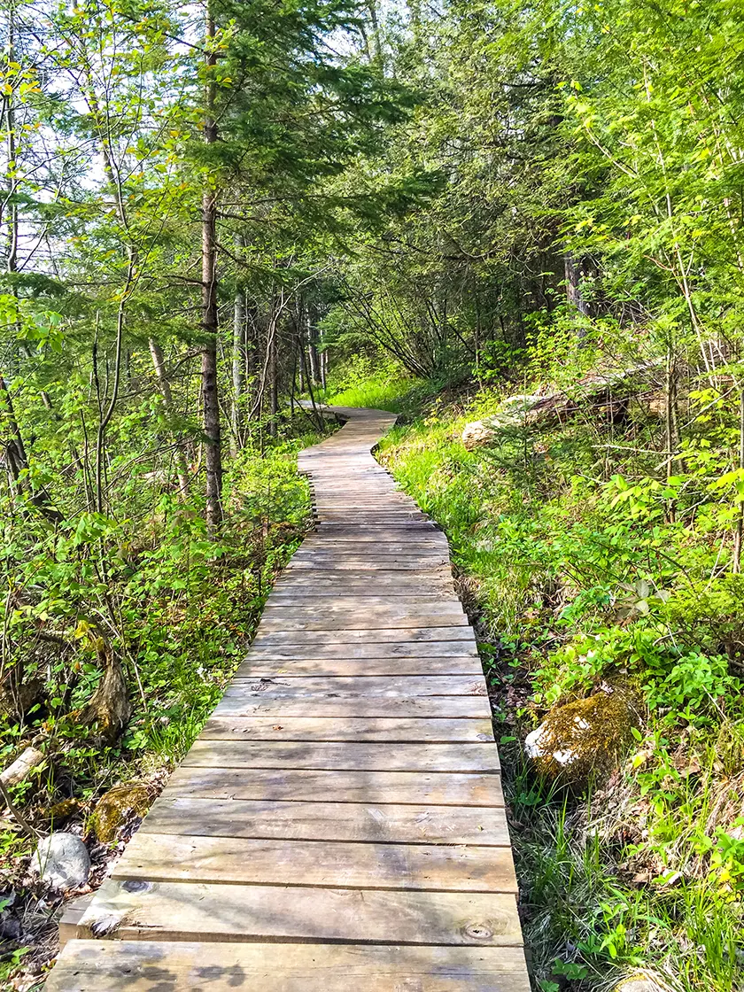
Heading north from Camp New Wood the trail is pleasant and mild. You'll pass through the Camp New Wood campgrounds and then along footpaths with extensive boardwalks over muddy areas. This portion of the trail lets out at a parking area near the Grandfather Falls powerhouse.
The Grandfather Hydroelectric Dam is unusual. It is a closed aqueduct system. You will first notice the two surge towers as you approach the powerhouse. The other oddity are the pair of wood pipes that feed water to the powerhouse - those are called penstocks.
The most efficient way to harness gravity in a hydroelectric system is to locate the turbines in the powerhouse at the lowest point of a waterfall and to draw in water to it from the highest point. Grandfather Falls is a mile long waterfall - so water needs to be transported in pipes between the high point and the low point. At Grandfather Falls a reservoir of water is created by the regulating upper dam with floodgates that open and close to keep the reservoir at a consistent level. Water from the reservoir is transported within the penstocks which increases water pressure rather than in an open mill race.
At the generators there are valves which regulate how much water is pouring over the turbines. When these valves begin to close to decrease flow into the turbines it causes water pressure to build up in the penstocks. So, the surge towers are elevated tanks that high pressure water splashes up into. Providing a place for the pressurized water to divert to protects the penstocks from bursting.

|
| Penstocks and Surge Towers at Grandfather Hydroelectric Dam |
As you walk alongside the penstocks you'll notice that they are made of redwood planks and reinforced by steel bands similar to wood barrels turned on their sides. Holes in the wood are filled with tar, but not all holes and seams can withstand the pressure and river water sprays out of them like a water fountain. Further up the trail you will walk on a bridge over the penstocks at the intake house.
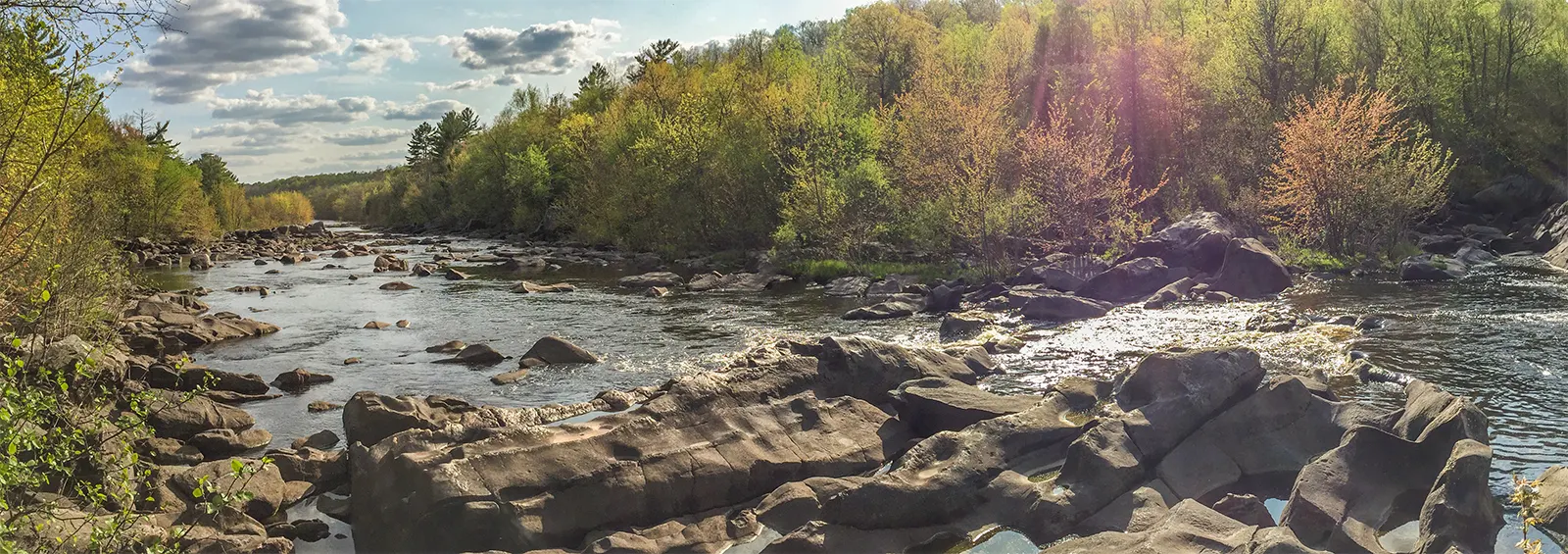
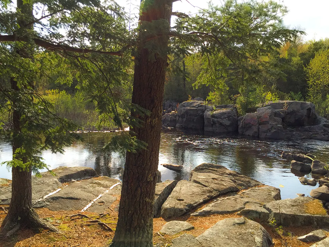
The area between the penstocks and the upper dam is the most scenic part of the hike. But, the trail becomes very rugged and closed in; use of trekking poles here is wise to maintain your balance. Many rocky outcroppings offer views of the rapids and river. The stones here are ancient volcanic stone and polished smooth by the River. They are so smooth that I was able to find a sculpted nook that was as comfortable as any bed that I have laid in. I took some time to stare at the clouds forming shapes above and took a short snooze in the sun.
This northern part of the trail was established by French voyageurs, trappers, and fur traders. They named this falls Grand Pere Taureau which translates to Grandfather Bull. The sound of the rapids was said to remind the traders of running bulls from France. This name established a tradition of naming other falls on the Wisconsin in honor of bulls - such as Little Bull Falls in Mosinee, Big Bull Falls in Wausau, and Jenny Bulls Falls in Merrill.
In the 1800's the rocks along the banks of Grandfather Falls was a popular place to sit and watch the entertainment of log raftsmen untangling huge logjams which often occurred at Grandfather Falls. At times the piles of logs jammed up in the river rose as high as twelve feet.
The north end of the trail terminates at a parking lot across a bridge over the Grandfather Flowage above the upper dam. A mile west is the trailhead for the Turtle Rock Segment of the IAT. This trail meanders along the western banks of Grandfather Falls and then turns towards the Averill-Kelly Creek Wilderness. From this same northern terminus of the Grandfather Falls Segment you can head eastbound several miles along roads to the Underdown Segment.
Check out more photos of this segment and the trail map below.

|
| Rocks and roots make for tricky hiking on the Grandfather Segment of the IAT |
Overview: Ice Age National Scenic Trail - Grandfather Falls Segment
COUNTYLINCOLN COUNTY
COMMUNITIES
MERRILL, IRMA
TOTAL MILES
3.9-MILE POINT-TO-POINT
DIFFICULTY
MODERATE
LOWEST ELEVATION
1300 AMSL
HIGHEST ELEVATION
1430 AMSL
TOTAL ELEVATION GAIN
560 FT
TOTAL ELEVATION LOST
-550 FT
CAMPING
Camp New Wood County Park
POINTS OF INTEREST
David Obey Interpretive Center, Chippewa Moraine National Scientific Reserve, Chippewa County Forest, Chippewa Moraine Lakes State Natural Area, Horseshoe Lake (2), North Shattuck Lake, Payne Lake, North of North Shattuck Lake, Knickerbocker Lake, Dam Lake, Drumke Lake, Plummer Lake
NEXT IAT SEGMENT EASTBOUND
UNDERDOWN SEGMENT
NEXT IAT SEGMENT WESTBOUND
TURTLE ROCK SEGMENT
Directions and Trail Map
DOWNLOAD PRINTABLE PDF USGS TOPOGRAPHIC MAPGRANDFATHER FALLS QUADRANGLE
Click Map Image to load the full interactive map.
If viewing on a mobile device, open the trail map above to load into Google Maps App by touching the expand rectangle in the upper right corner
Address for your GPS: N4581 WI-107, Merrill, WI 54452
| coordinates: 45.287719, -89.792428 |
| From Milwaukee | 3.5 Hours |
| From Madison | 2.75 Hours |
| From Green Bay | 2 Hours |
| From Wausau | 40 Minutes |
| From Minneapolis | 3 Hours |
| From Chicago | 5 Hours |
Photos

|
| Along the Grandfather Falls Segment of the Ice Age National Trail |

|
| Along the Grandfather Falls Segment of the Ice Age National Trail |

|
| The trail runs through campgrounds at Camp New Wood County Park |

|
| Boardwalk on the Grandfather Dam Segment of the Ice Age Trail |

|
| Grandfather Dam Powerhouse |

|
| wood penstocks at Grandfather Dam |

|
| wood penstocks at Grandfather Dam |

|
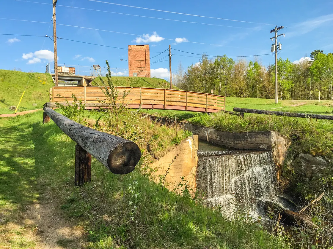
| Overflow return at Grandfather Dam on the IAT |

|
| The Wisconsin River on the Grandfather Falls Segment of the Ice Age National Trail |

|
| Rocks and roots make for tricky hiking on the Grandfather Segment of the IAT |

|
| Grandfather Dam on the Grandfather Falls Segment of the Ice Age National Trail |

|
| The Wisconsin River on the Grandfather Falls Segment of the Ice Age National Trail |

|
| Overflow return at Grandfather Dam on the IAT |

|
| Crossing The Wisconsin River on the Grandfather Falls Segment of the Ice Age National Trail |

|
| Grandfather Dam Powerhouse on the Ice Age Trail |

|
| The Wisconsin River on the Grandfather Falls Segment of the Ice Age National Trail |


