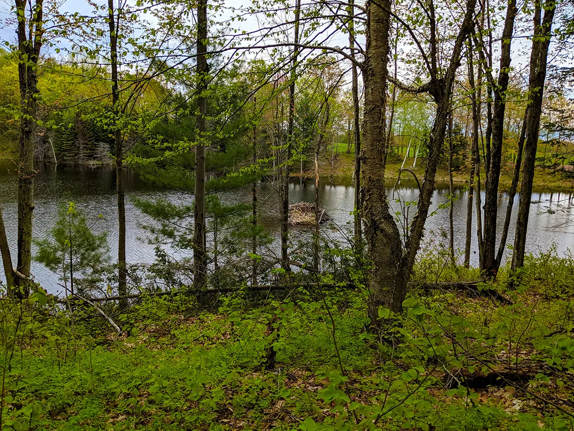
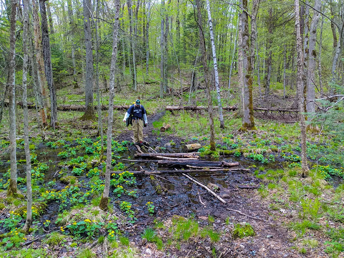
The Lake Eleven Segment of the Ice Age Trail is a 15.5-mile point-to-point footpath that covers backcountry of the Chequamegon National Forest in Taylor County Wisconsin. Unlike many segments of the Ice Age National Trail, this segment is not usually considered a day hike. Its length, difficulty, and remoteness demand a more intensive approach and it is more common to see backpackers along this trail than day hikers.
At least two rustic campsites are available at Lake Eleven and you can set up your own primitive campground anywhere along this trail route as it is entirely surrounded by national forest.
This trail is hilly, at times muddy, and requires fording many streams and negotiation of swamped areas of trail. The footpath is narrow and closed in by thick vegetation. Its 15+ miles are difficult. That makes it pretty much the ideal trail experience sought after by wilderness backpackers.
{tocify} $title={Table of Contents}
$ads={1}
advertisement

|
| Backpacking along the Lake Eleven Segment of the Ice Age Trail |
I backpacked this trail along with three members of my extended family as part of a 3-day adventure on the IAT. We hiked from Highway 64 to Lake Eleven on Day 1, then to Sailor Creek on the Jerry Lake Segment on Day 2, and finished at Spearhead Point on the Mondeaaux Esker Segment on Day 3.
This is a very typical approach to covering this long section of the Ice Age Trail in the Chequamegon (she-want-me-gone). Though, by the end of our trip, I would recommend that it be split down further into 4 days. These three segments line up to be deceptively challenging.
When we started at the Highway 64 trailhead it looked like just another day on the easy-going Ice Age Trail. The Lake Eleven Segment started with easy rollers past a small glacial pond. When we reached the first beaver dam and stream ford we knew we were Up North and immersed in pristine scenery.
We casually diverted off the line of the trail to circumvent a few swampy mud traps and carried on this way for most of the day: climb up a hill, climb down a hill, circumvent a bog, climb up a hill, cross a stream balancing on a few small logs, then circumvent a bog ... repeat.
We found the IATA atlas maps to be underwhelming in detail, I would much prefer a topographic map. This became problematic. And, here is where I get to my lessons learned from this trip. This was my first backpacking excursion in nearly 20-years. I normally hike at an aggressive three-mile-per-hour pace, and I planned on hiking at 30-minute miles when loaded down with a 30lb backpack. But, it was hard to gauge our speed and progress without adequate maps.
There was no cell coverage to confer with satellite maps and the atlas maps I had from 2013 were missing some key fire road crossings, major intersecting trails, or details like bridges and topography. I was unaware that our party was lagging at 1-to-1.5 mph pace. With an expected 9.5-miles to reach the Lake Eleven campsites, this meant that we would be backpacking for 8-9 hours, where I had planned for 5-hour hiking days.
I was sure that we were in the area of Lake 11 when the trail passed beside a smaller unnamed lake surrounded by deep hemlocks. And, here we found the snowmobile trail that is mentioned in the IATA guidebook as leading to hemlock shaded campsites. Little did I know we had not yet even crossed Sawyer Road. The two water bodies I mentioned that the snowmobile trail threads between incidentally are positioned and roughly shaped similarly to Lake Eleven and the unnamed lake to the south of it (This is evident on a satellite map and not on the atlas maps) - leading to a complete deception.
With a morale-sucking stop to scout out campsites between these unnamed lakes, we realized that we had at least 2-miles further to go. From Sawyer Road, the Lake Eleven Segment begins to climb longer, steeper, and higher hills; and this topography continues on to Jerry Lake before calming.
There isn't a snowmobile trail leading off from the south end of Lake Eleven as mentioned in the official trail guide. We spotted the fire ring of the south campsite just a few steps off to the left of the trail as Lake Eleven came into view.
The campsite was picture perfect and featured plenty of flat spots on beds of soft pine needles to set up our four tents spaced out extending down the ridge. We quickly got to work filtering lake water and heating up dinner, and then enjoyed a few sips of brandy and cider as night fell quickly. In my exhaustion I forgot to head down to the lakeshore to stargaze ... the dark skies of the Chequamegon have few parallels in Wisconsin.
The next morning we got started again just after sunrise. We didn't stop to photograph the campsite on the north end of the lake as it was occupied by another group. I am told that this site is near to a stream which is preferable for filtering drinking water from as opposed to lake water.
We had a warm and sunny hike the rest of the way on the Lake Eleven Segment through picturesque northern forest. The trail features some memorable hill climbs through the Richter Lake Hemlocks State Natural Area, and the higher relief topography makes for a more scenic and challenging hike.
We finished out the Lake Eleven Trail at Sailor Creek Road and continued on to the Jerry Lake campsite where we stopped for lunch and a half hour break with the packs off our shoulders.
If you are into hiking deep forest on challenging single track trails the Lake Eleven Segment will be right up your alley. But, of the two, I would recommend the Jerry Lake Segment for its extraordinary scenic beauty over the Lake Eleven Segment.
You can continue the story of our 3-day hike here on the Hiking The Ice Age Trail Jerry Lake Segment Post.

|
| Rustic campsite overlooking Lake Eleven |
Ice Age Trail Lake Eleven Segment
COUNTY
TAYLOR
COMMUNITIES
FORD, PERKINSTOWN, GILLMAN, MEDFORD
TOTAL MILES
15.5-MILES POINT-TO-POINT
DIFFICULTY
MODERATE-DIFFICULT
LOWEST ELEVATION
1298 AMSL
HIGHEST ELEVATION
1452 AMSL
TOTAL ELEVATION GAIN
3358 FT
NEXT IAT SEGMENT EASTBOUND
JERRY LAKE SEGMENT
NEXT IAT SEGMENT WESTBOUND
CHIPPEWA RIVER SEGMENT
Directions and Trail Map
Click Map Image to load the full interactive map.
If viewing on a mobile device, open the trail map above to load into Google Maps App by touching the expand rectangle in the upper right corner.
Address for your GPS: 12900 WI-64, Ford, WI 54447
| coordinates: 45.119549, -90.701695 |
| From Milwaukee | 4 Hours |
| From Madison | 3 Hour |
| From Green Bay | 2.5 Hours |
| From Wausau | 1 Hour |
| From Minneapolis | 2.5 Hours |
| From Chicago | 5.5 Hours |
Photos

|
| Pond along the Ice Age Trail Lake Eleven Segment |

|
| Stream Crossing on the IAT Lake Eleven Segment |

|
| Pond along the Ice Age Trail Lake Eleven Segment |

|
| Creek Crossing on the IAT Lake Eleven Segment |

|
| Rustic Campsite on South end of Lake Eleven |

|
| Pond along the Ice Age Trail Lake Eleven Segment |

|
| Crossing a mud pit and swampy area on the Ice Age Trail Lake Eleven Segment |

|
| Along the Lake Eleven Segment of the Ice Age Trail |

|
| Lake Eleven |

|
| New Rustic Campsite between Fire Road 558 and Beaver Creek (Does not appear on official maps) |


