The Portage Canal Segment of the Ice Age Trail is a very easy 3.5-mile hike along paved trails and sidewalks in the trail town of Portage, Wisconsin. This historic route traces The Grand Portage between the Fox River and the Wisconsin River - effectively uniting clear routes between the Atlantic Ocean and the Gulf of Mexico via the inland route. For centuries, this was a major trade route in the US Interior. Fort Winnebago and an Indian Agency House were established to protect this geographically important sliver of land and the many people it connected. A canal was added in the late 19th Century, which was quickly made irrelevant by rail routes.
The Ice Age Trail route follows the canal from an old lock on the Wisconsin River to the Indian Agency House at the Fox River. Parking is available in lots at Pauquette Park and the Indian Agency House, as well as along streets and public lots along the length of this route. Restrooms and potable water can be found at various parks, including Pauquette, Riverside, The Fairgrounds, and the Indian Agency House. The Fairgrounds offers showers and camping on non-event days. Being a trail town, long-distance hikers will also find other services such as groceries, pharmacies, medical centers, laundromats, and other retail. Portage also is a stop on an Amtrak line between Milwaukee and the Twin Cities.
{tocify} $title={Table of Contents}
$ads={1}
advertisement
 |
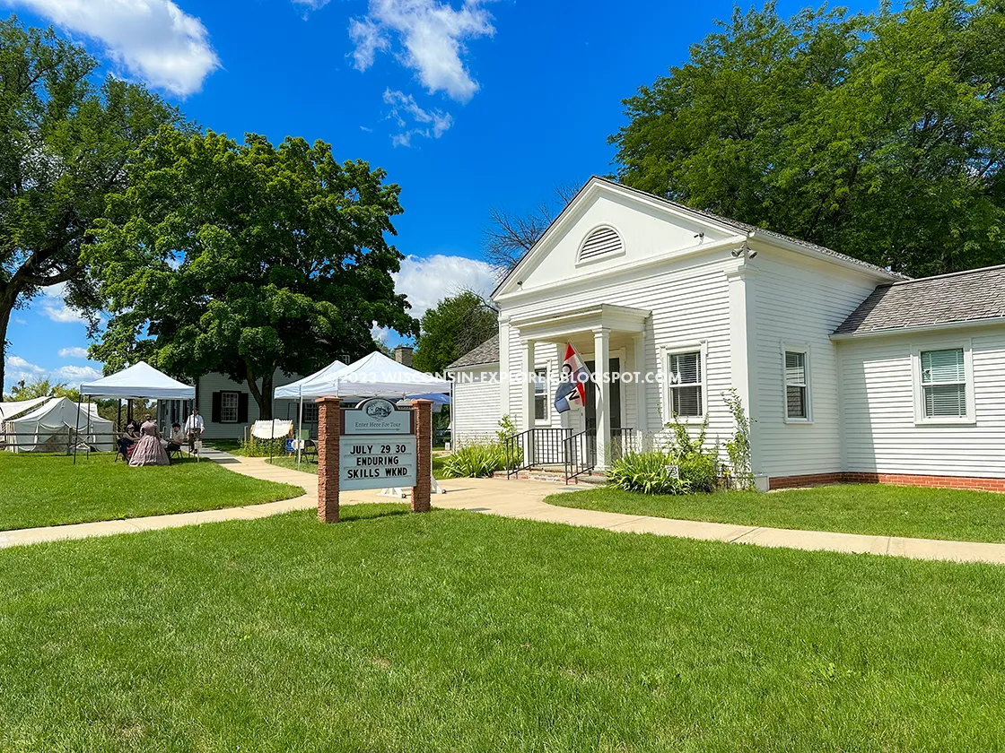
| Indian Agency House at the Westbound Trailhead of the Ice Age Trail Portage Canal Segment |
The word Winnebago adorns the names of lakes, forts, and sites around Wisconsin. The Ho-Chunk translation of Winnebago is 'to carry on one’s shoulder'. The French word for this is, 'portage'. For most of history, travelers through Portage, WI, had to carry their canoes and gear on their shoulders as they hiked from the Fox River to the Wisconsin. The first European contact here was likely Jaques Marquette and Lois Joliet, who portaged through in 1673 while mapping the upper Mississippi River.
Imagine walking in the footsteps of the great French voyageurs. So much history happened in this place between two rivers. The canal itself is a visceral monument to the history of trade, travel, engineering, and conquest. I started my hike on the Portage Canal Segment at Pauquette Park and quickly found my way to the levees, old lock, and gate to the Wisconsin River. It’s a powerful notion to contemplate, the idea of connecting the St Lawrence Seaway to the Mississippi River through this one mechanical gate likely powered with beasts of burden.
The trail continues through downtown, sometimes on sidewalks and other times on a freshly paved asphalt trail beside the canal. When the trail reaches the fairgrounds the pathway along the canal is interrupted by still active industrial sites abutting the canal. You’ll follow maps, but no blazes or signage down a few side streets, over the railroads, and across busy Highway 33 before joining the canal again.
The last leg of the trail is along a crushed stone gravel path beneath tall oak and maple trees until you reach a footbridge by the Indian Agency House.
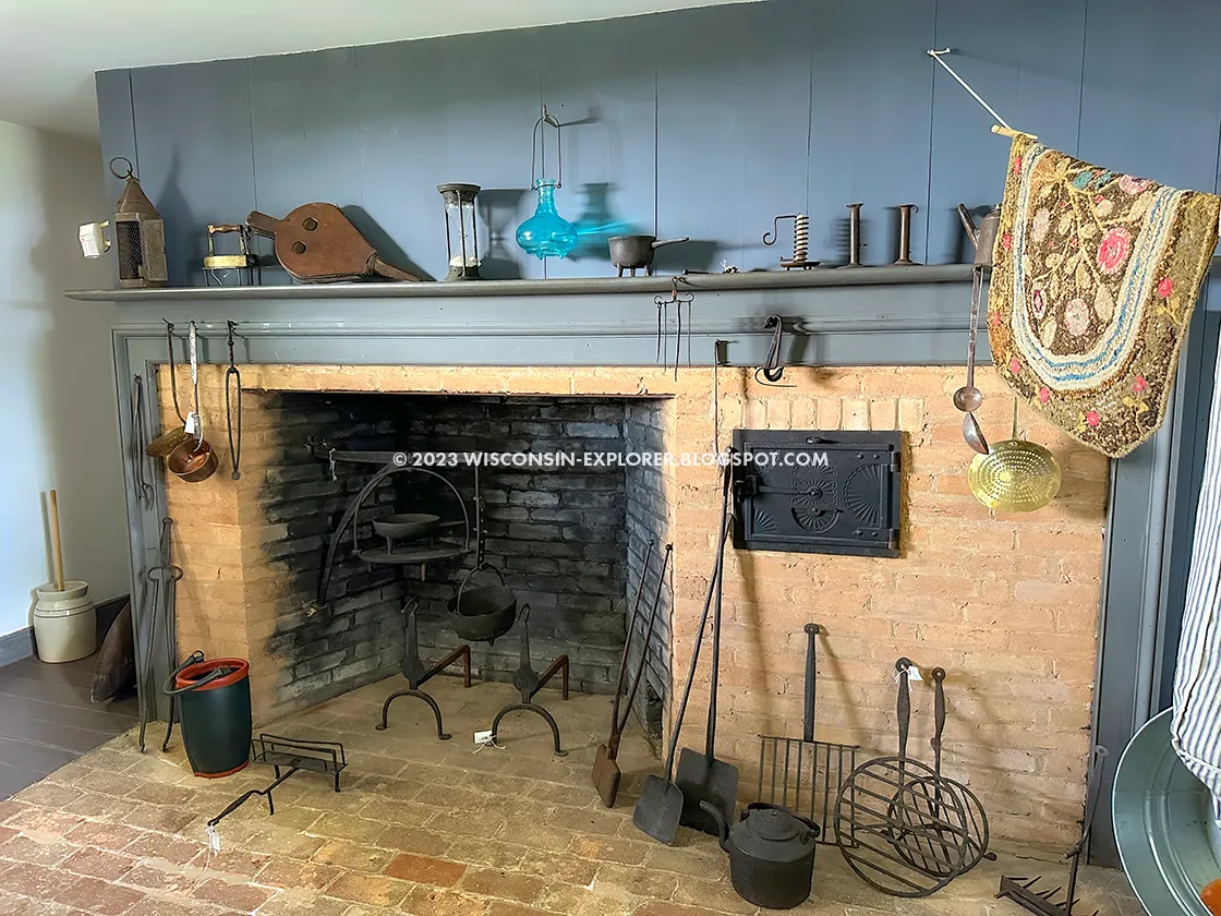
The Indian Agency House is another historic site worth visiting at the end of your hike. A guided tour of the house reveals the very short span when it was used to distribute payments to American Indian Tribes who had signed treaties with the US. The Blackhawk wars unfortunately led to a new, more destructive US policy towards tribes. Nonetheless, the tour and associated museum provides great insight into life here before the canal, the railroads, and the freeways.
 |
| Portage Canal in downtown Portage WI along the Ice Age Trail Portage Canal Segment |
Ice Age National Trail - Portage Canal Segment
COUNTY
COLUMBIA
COMMUNITIES
PORTAGE
TOTAL MILES
3.6-MILES POINT-TO-POINT
DIFFICULTY
VERY EASY
LOWEST ELEVATION
780AMSL
HIGHEST ELEVATION
800 AMSL
CUMMULATIVE TOTAL ELEVATION GAIN
500 FT
NEXT NCT SECTION WESTBOUND
IAT JOHN MUIR SEGMENT
NEXT NCT SECTION EASTBOUND
ICE AGE TRAIL SAUK POINT SEGMENT
Directions and Trail Map
If viewing on a mobile device, open the trail map above to load into Google Maps App by touching the expand rectangle in the upper right corner.
Address for your GPS: 1490 Agency House Rd, Portage, WI 53901
| coordinates: 43.55953648436055, -89.43688492456029 |
| From Milwaukee | 1.5 Hours |
| From Madison | 1 Hours |
| From Green Bay | 2 Hours |
| From Wausau | 1.5 Hours |
| From Minneapolis | 3.5 Hours |
| From Chicago | 3 Hours |
Photos
 |
| The Westbound Trailhead for the Ice Age Trail Portage Canal Segment |
 |
| Wisconsin River on the Ice Age Trail Portage Canal Segment |
 |
| Portage Canal Trail on the Ice Age Trail Portage Canal Segment |
 |
| Downtown Portage on the Ice Age Trail Portage Canal Segment |
 |
| Ice Age Trail Portage Canal Segment |
 |
| Portage Canal Trail Sign on the Ice Age Trail Portage Canal Segment |
 |
| Fresh pavement on the Ice Age Trail Portage Canal Segment |
 |
| A new route around the fairgrounds on the Ice Age Trail Portage Canal Segment |
 |
| Ice Age Trail Portage Canal Segment |
 |
| Ice Age Trail Portage Canal Segment |
 |
| Ice Age Trail Portage Canal Segment |
 |
| on the Ice Age Trail Portage Canal Segment |
 |
| The Portage Canal near the Fox River end on the Ice Age Trail Portage Canal Segment |
 |
| Indian Agency House Museum on the Ice Age Trail Portage Canal Segment |
 |
| Indian Agency House |
 |
| Indian Agency House Museum |
 |
| Inside the Indian Agency House |
 |
| Inside the Indian Agency House |
 |
| Inside the Indian Agency House |
 |
| Inside the Indian Agency House |
 |
| Inside the Indian Agency House |

