The haunting wail of a loon echoing across the glassy waters of an up north Wisconsin lake silences our busy minds for a moment, and reminds us why we go in search of these isolated fishing lakes at the ends of long gravel roads. Firth Lake is one of those; a quiet and still lake surrounded by sedge meadow, water lilies, cattails, beavers, and loons - at the end of an unmarked road off the ubiquitous 250th avenue.
The parking area for Firth Lake acts as the de facto trailhead for the Firth Lake Segment of the Ice Age Trail, A 6.5-mile point-to-point footpath coursing over innumerable hills and around the rims of deep kettles in the Chippewa County Forest. On its own, this trail is a remarkable section of wilderness footpath. But, it is also nestled via short road connections between the Chippewa River Segment and the Harwood Lakes Segment, making it among the most popular weekend backpacking routes in Northern Wisconsin.
Primitive camping is permitted anywhere along this trail, so long as your site is 100ft from the trail. Long-distance hikers will find an established primitive site just off the trail between Moonridge Trail Road and a fork of the Bob River. The Firth Lake Segment crosses numerous creeks for filtering water.
{tocify} $title={Table of Contents}
$ads={1}
advertisement

|
| The Firth Lake Segment of the Ice Age Trail |
The Firth Lake Segment is one link in a chain of segments between the Chippewa Moraine and the Chippewa River. These four segments are particularly nice for backpacking. There are a number of established primitive sites along the way, and these trails connect together nicely as they wind around lakes and over streams.
I, however, did not backpack them. Instead, I used campsites at Brunet Island State Park as a base camp and headed out on these trails as individual out-n-backs. For the Firth Lake Segment, I used Moonridge Trail and 250th Ave to form a double loop for the return trip. This could easily be done as a bike shuttle as well.
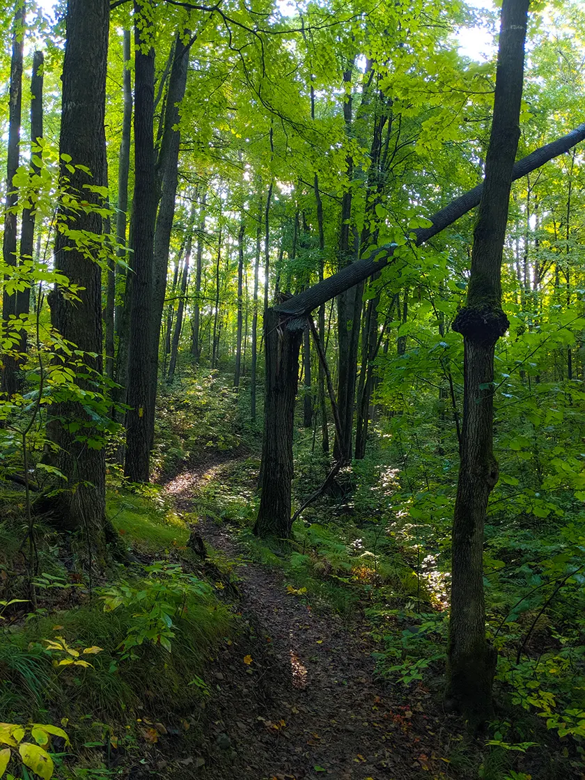
The landscape around the Firth Lake Segment is particularly lush. It is a second-growth forest and has a variety of tree types, with maples, birches, and balsam firs. While beneath the shaded canopy ferns thrived alongside Indian pipe and baneberry.
The trail bed is a well worn single track most of the way, with a few sections on wider two-tracks. It is easy to follow and well-marked with golden blazes. The trail meanders quite a bit and also climbs and dips over numerous rolling hills. Boardwalks and bridges are well placed to keep your feet dry in swampy areas.
A long boardwalk leads along the southern shore of Firth Lake and over the North Fork of the Bob River. Heading towards the Chippewa River from there the trail abruptly stops due to a recent change in land ownership which resulted in a large portion of the Chippewa River Segment being closed. At that eastern trailhead, you'll find a parking lot connector trail that runs north for about a mile before reaching 250th Ave where there is a parking area for 3 vehicles. This parking lot and the lot at Firth Lake landing are the only two parking areas on the trail.
Overall, Firth Lake is one of my favorite segments in Chippewa County and a hike I highly recommend along with the adjacent Harwood Lakes Segment.

|
| Spring Creek Flowage #1 on the Firth Lake Segment of the Ice Age Trail |
Ice Age Trail Firth Lake Segment
COUNTYCHIPPEWA COUNTY
COMMUNITIES
CORNELL
TOTAL MILES
6.5-MILE POINT-TO-POINT
DIFFICULTY
MODERATE
LOWEST ELEVATION
1068 AMSL
HIGHEST ELEVATION
1252 AMSL
TOTAL ELEVATION GAIN
938 FT
TOTAL ELEVATION LOST
804 FT
CAMPING
Anywhere in the Chippewa County Forest. Primitive Site 1/4-mile southwest of 256th Ave.
NEXT IAT SEGMENT EASTBOUND
CHIPPEWA RIVER SEGMENT
NEXT IAT SEGMENT WESTBOUND
HARWOOD LAKES SEGMENT
Directions and Trail Map
DOWNLOAD PRINTABLE PDF TOPOGRAPHIC MAPCORNELL QUADRANGLE 2015
DOWNLOAD PRINTABLE PDF TOPOGRAPHIC MAP
BOB LAKE QUADRANGLE 2015
Click Map Image to load the full interactive map.
If viewing on a mobile device, open the trail map above to load into Google Maps App by touching the expand rectangle in the upper right corner.
Address for your GPS: 250th Ave Cornell, WI 54732
| coordinates: 45.204682, -91.215089 |
| From Milwaukee | 4 Hours |
| From Madison | 3 Hours |
| From Green Bay | 2.5 Hours |
| From Wausau | 1.5 Hours |
| From Minneapolis | 2.5 Hours |
| From Chicago | 5 Hours |
Photos

|
| Primitive Campsite between Moonridge Trail Road and a North Fork of the Bob River |

|
| Firth Lake Segment of the Ice Age Trail |

|
| Firth Lake Segment of the Ice Age Trail |

|
| Firth Lake Segment of the Ice Age Trail |

|
| Firth Lake Segment of the Ice Age Trail |

|
| Firth Lake Segment of the Ice Age Trail |

|
| Firth Lake Segment of the Ice Age Trail |

|
| Parking Lot at Firth Lake Landing |

|
| Firth Lake Segment of the Ice Age Trail |

|
| Firth Lake Segment of the Ice Age Trail |

|
| Firth Lake |

|
| Firth Lake Segment of the Ice Age Trail |


