|
| Ice Age National Trail - Holy Hill Segment |
The Holy Hill Segment of the Ice Age National Trail is a 7 mile single track footpath through the Kettle Moraine region west of Milwaukee. The iconic Holy Hill Shrine with its twin towers that can be seen from several counties in all directions sits atop one of the tallest kames in this hilly terrain. Deep kettles and glacial lakes spot the low areas beneath dramatic mounds of glacial till. The trail cuts a winding path through this forested and hilly terrain.
{tocify} $title={Table of Contents}
$ads={1}
advertisement

|
| Ice Age National Trail - Holy Hill Segment |
The church bells in Holy Hill's iconic twin towers were tolling to call the faithful to Sunday mass. For me and my crew It was another grand August weekend for hiking in the middle Kettle Moraine of Washington County.
Traditionally the Ice Age Trail is hiked west to east. So, the trail begins on Donegal Road, the southern (or western) trailhead for the Holy Hill Segment. There's no official parking lot at either end of this segment. But we were able to find enough shoulder room to leave one car on an unnamed road off Glassgo Drive at the Northeastern trailhead and also found just enough solid ground in the shoulder on Donegal Road to leave one car there. A police officer was driving past as we parked on Donegal Road and confirmed that parking was legal there.
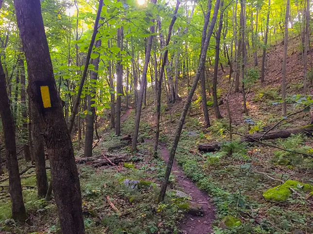
The trail begins by ascending a few steep inclines that get the heart racing. This forested section is scenic and rustic. There's no sound of highways here, just birds chirping and church bells tolling. There is a lookout that is positioned with a view of Holy Hill from the trail - but it is covered by leaves in all but the winter months.
Between Holy Hill Road and Pleasant Hill Road the trail is wider and more mild - covering open fields and restored prairies on a wide mowed grass trail bed. A short 1/2 mile walk along the quiet Pleasant Hill Road leads to another length of the trail that begins in a corn field. Back in the forest on the other side of the field the trail picks up hills that are easy rollers. Across E Waterford Road another hilly section leads past dramatic views of a kettle lake and eventually to long views of the rolling hills of Wisconsin. The end of the trail is a long slog along the edge of corn fields to Glassgo Drive.
Markers for the trail continue along Glassgo Drive and lead to the official trailhead for the Pike Lake Segment at County E. It is another mile along Glassgo Drive before picking up the trail again at Pike Lake Unit of the Kettle Moraine State Forest.
The main lot for the Holy Hill Segment is off Shannon Road at the center of the trail. This segment can be easily broken into two separate out-n-backs by using the parking lot at Shannon Road.

|
| Ice Age National Trail - Holy Hill Segment |
Ice Age National Scenic Trail - Holy Hill Segment
COUNTYWASHINGTON COUNTY
COMMUNITIES
HUBERTUS, ACKERVILLE, HARTFORD
TOTAL MILES
7-MILE POINT-TO-POINT
DIFFICULTY
MODERATE
LOWEST ELEVATION
1060 AMSL
HIGHEST ELEVATION
1240 AMSL
TOTAL ELEVATION GAIN
1030 FT
TOTAL ELEVATION LOST
-1000 FT
NEXT IAT SEGMENT EASTBOUND
PIKE LAKE SEGMENT
NEXT IAT SEGMENT WESTBOUND
LOWE LAKE SEGMENT
Directions and Trail Map
DOWNLOAD PRINTABLE PDF USGS TOPOGRAPHIC MAPHARTFORD EAST QUADRANGLE
MERTON QUADRANGLE
Click Map Image to load the full interactive map.
Address for your GPS: 5975 Shannon Rd Hartford, WI 53027
| coordinates: 43.258334, -88.334363 |
| From Milwaukee | 40 Minutes |
| From Madison | 1 Hour |
| From Green Bay | 2 Hours |
| From Wausau | 2.5 Hours |
| From Minneapolis | 5 Hours |
| From Chicago | 2 Hours |
Photos

|
| Ice Age National Trail - Holy Hill Segment |

|
| Ice Age National Trail - Holy Hill Segment |

|
| Ice Age National Trail - Holy Hill Segment |

|
| Ice Age National Trail - Holy Hill Segment |

|
| Ice Age National Trail - Holy Hill Segment |

|
| Ice Age National Trail - Holy Hill Segment |

|
| Ice Age National Trail - Holy Hill Segment |
Links
Holy Hill Basilica National Shrine of MaryIce Age National Trail Alliance
Ice Age National Trail - National Parks Service

