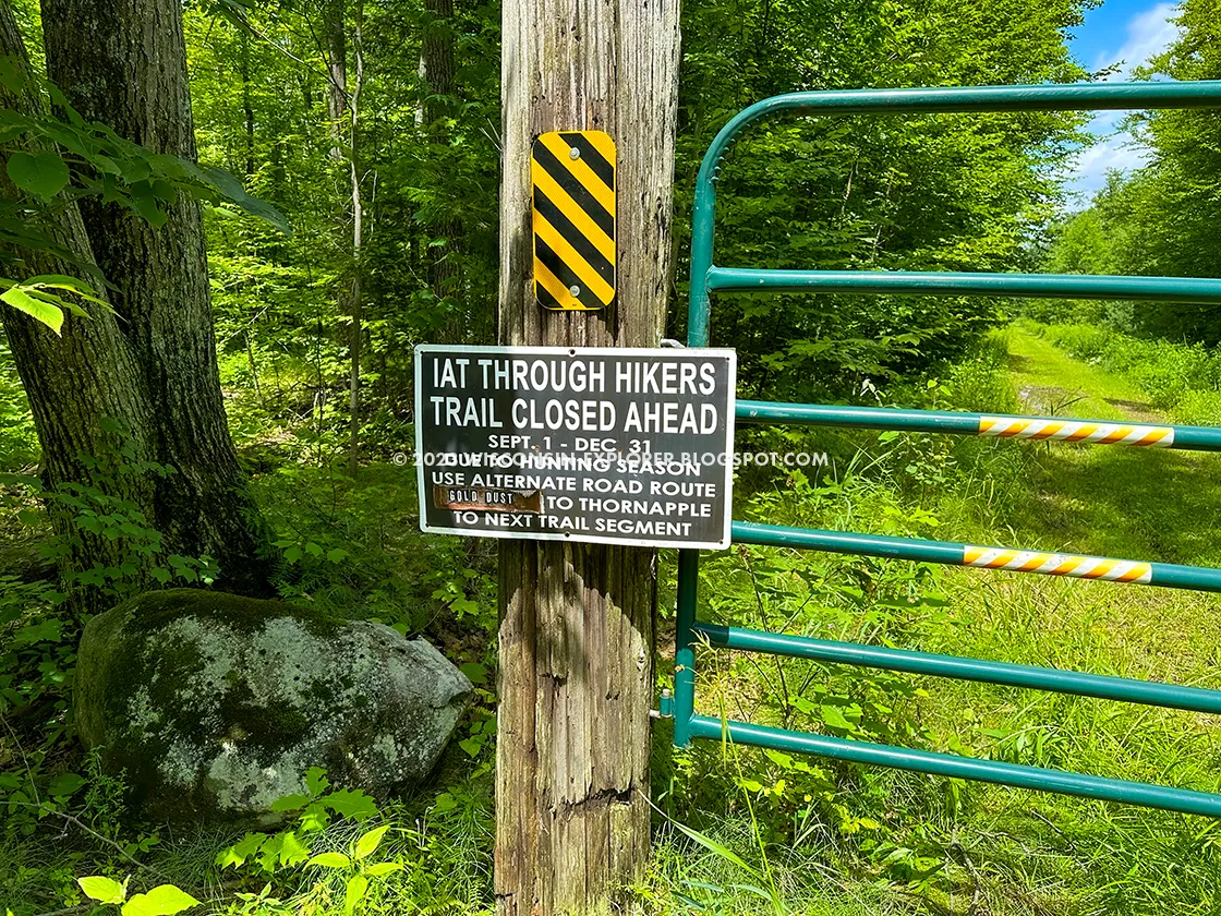
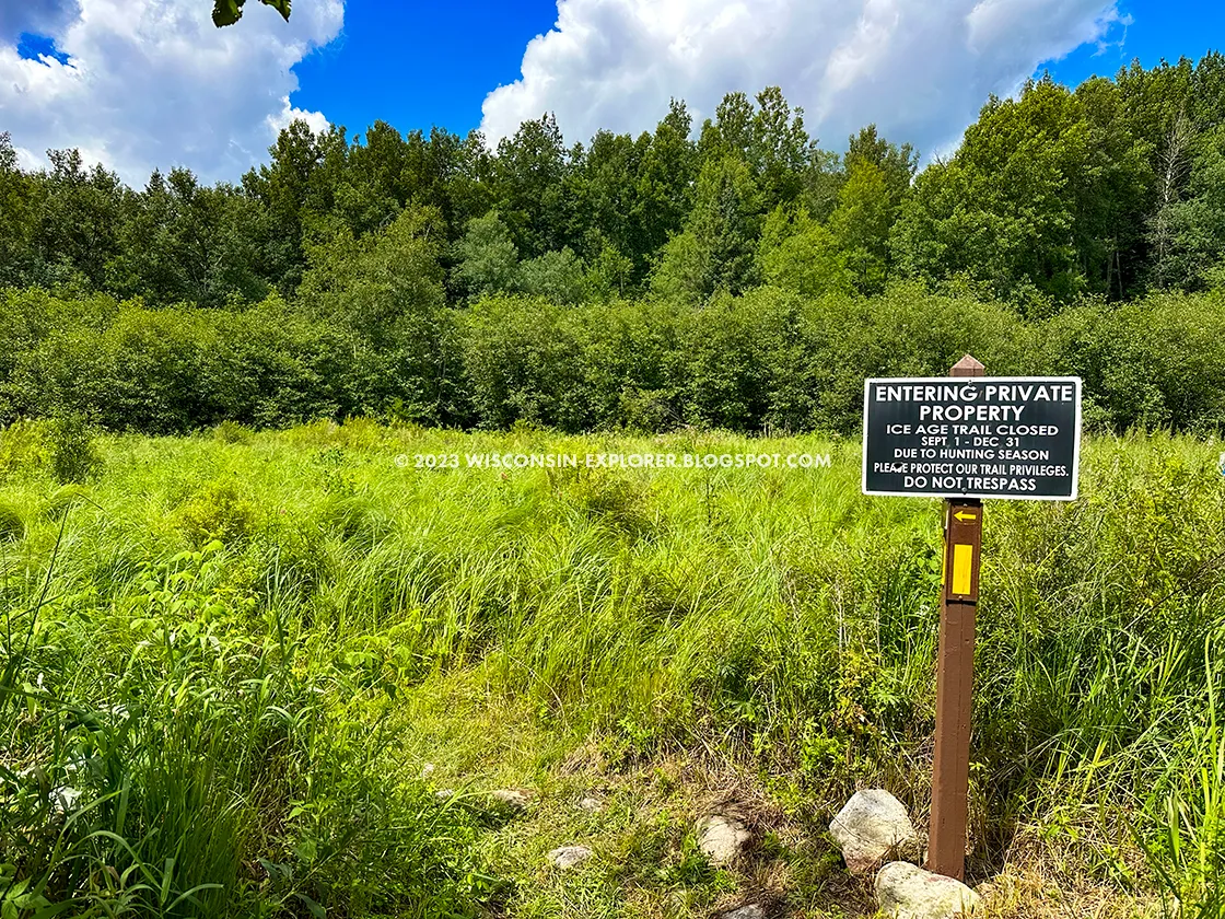
The Thornapple Creek Segment of the Ice Age Trail is a 4-mile multi-use trail through private property in Marathon County, Wisconsin. The trail follows private roads, a fire lane, snowmobile trails, and a high-tension-wire right-of-way to Thornapple Creek, where the trail is submerged in wetlands and mud for its last single-track mile to Thornapple Creek Road. This last part of the trail is closed for hunting between September 1st and December 31st.
A parking lot on the Ringle Segment at Highway N is the closest legal place to park. This lot can be difficult to find and access in winter.
{tocify} $title={Table of Contents}
$ads={1}
advertisement

|
| The trail uses a high tension power line right-of-way part of the distance |
When I finally got to hike the Thornapple Creek Segment it was just one of many segments I'd hike on a day trip mission to complete segments and sections in Marathon and Langlade Counties. It was a wonderful blue sky summer afternoon and on account of the good weather I enjoyed my out-and-back hike on this segment.
But I can also understand why most hikers, who may not be trying to hike every
last mile of the IAT, would skip this one. The tail is mostly a long straight
two-track troad with little in the way of scenery. After a short jog though
more dense forest the tail then bashes its way through wetlands and thick
vegetation below a power line right-of-way before a final mile of thick mud
and flooded trail in an area of private hunting property that is closed to
hiking for half the year. With all this in mind this segment might not be your
first pick for a afternoon ramble in the woods with the family. However, its
an important connector trail in this region between two of the finest segments
- The Eau Claire Dells and the Ringle Segments.
There's not much to say about this hike, so I'll just let my photos tell the
story.
COUNTY
MARATHON
COMMUNITIES
RINGLE, BIRNAMWOOD
TOTAL MILES
4-MILES POINT-TO-POINT
DIFFICULTY
MODERATE
LOWEST ELEVATION
1300 AMSL
HIGHEST ELEVATION
1500 AMSL
CUMMULATIVE TOTAL ELEVATION GAIN
500 FT
NEXT NCT SECTION WESTBOUND
IAT EAU CLAIRE DELLS SEGMENT
NEXT NCT SECTION EASTBOUND
IAT RINGLE SEGMENT
If viewing on a mobile device, open the trail map above to load into Google Maps App by touching the expand rectangle in the upper right corner.
Address for your GPS: County Hwy N, Ringle, WI 54471
| coordinates: 44.94263034026279, -89.35500515260681 |

|
| Most of the Thornapple Creek Segment is on a two-track troad |
ICE AGE NATIONAL SCENIC TRAIL - THORNAPPLE CREEK SEGMENT
COUNTY
MARATHON
COMMUNITIES
RINGLE, BIRNAMWOOD
TOTAL MILES
4-MILES POINT-TO-POINT
DIFFICULTY
MODERATE
LOWEST ELEVATION
1300 AMSL
HIGHEST ELEVATION
1500 AMSL
CUMMULATIVE TOTAL ELEVATION GAIN
500 FT
NEXT NCT SECTION WESTBOUND
IAT EAU CLAIRE DELLS SEGMENT
NEXT NCT SECTION EASTBOUND
IAT RINGLE SEGMENT
Directions and Trail Map
If viewing on a mobile device, open the trail map above to load into Google Maps App by touching the expand rectangle in the upper right corner.
Address for your GPS: County Hwy N, Ringle, WI 54471
| coordinates: 44.94263034026279, -89.35500515260681 |
| From Milwaukee | 2.75 Hours |
| From Madison | 2.5 Hours |
| From Green Bay | 1.25 Hours |
| From Wausau | 20 Minutes |
| From Minneapolis | 3 Hours |
| From Chicago | 4 Hours |
Photos

|
| The Thornapple Creek Segment starts on a rustic gravel drive |

|
| Gentle farmland provides scenery along part of the trail |

|
| The road keeps going in a straight line but becomes more remote |

|
| Eventually the road meets a gate where there is a trailhead at private land. |

|
| Signs on the gate are very clear about closures for deer hunting season |

|
| If you haven't caught on, the trail is closed between Sept 1 and Dec 31 for hunting |

|
| And the straight two track road continues past the gate |

|
| A stream breaks up the monotony |

|
| Signs at a snowmobile trail intersection |

|
| The road becomes more rustic until it disappears and the trail then follows a high tension power line right of way |

|
| occasionally the trail cuts away from the main right of way into the shade of a thick forest |

|
| small sections of the trail feel forested like this little fern glen |

|
| But then you get kicked back out to the power line right of way |

|
| Here is the area that is closed during the hunting season, its only the last half mile of the segment |


