|
| Honey Creek Crossing #3 |
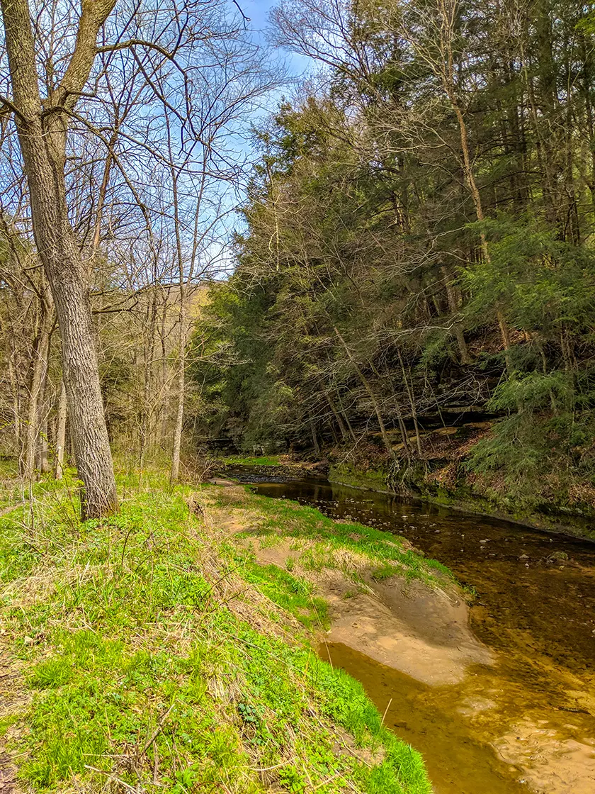
Honey Creek State Natural Area features an adventurous wilderness trail that cuts deep into the surreal landscape of Borns Hollow along the golden Honey Creek in the Baraboo Hills.
A 1.6-mile point-to-point footpath cuts north through the Harold and Carla Kruse Honey Creek Nature Preserve along the creek bottoms of Honey Creek. The preserve is owned jointly by the Wisconsin Society of Ornithology and the Nature Conservancy. These tracts are also designated as the Honey Creek State Natural Area.
{tocify} $title={Table of Contents}
$ads={1}
advertisement

|
| Honey Creek |
The Harold and Carla Kruse Honey Creek Nature Preserve is a key property owned by the Wisconsin Society of Ornithology and the Nature Conservancy.
The primary purpose of the preserve is to provide nesting habitat for birds and wildlife. As part of the larger Nature Conservancy Baraboo Hills holdings, Honey Creek provides habitat for birds who can only nest and breed in large uninterrupted stands of forest. The Baraboo Hills is the largest stand of continuous forest in Southern Wisconsin. It remains that way largely due to the efforts of the Nature Conservancy who had declared the Baraboo Hills one of the original twelve Last Great Places on Earth, a selection of extraordinary habitats that was eventually expanded to protect 200 preserves.
As its primary purpose is for wildlife habitat, human impact on this land is intended to be minimized. The trail and wider state natural area is open to the public for low impact activities such as hiking. But, the trail is narrow, undeveloped, and does not include human constructions such as bridges. There are four creek crossings which hikers must ford. Prepare for wet feet.
The wild nature of this trail and the surreal scenery of the Borns Hollow give this trail a back-country feel that is adventurous, extraordinary, and memorable. The first 1/4-mile of the trail does include boardwalks through a boggy area. From there, hikers may find occasional orange diamond trail markers posted on trees. Otherwise, the trail can become undefined and difficult to see. Several deer trails cross the hiking trail and may lead inattentive hikers astray.
The hike progresses from Skyview Road into Borns Hollow. You can park at the Cox Nature Center at the end of Alder Drive of Skyview Road. Towering stone escarpments topped by thick groves of hemlocks close in the trail and define the meander of Honey Creek. The first ford is easy to spot, and you'll cross a wider section of the creek which is ankle deep in spring. The trail follows the river banks to the next crossing which is shin deep. Across the second ford, I lost sight of the official trail but regained it by staying close to the creek banks. The trail continues in this fashion, staying close to the creek below hardwood canopy.
The further you hike in, the more narrow the trail becomes. After crossing the creek a fourth time the trail virtually disappears. You'll have to bushwhack through cutting nettles and thorny bushes before reaching an old grazing paddock which is restored to a prairie which is bursting with colorful wildflowers in summer. You are left to discover your own way through this meadow, but it is open and easily navigated. I followed the stream to the far end of the meadow and found an old access road cutting up the incline and followed this before turning off towards an isolated stand of woods that holds a high mound overlooking the Borns Hollow.
Honey Creek is a rustic wilderness, a hike for explorers undaunted by wilderness challenges. You are not likely to encounter any other hikers along this route. Study the map and preserve boundaries well and come prepared for wilderness navigation, uneven rocky trail surfaces, thick thorny vegetation, and creek crossings.

|
| Honey Creek Crossing #1 |
Honey Creek Trail
COUNTYSAUK
COMMUNITIES
LOGANVILLE, HONEY CREEK
TOTAL MILES
1.6-LINEAR (3.2-MILES OUT-AND-BACK)
DIFFICULTY
MODERATE-TO-DIFFICULT
LOWEST ELEVATION
816 AMSL
HIGHEST ELEVATION
1082 AMSL
TOTAL ELEVATION GAIN
633 FT
Directions and Trail Map
Click Map Image to load the full interactive map.
Address for your GPS: 8000 Alder Dr, Honey Creek, WI 53943
| coordinates: 43.354672, -89.982818 |
| From Milwaukee | 2 Hours |
| From Madison | 1 Hour |
| From Green Bay | 2.75 Hours |
| From Wausau | 2.5 Hours |
| From Minneapolis | 3.75 Hours |
| From Chicago | 3 Hours |
Photos

|
| Honey Creek Trail |

|
| Natural Color Abstraction |

|
| Honey Creek |

|
| Honey Creek Crossing #3 |

|
| Honey Creek Crossing #4 |

|
| Honey Creek |
Links
Honey Creek State Natural Area DNRWisconsin Society for Ornithology
Nature Conservancy Baraboo Hills - Last Great Places on Earth

