 |
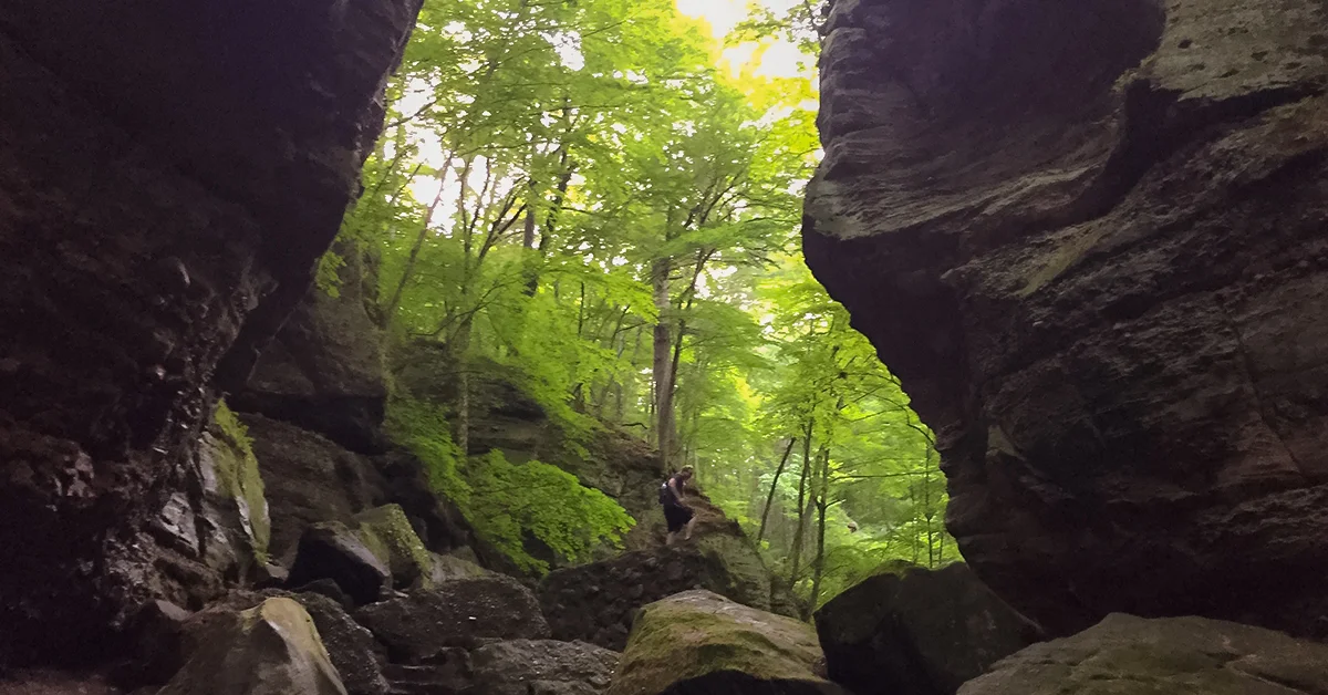
The cavernous gorge at Parfreys Glen has been cut by a gentle babbling brook which day by day continues to write the story of persistence into stratified layers of stone. A winding trail back into the gorge of less than 1 mile in length has been delighting visitors for generations, making Parfreys Glen a destination hike in the Baraboo Hills.
Parfreys Glen was Wisconsin's first designated state natural area, established in 1952. Since then the path into this natural wonder has been changed by frequent floods which have washed away robust boardwalk constructions and dismantled stone and concrete overlooks.
Today, only the first half of the trail is maintained. On reaching the mouth of the stone gorge the trail abruptly ends. Those seeking to press on into the stone canyon must hike through the stream bed and scramble over giant boulders loosed from the canyon walls.
{tocify} $title={Table of Contents}
$ads={1}
advertisement
 |
| Parfrey's Glen State Natural Area in Merrimac WI |
The trail head for Parfrey's glen is at a small parking lot off Sauk County highway DL just west of Devil's Head Resort and Ski Area in Merrimac. The lot can hold about 20 cars and is frequently overflowing with cars parked on the highway shoulder. There is a small picnic area, a vault toilet, and a water pump near the parking lot.
This trailhead is also the trailhead for the Sauk Point Segment of the Ice Age National Trail. For those seeking a longer hike the Sauk Point Segment is a 4 mile walk from Parfrey's Glen to Devil's Lake State Park and includes a long two mile climb of 775 feet.
Most visitors to Parfrey's Glen prefer the leisurely stroll back towards the glen. The trail begins on a wide gravel road before cutting into deep hardwood forest alongside the babbling Parfrey's Glen Stream. The trail is wide and easy. It crosses several constructed bridges as it winds back into the gorge. Further back there are a few easy rock hops over the stream to negotiate.
As the sides of the ravine begin to rise the official trail ends. From the sign announcing the end of the trail curious and adventurous hikers must walk through the stream for a few hundred feet before catching up to some footpaths on the west side of the stream. The stream bed is generally only ankle deep except after heavy rains when the water level can rise dramatically.
Further in the wooded ravine becomes more enclosed and transforms into a narrow stone canyon. Large boulders must be climbed up and over to continue on. You'll be able to see remnants of the old stone and concrete stairs of the former trail which have been broken apart by forceful floods. At the end of the gorge is a small waterfall.
Today, with the boardwalk and stone pathway washed out most visitors to the glen will not make it all of the way to the waterfall. But, the gentle hike alongside the brook still draws many walkers of all ages and their families.
The verdant ravine and photogenic stream seems a world away like a mysterious scene in fantasy film. Indeed Parfrey's Glen is a wonderful place. The protected ravine is home to rare species of flora and herbs which grow no where else on earth. Even if you cannot identify these plants there is a prehistoric feeling exuding from stone and earth gorge at Parfrey's Glen.
 |
| Parfrey's Glen - Merrimac WI |
Overview: Parfreys Glen Trail
COUNTYSAUK COUNTY
COMMUNITIES
MERRIMAC
TOTAL MILES
.85-MILE POINT-TO-POINT (1.7-MILE OUT-N-BACK)
DIFFICULTY
VERY EASY, THEN DIFFICULT
LOWEST ELEVATION
860 AMSL
HIGHEST ELEVATION
1200 AMSL
TOTAL ELEVATION GAIN
380 FT
TOTAL ELEVATION LOST
-50 FT
POINTS OF INTEREST
Parfrey's Glen State Natural Area, First State Natural Area Marker, Parfrey's Glen Stream, Ice Age National Scenic Trail -Sauk Point Segment, stone gorge, waterfall
Directions and Trail Map
Click Map Image to load the full interactive map.
Or Click here to open Interactive Map in Google Maps App.
Address for your GPS: E13981 County Road DL, Merrimac, WI 53561
| Coordinates: 43.409938, -89.636708 |
| From Milwaukee | 1 Hour 45 Minutes |
| From Madison | 25 Minutes |
| From Green Bay | 2.5 Hours |
| From Wausau | 2 Hours |
| From Minneapolis | 4 Hours |
| From Chicago | 3 Hours |
Photos of Parfrey's Glen
 |
| Parfrey's Glen in Merrimac WI |
 |
| Parfrey's Glen State Natural Area in Merrimac WI |
 |
| Parfrey's Glen State Natural Area in Merrimac WI |
 |
| The Trail becomes difficult further into the glen hikers must walk through the stream |
 |
| The trail into Parfrey's Glen is mostly easy but then becomes difficult |
 |
| The Trail into Parfrey's Glen becomes difficult further into the glen hikers must walk through the stream |
 |
| The Trail into Parfrey's Glen becomes difficult further into the glen hikers must walk through the stream |
 |
| Parfrey's Glen - Merrimack Wisconsin |

