

Day hikers and seasoned thru-hikers will find all they need on this trail. A trailhead pinned at the historic Merrimac ferry landing makes the perfect launchpad for a full-day out-and-back. Here hikers have access to a paved parking lot, flush restrooms, running water, and a seasonal concession stand featuring locally made ice cream. Just up the trail from the ferry landing backpackers in need of rest will find a shaded dispersed camping area tucked behind tall prairie grasses where dreamy sunset views can be enjoyed from a swaying hammock.
The IAT Gibraltar Segment's unique mix of terrain and vibrant ecosystems are filled with four seasons of wonder. Prairies, gullies, stands of northern pine and gnarly cedars embrace the trail with a tapestry of wonders keeping naturalists and bird watchers busy with new discoveries on every step.
Most just come for the views. The soaring experience of gazing over Wisconsin's unique Driftless region from the heights of the Gibraltar overlooks is breathtaking. Find a perch on one of many bald rock promontories where you can ease back and enjoy the pillowy sensation of rising thermal currents brushing your face as the huge wingspans of raptors open before you in a coordinated show of aerial acrobatics. A hike on the Ice Age Trail Gibraltar Segment can be a full day experience. Below I’ll share all I know about my favorite segment of the IAT from the history of this area to the birds and plants you’ll find along the hiking trail at this ancient sacred place.
{tocify} $title={Table of Contents}
$ads={1}
Trail Images
Twisted cedar trees hang over the void on the Ice Age Trail Gibraltar Segment.

Sunset over the Barboo Hills from the Ice Age Trail Gibraltar Segment.

A narrow dirt path curves along the heights on the Ice Age Trail Gibraltar Segment.

Merrimac Ferry and railroad bridge crossing seen from an overlook the Ice Age Trail Gibraltar Segment.

Steenbock Overlook on the Ice Age Trail Gibraltar Segment.

Dispersed Camp Area on the Ice Age Trail Gibraltar Segment.

Dispersed camping rules

Stone steps and scattered boulders climb upward through the center of a forested trail, with trees and rock slabs bordering both sides on the Ice Age Trail Gibraltar Segment.

Misty morning on the Ice Age Trail Gibraltar Segment.

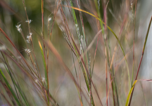
Prairie grasses fill the lower foreground while layered blue ridges recede across the middle distance under a pale sky on the Ice Age Trail Gibraltar Segment.

Trail Guide
Mile 0.0 – 1.5 | Merrimac Ferry to Steenbock PreserveFrom the State Historical Marker, commemorating the ferry crossing in continuous operation since 1848, begin a footpath that threads between Highway 113 and the Wisconsin and Southern Railroad line. Beyond the din of motorboat traffic on Lake Wisconsin Listen for Black-capped Chickadees and Downy Woodpeckers working the lower canopy.
Cautiously cross the busy highway at Northern Cross Arm Road and begin a steep climb on switchbacks into a stand of cedar. Listen for pine warblers and admire the view of Lake Wisconsin and the Baraboo Hills beyond. The busy highway below will remind you of how far and quickly you’ve climbed. You’ll probably also be out of breath. Here you’ll notice the soil thinning beneath your feet and a shift from damp lakeshore topsoil to dry sandy uplands.
The trail rolls through the summer flowers of a goat prairie. These upland prairies are small, warm, windy openings on south and west facing slopes where only sun-hardened grasses and wildflowers survive. Butterfly milkweed, hoary puccoon, black-eyed Susan, and blazing star bloom in progression. Regal fritillary butterflies may float past your knees. An adjoining white blazed loop option descends and traces the edge of prairie and a wooded ravine.
The forest welcomes hikers into the shade of an upland oak savanna. Bur and white oaks spread wide-branched over little bluestem and big bluestem grasses. Dappled sunlight patterns the ground. Look for Lark Sparrow tail-flashes and the scratchy call of the Eastern Towhee from the shrubby edges. Here you’ll find a side spur that leads to a dispersed camping area. This campsite is set aside for the occasional long distance hikers in need of a single night layover on the trail – it is non-reservable and is always open to all comers. The site is rustic and does not feature any water sources, toilets, and campfires are not allowed.
Mile 1.5 – 2.2 | Steenbock Overlook to Slack Hill Road
The trail emerges from a recent reroute at a grand view with a log bench and trail registry. Around the bend from the overlook a second white blazed loop option descends on a gentle line to the parking area at Slack Hill Road. Staying on the yellow-blazed Ice Age Trail the route once again enters a darkened pine plantation.
In a roller-coaster of switchbacks the trail descends quickly in a dry stream ravine beneath a mature oak canopy. The trail emerges at a parking lot on Slack Hill Road.
Mile 2.2 – 2.6 | Slack Hill Road to Gibraltar Rock State Natural Area
Turn onto Slack Hill Road and then onto County Road V. Hold onto your children and with great caution proceed a quarter-mile to Gibraltar Rock Road. The shoulders on this highway are in desperate need of widening. Until the Columbia County Highway Department gets wise to this need, hikers are pinched between unforgiving edges with a steep drop-off and a high speed and busy highway with blind corners and hills obscuring drivers’ views of you. Contrary to the usual advice of hiking to the side of the oncoming traffic lane, the more spacious shoulder is on the west side where you may take a few steps off the highway to safety.
Mile 2.6-4.0 | The Ascent to Gibraltar Rock Overlook
Find the yellow blazed trailhead and follow off-road and upward through steep ravines carved long ago by spring meltwater. Look for wild columbine blooming in shady pockets.
A surprise stand of northern pine offers a resin-scented infusion. Red-breasted Nuthatches and Pine Warblers make a racket here at dawn chorus. A hand-laid winding stone staircase completes the ascent to the top of this dolomite capped sandstone butte.
The bluff opens to bald rock shelves and the famous overlooks. Pastoral fields, pastures and paddocks, and Lake Wisconsin spreads wide below. Look for huge turkey vultures and red-tailed hawks riding rising thermals—often so close you could reach out to touch them. This is a natural place to rest long and stay awhile. Cedar trees set back from the cliff edge are excellent hammock supports for those who want to enjoy a long read of a field guide on a lazy summer afternoon.
Mile 2.6-4.0 | The Descent to The Southern Trailhead
Descend through hardwoods and emerge into a final stretch of a tallgrass prairie where Monarch butterflies drift among the grasses in late summer. A thinner true goat prairie holds the southern exposure on this steep hill. You’ll pass it in the shade of the forest edge. Before reaching the large parking lot at the trail end you’ll spot a new connector trail that safely loops back to Gibraltar Rock Road. To avoid parking congestion, avoid the all-too-popular parking lot at Gibraltar Rock Road and instead use the new larger lot on County V at this southern trailhead. Otherwise, be on your way to return on a 10-mile out-and-back that you are a little more than halfway through.
Overview: Ice Age National Scenic Trail - Gibraltar Segment
COUNTYCOLUMBIA COUNTY
COMMUNITIES
WEST POINT, MERRIMAC, LODI
TOTAL MILES
4.6-MILE POINT-TO-POINT
DIFFICULTY
MODERATE-DIFFICULT
LOWEST ELEVATION
770 AMSL
HIGHEST ELEVATION
1270 AMSL
CAMPING
Disperse Camping Area
POINTS OF INTEREST
Lake Wisconsin, Merrimac Ferry, Disperse Camp Site, Rocks of Gibraltar Natural Area, White Blazed Trail
NEXT IAT SEGMENT WESTBOUND
Merrimac Segment
NEXT IAT SEGMENT EASTBOUND
Fern Glen Segment
Directions and Trail Map
Address for your GPS: Nearest address (use coordinates instead): W12037 Wisconsin 113 Lodi WI 53555| coordinates: N43.365512,W089.619063 |
| From Milwaukee | 2 Hours |
| From Madison | 35 Minutes |
| From Green Bay | 2.5 Hours |
| From Wausau | 2 Hours |
| From Minneapolis | 4 Hours |
| From Chicago | 3 Hours |
FIELD GUIDE
History - Where Roads and Rivers Meet
For thousands of years, the Wisconsin River served as a primary travel corridor for Ho-Chunk and other indigenous people. The River linked trade networks across the region. Ancestors to today’s Ho Chunk, ancient mound builders of the Mississippian Culture likely ruled this area, though any effigy mounds that may have been along the Gibraltar Segment have long-since been destroyed. It’s likely these cultures maintained footpaths parallelling the Wisconsin River. Trails which would appear similar to the tread of today’s Ice Age Trail Gibraltar Segment.Imagine the Wisconsin River in the age of exploration. Before the river was dammed this stretch was a shallow braided labyrinth of streams and riffles, dotted with hundreds of Islands. When French explorers and fur traders arrived in the 1600’s they explored these channels from long dugout canoes. Marquette and Jolliet passed this stretch in 1673. Just upstream lay a grand portage, a narrow divide where travelers carried canoes between the Wisconsin and Fox Rivers creating a nearly continuous water route between the Great Lakes and the Mississippi. A strategically important waterway – The lower Wisconsin River was defended in the early 1800’s by Fort Winnebago at Portage, while Fort Crawford anchored the river highway downstream in Prairie du Chien. Military movements and campaigns in this area were frequent and storied during America’s pioneer period.
The mid-1800’s was the heyday of the river economy. Logging boomed in the area and men drove thousands of logs downstream every spring. Steamboats navigated the river between Sauk City and Portage. Crossing the river, however, was difficult. In 1844, a local settler named Matthew Mattson established Matt’s Ferry at Merrimac, pulling a flat-bottomed boat across the current by drawing hand-over-hand on heavy ropes stretched between the riverbanks.
The arrival of the Chicago and North Western Railway in the late 19th century shifted most long-distance travel from river to rail. Here the railroad crossed the Wisconsin on a steel truss bridge. Milwaukee and Chicago tourists, many of them first generation immigrants new to this nation, enjoyed their first wonderous views of the Baraboo Hills here on their way to Devils Lake aboard excursion trains.
By the turn of the 20th century, modern technology was rapidly changing the modes of transportation and with it the way the Wisconsin River was used. Long a trading highway and log conveyor, the power of the river would next be exploited for making electricity. In 1914 the Prairie du Sac Dam was built downstream of Gibraltar Rock. The river was transformed into Lake Wisconsin. So much power was created by this massive first-of-its-kind dam that the Sauk area became a center of military manufacturing, helping the US win World War II.
Coal fired steam locomotives still chugged in the valley below as conservationist and landscape architect Jens Jensen stood with wonder atop Gibraltar Rock’s overlook, then known as Richmond Memorial Park. He later became determined to bring state recognition to this place which would eventually be dedicated as a State Natural Area.
By the mid 20th century another idea began to take shape in the imagination of another conservationist with the vision of a long-distance footpath tracing the terminal glacial moraines of the Ice Age. The result is the Ice Age National Scenic Trail, which now links Devil’s Lake to Lodi by way of Gibraltar Rock. The Ice Age Trail returns travel here to footsteps, our most ancient and still our most reliable mode of transport.
FIELD GUIDE
Geology of the Gibraltar Segment
The geology uncovered and thrusting beyond the rich topsoil so famously farmed in Wisconsin tells a much longer pre-human history of the Ice Age Trail Gibraltar Rock Segment. The bedrock and lower portion of the cliffs along the trail are carved mostly from St. Peter Sandstone, a soft, pale, and described by some as a sugary stone formed about 450 million years ago when a shallow inland sea covered this area of Wisconsin. Its grains are so well-rounded and loosely cemented that the rock can crumble between your fingers. Hikers will notice how it weathers into smooth ledges and alcoves as they ascend towards the overlooks. Capping the summit is a much tougher layer of Prairie du Chien dolomite. This is a light gray, cherty limestone that forms the flat and resistant lid of the Gibraltar Rock butte. Dolomite breaks in blocky, angular slabs and protects the softer sandstone below from eroding from above.Scattered across the slopes, hikers will also encounter dark, rounded glacial erratics, hard granite and basalt boulders carried here by glaciers during the last Ice Age. These foreign stones contrast sharply with the local sandstone and dolomite, and their presence tells of the massive amounts of ice that once flowed around the Baraboo Hills.

St. Peter Sandstone
Ordovician quartz sandstone
A nearly pure quartz sandstone that weathers into pale, friable cliffs and loose sand, often forming underfoot slopes and soft rock faces.

Prairie du Chien Dolomite
Cambrian–Ordovician dolostone
A hard, blocky dolostone that breaks into angular ledges and controls many cliff edges and overlook rims in the Driftless Area.

Glacial Erratics
Ice-Transported Lithic Fragments
Isolated boulders and stones composed of nonlocal rock types, deposited far from their source by advancing continental ice sheets.
FIELD GUIDE
Plants and Flowers of the Gibraltar Segment
Setting this segment apart from others in Southern Wisconsin the IAT Gibraltar Segment trail feel unexpectedly northern. In several stretches you’ll walk beneath northern pines, tall and straight like telephone poles with soft and long whispering needles. These pines thrive because the underlying St. Peter Sandstone breaks down into dry, sandy soils where they outcompete fussier hardwoods. Turn a corner, and the landscape changes again. The Sunbaked goat prairie slopes facing south and west fall away into cooler north and east facing hollows where moisture lingers. This hike features a rare blend of prairie, savanna, hardwood forest, and pine glade all woven together by the tread of the trail.In the oak savanna, wide-armed bur oaks stand far apart over tall grass, their thick bark cracked and corky, built to handle drought, wind, and unbothered by wildfires. On rocky overlooks, picturesque eastern red cedar trees are rooted into bare stone, their evergreen needles aromatic and their forms wind-sculpted and begging to be painted plein air. Slip into a ravine, and the forest closes in. Oak, basswood, ash, and black cherry rise in close straight ranks, their broad leaves filtering the light into a soft green glow. The air becomes cooler, the soil richer and darker, an instant shift from sunburnt prairie to shaded forest.
Wildflowers follow these transitions. On softer soils beneath open hardwood canopy, look for shooting stars in late spring directly beside the trail tread, their backward-swept petals shaped like tiny white and pink comets. In the savanna and prairie fringes, bright butterfly milkweed glows orange against the grass and draws monarch butterflies, while hoary puccoon brightens early summer with silky leaves and golden blooms. Along sandstone ledges, wild columbine hangs delicate red-and-yellow bells from cracks in the rock, and little bluestem grass turns coppery-pink in evening light. Tall grasses and pine needles make this hike colorful in all seasons – even in the gray days of winter.
Little Bluestem Grass
Schizachyrium scoparium
A warm-season prairie grass with blue-green summer blades that turn coppery orange in fall and form distinctive upright clumps.

Hoary Puccoon
Lithospermum canescens
A spring-blooming prairie wildflower recognized by its soft gray-hairy leaves and bright yellow trumpet-shaped flowers.
Eastern Red Cedar
Juniperus virginiana
A hardy juniper with scale-like evergreen foliage and bluish berry-like cones, often colonizing dry, open slopes and old fields.
FIELD GUIDE
Birds of the Gibraltar Segment
Turkey VultureOne of the most unforgettable sights on this segment is the turkey vulture riding warm updrafts along the cliff faces of Gibraltar Rock. From the overlook, hikers stand nearly eye-level with their circling glide, the birds’ two-tone wings held in a loose V shape. They are most active on sunny, warm days when rising thermals lift them effortlessly over the goat prairie slopes in search of carrion below. Their presence is a signature experience of a visit to the bluff.
Red-headed Woodpecker
In the oak savanna sections leading toward Slack Hill, watch for the red-headed woodpecker. Once a year-round resident and one of Wisconsin’s most striking and increasingly uncommon birds. It prefers open-grown oaks with scattered snags and sunlit ground which there is plenty of between the Merrimac Ferry and Slack Hill Road. These woodpeckers hurl through the air overhead in acrobatic darting motions when they are feeding on flying insects. Look for its glossy red head and bold black-and-white wings in late spring through summer.
Eastern Towhee
Along the shrubby edges between prairie and woodland, especially where hazel and sumac edge into tall grasses, listen for the Eastern Towhee’s sharp, ringing song. These birds scratch for insects and seeds in dry leaf litter. They are most visible in May through July, when males perch on low branches to sing at dawn and dusk.
Pine Warbler
On the approach to the summit, the trail passes through surprising stands of red and white pine, remnants of northern forest echoes on this southern landscape. In spring and early summer, you may hear the Pine Warbler’s soft, musical trill drifting from high in the canopy. They move slowly among pine needles, gleaning insects.
Red-tailed Hawk
A permanent resident of Wisconsin, the red-tailed hawk patrols the valley below overlooks. Broad-winged and steady, it uses height to hunt voles, ground squirrels, and snakes in the open grasslands. Its rasping, descending scream is one of the defining sounds of this landscape.

Red-headed Woodpecker
Melanerpes erythrocephalus
Crimson head plus bold black-and-white wings; favors open oak edges and snags.

Eastern Towhee
Pipilo erythrophthalmus
A thicket bird—often heard first; listen for the classic “drink-your-tea.”
.jpg)
Pine Warbler
Setophaga pinus
Often high in pines; yellowish with a steady, musical trill that carries.

Red-tailed Hawk
Buteo jamaicensis
Soaring buteo over fields and ridges; often shows a dark belly band below.
FIELD GUIDE
Fishing at the Merrimac Ferry Landing
The Merrimac Ferry landing offers something rare along the southern Ice Age Trail, an easy opportunity to shore fish right at the trailhead. At this spot on Lake Wisconsin, the old Wisconsin River channel still shapes fish movement, and hikers with a light tackle kit can do well before or after a hike. A fishing dock and platform extends out toward the railroad bridge. It’s too distant to cast beneath the bridge pilings themselves, but the platform puts you close enough to reach moving current where fish travel along the edge of deeper water.Catches here include walleye, smallies, northerns, catfish, and mostly bluegill. In early spring and late fall low-light periods near dawn and dusk are prime for walleye, with my favorite lure the 3” silver paddle-tail – really a bait that draws all species of all sizes. In summer, a slip bobber and nightcrawler is a low gear setup that can draw action in the evenings on hot days. Smallmouth bass often patrol the riprap, these aggressive fish hit on just about anything pulled fast just to show your lure who’s boss. One note, there’s plenty to snag on here from rip rap rocks to submerged branches – great for habitat but you’ll want to use weedless hooks that glide over structure.
Links and Resources
- Prehistoric Mississippian Societies (Illinois State Museum) — Archaeological explanation of Mississippian people’s lifeways, agriculture, and mound building with links to physical site interpretation.
- Aztalan Mississippian Research (Milwaukee Public Museum) — Museum anthropology resource describing Mississippian settlement, architecture, and ceremonial traditions in the Upper Midwest.
- History of Devil’s Lake State Park (Wisconsin DNR) — Official park authority history detailing early travel, steam train arrivals from Chicago and Minneapolis, and 19th-century tourism infrastructure.
- The Devil’s Lake Story (Sauk County Historical Society) — Local historical society account of rail access in the 1870s, excursion trains, and the resort era around Devil’s Lake. :contentReference[oaicite:3]{index=3}
- Expedition of Marquette and Jolliet, 1673 (Wisconsin Historical Society) — Primary historical essay on the first documented European exploration of the Wisconsin River and surrounding lands by Fr. Jacques Marquette and Louis Jolliet.
- Jacques Marquette Virtual Museum of New France — Curated coverage of Marquette’s background, Jesuit mission work, and exploration that informed early European understanding of interior North America.
- Audubon Bird Guide App and Field Guide — Free, expert-curated mobile field guide to birds in your area, with audio calls and range maps for species like turkey vultures and warblers.
- Cornell Lab of Ornithology – All About Birds — Scientific species accounts with photos, sound recordings, and habitat info for the birds you’ll encounter on the Gibraltar segment.
- University of Michigan – Jens Jensen Drawings and Papers Collection — Archival finding aid for original documents of Jens Jensen, the landscape architect who helped conserve Gibraltar Rock.
- Wisconsin Conservation Hall of Fame – Jens Jensen — State-level biographical profile emphasizing Jensen’s conservation legacy and ecological design philosophy.
- Hygeia Spring Pipeline Protest, April 1893 (UW-Madison Libraries Digital Collections) — Original historical photograph and archival notes documenting the special train chartered by Waukesha citizens traveling to Madison to legally block James E. McElroy from siphoning the town's mineral springs.
- The Clash Over Water in Waukesha, Wisconsin (JSTOR Daily) — Scholarly historical analysis detailing how an armed mob of local residents met the pipeline company’s midnight construction trains at the station, successfully routing the workers out of town and forcing them to relocate the line to Big Bend.
Thanks for bringing back memories of my hike four years ago on the trail near Gleason in the Harrison Hills section. For a week I joined my friend, Wendy, who spent forty days hiking one from the Mississippi to the east end of the Ice Age. You are right about the incomplete sections. We did a lot of road walking and at one point the blazes disappeared and left us in acres of thick willow/bamboo type reeds. We fought that stuff for hours, finally bursting out onto Hwy.17. In the middle of no where...except for a bar with cold beer. Gotta love WI. What joy!
ReplyDeleteThank you so much for this information, we used it as a guide on our latest trip to WD. We loved the ferry ride, the walk. the rocks. The silence of the woods was absolutely magical. And the view from the rocks so unexpected and breathtaking. We'll probably do it again!
ReplyDeleteIt's comments like these that make it real. I often think that no one is reading these old posts. Thank you for posting the positive comment.
Delete