If you are looking for a weekend backpacking trip in Wisconsin, this is the
trail you’re looking for. Hidden Lakes is a 15.5-mile loop trail – ideal for
solo hikers, it has dispersed non-designated campsites all along it, there are
two established National Forest campgrounds set 5-miles apart along its route.
Views are rich with scenic lakes, dense forest, birch groves, hemlocks, pines
and maple forest. There are hills, but they not too frequent. And, there are
lakes ... lots of lakes with echoes of loons and great horned owls. On top of
that, if you have ATT wireless, you will have great phone service and at least
enough internet service to pull down a weather forecast.
The Hidden Lake Trail is comprised of a series of footpaths, mountain bike trails, ski trails and horseback trails that taken together form a continuous loop around Butternut Lake in the Nicolet National Forest in Forest County WI near Eagle River off Highway 70. The trail contorts its way from one small lake to another over undulating glacial terrain, along eskers high above deep ravines, beside wetlands and disappearing kettle lakes, through thick pines and wide expanses of maple forest.
The Hidden Lake Trail is comprised of a series of footpaths, mountain bike trails, ski trails and horseback trails that taken together form a continuous loop around Butternut Lake in the Nicolet National Forest in Forest County WI near Eagle River off Highway 70. The trail contorts its way from one small lake to another over undulating glacial terrain, along eskers high above deep ravines, beside wetlands and disappearing kettle lakes, through thick pines and wide expanses of maple forest.
{tocify} $title={Table of Contents}
$ads={1}
advertisement

|
|
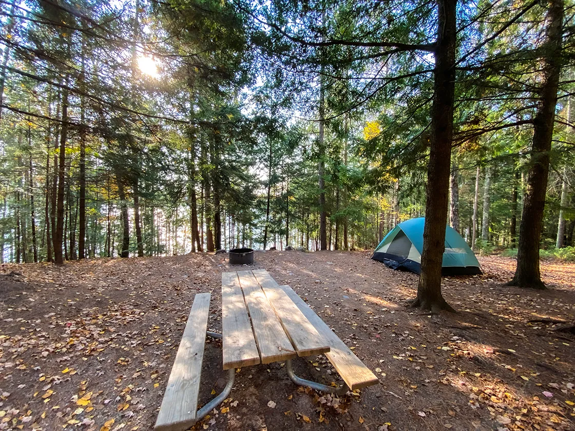
Campsite at Pat Shay Lake |
So, let’s clear something up about the mileage of this trail. Some say 13 miles, others 15, and I GPS recorded my two-day hike at 18.5 miles. The discrepancy lies in the fact that nearly every map of the hidden lake trail differs from other maps. I had three maps that I used for navigation and each had a unique route ... and with 3 maps I still managed to take a ‘wrong turn’ and create my own version of the Hidden Lake Trail.
All this inconsistency boils down to the fact that the Hidden Lake trail didn’t start out as its own trail; it evolved when backpackers in the 1970’s realized that if you took this short trail over to this short trail, and so on, that you could form a larger loop around Butternut Lake.
Knowing this, you can already guess that it’s a maze of trails intended for uses other than hiking, along with old forest roads, some of which are disappearing into the forest. In many ways, this trail is far harder to navigate than a deep wilderness trail just on account of its many intersections, some that are signed well, and others that are not. But thankfully, there are plenty of maps to help you through ... oh dear! There are too many maps with conflicting information and none that show where every intersecting trail goes.
So, here’s how I will break this down. The official forest service map available online will be of little help to you. The trails shown in the National topographic survey quadrangle are completely wrong and outdated. The Alltrails route is a loop route, but not quite the Hidden Lake official route. The Vilas County Trails App also has a workable but inaccurate map. But along the trail there are newer maps posted. I’m going to call the maps posted by the forest service along the trail the official route. But, understand, that if you came by another map it will probably get you around the loop on clear and hiker friendly trails.
So, here’s my story of hiking this superb loop. I had requested Columbus Day off but got scheduled for a meeting. My consolation was Friday off instead which turned out to be Indian Summer, a sunny day near 80 degrees in early October. This schedule change came so last minute that I only had a few hours to decide whether to go somewhere and what to do. Luckily, I had known about and already scoped out the Hidden Lake Trail. So, I grabbed an armful of dirty clothes out of the laundry hamper and just jumped in the car and headed for the Luna White Deer Lake Campground which I reached at 2pm. I grabbed a lakeside site in the campground, setup a palace tent so it would be ready for me when I finished the multi-day hike, threw on my backpack and walked out a few steps from my campsite and was on the trail headed towards Pat Shay Lake.
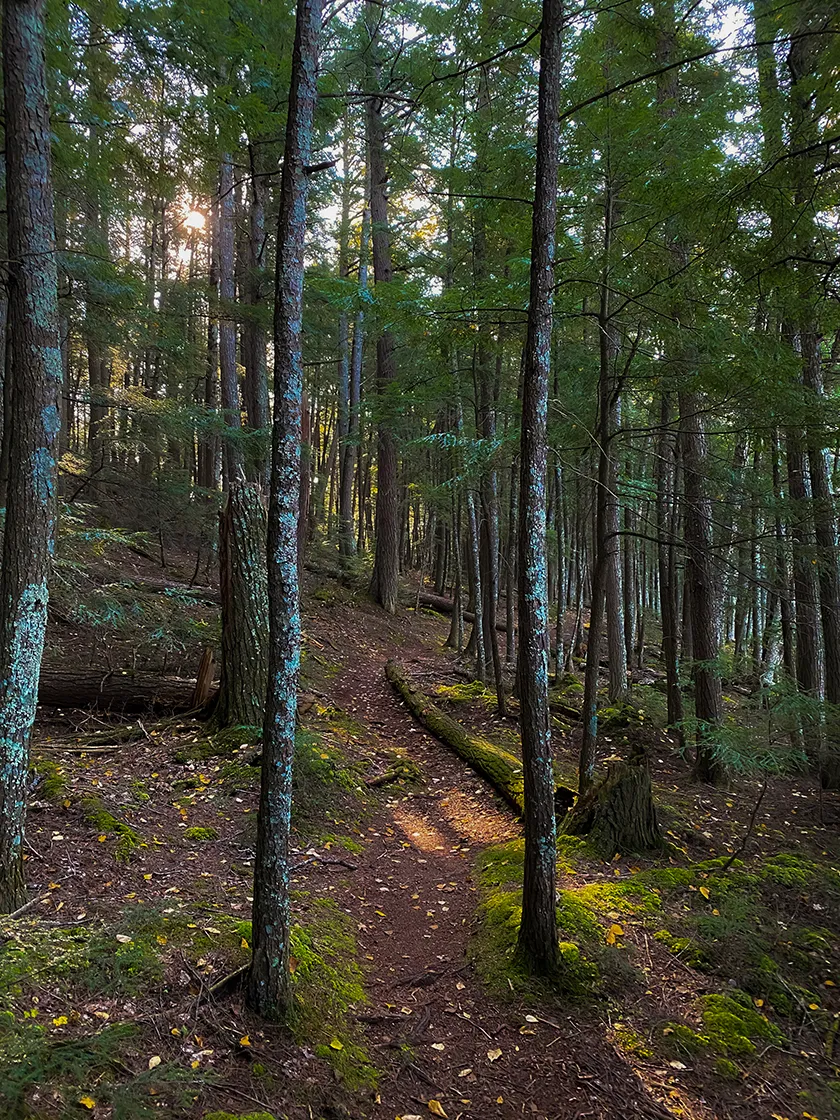
I wasn’t sure about the miles to Pat Shay, but I wanted to reach it before 6:30pm when the sun would be below the trees so I hustled without any breaks. The trail around White Deer Lake was magnificent with large towering pines above a fern covered forest floor and with lake views all the way. This trail connected to the Hidden Lake Trail which climbed in elevation through golden hardwoods and birch forest. After the first mile the trail leveled off to very low rollers and long stretches of relatively flat walks.
I came to a detour where I found the first real trail markings I could distinguish. There is a section of the Hidden Lake Trail that has been underwater for several years, and so a 3/4 mile reroute has been cut along old bike trails. So, add 3/4 miles to your total distance.
The area from the wetlands that detoured to the area around Pat Shay Lake was an unremarkable section, and most of the autumn leaves were already down, so this was the saddest section of the trail.
I could tell I was approaching the Pat Shay valley as groves of hemlocks began to appear. The hardest series of climbs on Hidden Lake is near Pat Shay. The climb was followed by a long steep decline to the shore of the lake. And a bit after meeting the lake a dispersed campsite came into view right beside the trail. I was happy it was not yet taken and I quickly setup camp, enjoyed a cooking fire and was down for the night by 8:30pm.
The next morning, I dug out the fire circle to create a more wind tolerant fire pit and had a fire at predawn and packed up with the sunrise. A few close gun shots rang out and a dog barked. Some bird hunters must have been on Pat Shay as well that morning. I was out of drinking water following my morning coffee and attempted to dunk a bag for filtering int Pat Shay, but the lake edge is very swampy and I couldn’t get close enough for a clean grab of water. I estimated it was a 6-mile hike to Franklin Lake where there would be running water and decided hold off on a water refill till then.
The section between Pat Shay Lake and Franklin Lake is the Nicolet North Ski Area. This is where you are most likely to get turned around. I found the trail route to be fairly straight forward and there were lots of intersections that included map postings. This is where the map you are using may disagree with the official line of the trail. I did make a turn to stay on the Pat Shay Ski Trail, which is the route that Vilas County Trail Maps claims as the correct line, but that is different than the official line. I also made an iteration with another trail that was supposed to shave off a mile overall.
Coming into Franklin lake the trail goes right up to the lakeshore where windswept waves crashed ashore. The trail dumped out at the boat ramp and then I was left without any indication as to which way to go to get back on it. I continued along the lakeshore towards the picnic area and a large 2-story log cabin emerged from the woods in front of me. This cabin is the picnic shelter and I was eager to get my pack off and have lunch. The water at the shelter was turned on and I was able to quench my thirst and refill my bottles. I took an hourlong break here, made hot lunch, and enjoyed the views.
To exit Franklin Lake Campground I turned up Nature Trail Road and after only a few hundred paces found a crossing of the Hidden Lake Trail. The trail between Franklin Lake and Luna lake is single track winding mountain bike trail. There is a long climb along an esker towards Two Dutchmen Lake. The trail encircles Two Dutchmen and the crosses over to Three Johns Lake. I found two non-designated dispersed sites along this lake. The one at the point looked picture perfect, but was taken by a group so I didn’t grab a photo of it. The trail crosses to another lake and then back over to Butternut Lake where there is one of the best non-designated dispersed sites I have seen. you’ll find it just after the bridge over the north branch of the Pine River.
From the Pine River it was a short walk over to Luna Lake and then onto the White Deer Lake Trail which led back to my campsite where I began the loop. In total, I logged 18.5 miles on my GPS recorder. You can expect to take a few more steps while you are exploring along the trail, and this will always add a few miles to your longer hikes. Hiker miles, of course, are always longer than road mile because there are so many short twists and turns that don’t get accounted for in the official trail mileage.
Now that I have scouted this trail out, I will be sure to bring friends back with me to do it again. This is a great introductory level backpacking trail. You could easily split it into a three-day hike with two nights camped along the route. If you begin at Franklin Lake and head clockwise around the loop it will be about 5-miles to reach White Deer Luna Lake Campground where there are a pair of dispersed sites along the Luna Lake Trail. From Luna Lake it will be about 6-miles to reach Pat Shay Lake. If the site at Pat Shay Lake is taken then it is only another 1.5-miles to the Warming Shelter where there is a large space to set up tents. And, then it will be 5-miles to return to Franklin Lake.
This trail can also be done in a single day hike, or as a one-night backpack like I did. Also, for groups with younger children you can backpack between White Deer Luna Lake and Franklin Lake Campgrounds and then return on the same route for a 10-mile out-and-back.
The iterations don’t stop there. The Nicolet Nordic Ski Trails connect to the Anvil Trail System, so you can really add on miles and make a long multi-day backpacking trip by incorporating the Anvil Trails and hike all the way to the Anvil Lake Recreation Area campground.

|
|
Nicolet North Trails |
Hidden Lake Trail
COUNTY
FOREST
COMMUNITIES
THREE LAKES, LONG LAKE, ALVIN, EAGLE RIVER
TOTAL MILES
15.5-MILE LOOP
DIFFICULTY
MODERATE
LOWEST ELEVATION
1676 AMSL
HIGHEST ELEVATION
1842 AMSL
TOTAL ELEVATION GAIN
2100 FT
POINTS OF INTEREST
Chequamegon-Nicolet National Forest, Franklin Lake, Two Dutchmen Lake, Three Johns Lake, Luna Lake, North Branch of the Pine River, White Deer Lake, Four Ducks Lake, Pat Shay Lake, Echo Lake, Butternut Lake, Nicolet North Nordic Ski Trails, White Deer Trail, Luna Lake Trail, Franklin Lake Nature Trail
CAMPING
Anywhere along the trail 50 feet from a trail or road and not within 1 mile radius of a campground. White Deer Luna Lake Campground, Franklin Lake Campground, Dispersed Sites at Three Johns Lake, Luna Lake, Pat Shay Lake, and the Nicolet North Trails Warming Shelter
Directions and Trail Map
Click Map Image to load the full interactive map.
If viewing on a mobile device, open the trail map above to load into Google Maps App by touching the expand rectangle in the upper right corner.
Address for your GPS: 15296 Butternut Lake Rd, Three Lakes, WI 54562
| coordinates: 45.927171, -88.995049 |
| From Milwaukee | 4.5 Hours |
| From Madison | 4 Hours |
| From Green Bay | 3 Hours |
| From Wausau | 2 Hours |
| From Minneapolis | 4.5 Hours |
| From Chicago | 5.5 Hours |
Photos

|
|
I started my loop around Hidden Lakes at a campsite at the White Deer
Luna Lake Campground |

|
|
This is the view from my campsite at White Deer Luna Lake
Campground |

|
|
The White Deer Lake Trail leaves the campsite and connects to the
Hidden Lakes main line trail |

|
|
As the White Deer Lake Trail leaves the boat ramp and beach the forest
closes in |

|
|
After connecting to the Hidden Lakes main line trail the forest turns
to hardwood and climbs hills |

|
|
Fairly Steep hills between White Deer Lake and Four Ducks Lake |

|
|
A new detour/reroute of the Hidden Lakes Trail crosses through
marshes |

|
| I camped my first night on the trail at Pat Shay Lake. This is the sunrise scene. |

|
|
It is near impossible to get water from Pat Shay Lake as the lake edge
is marshy |

|
| Heading northbound from Pat Shay Lake you enter the Nicolet North Nordic Ski Trail System |

|
|
The Nicolet North Nordic Ski Trails are wide two track ski trails |

|
|
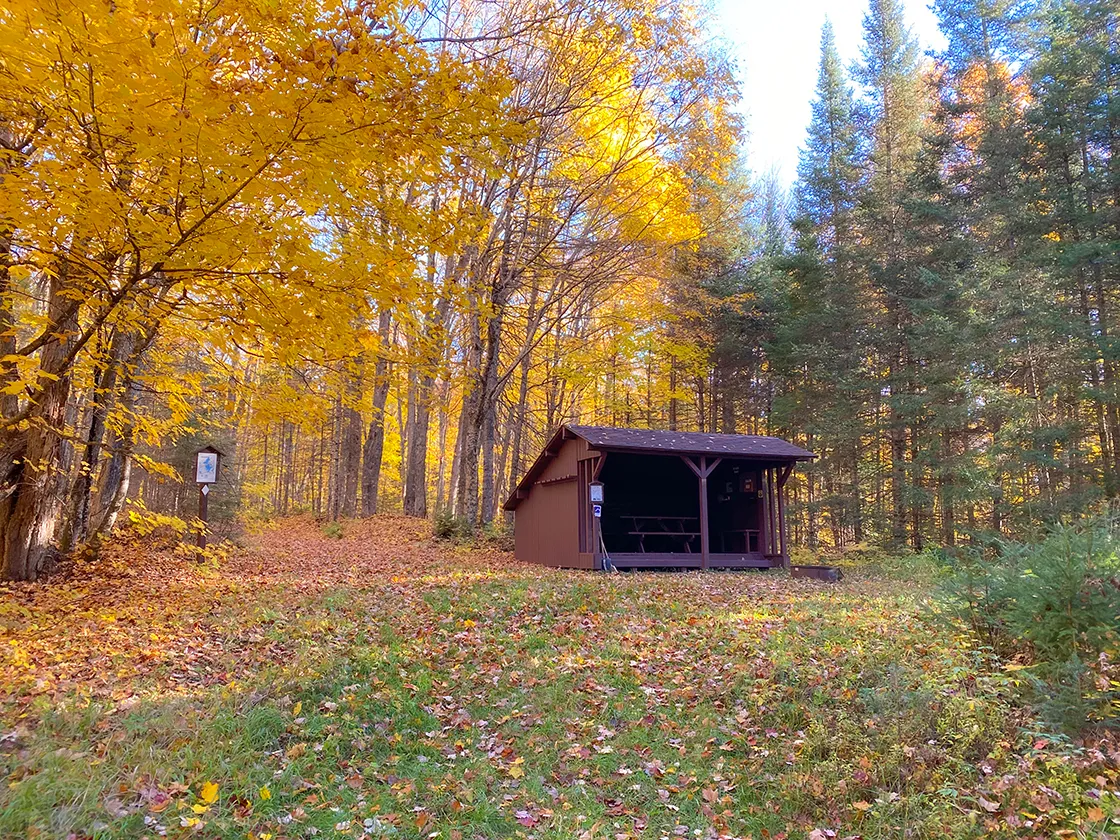
There is a very clean shelter along the Nicolet North Nordic Ski
Trails. This area could be used as a dispersed camp area. |

|
| This is the cleanest trail shelter I've ever seen. Please keep it that way. |

|
| Areas of the Nicolet North Nordic Trails can be very hilly |

|
| The Hidden Lakes Trail becomes a single track hiking trail near Franklin Lake |

|
|
There is a good bridge over a stream at Franklin Lake |

|
|
I stopped for a hot lunch at Franklin Lake Picnic Shelter |

|
|
The Franklin Lake Picnic Shelter has running water nearby and
fireplaces |

|
|
This looks like the official trailhead for the Hidden Lakes Trail
where it diverges from the Franklin Lake Nature Trail |

|
|
Three Dutchmen Lake is scenic |

|
|
Three Johns Lake is more scenic and there are many possible disperse
campsites that can be found or made on its shore |

|
|
This is the dispersed site at the bridge over the North Branch of the
Pine River. There is a fast flowing stream surrounding this site. |

|
| Luna Lake |

|
|
As you enter the Luna Lake area there is this bridge where your feet
will get wet. |
Links
Hidden Lake Trail Nicolet National ForestWhite Deer Luna Lake Campground
Franklin Lake Campground
Nicolet North Trails Map
Anvil Tails
Anvil Lake Recreation Area and Campground


