 |
The trail is a two track logging road and covers flat terrain. That makes this trail very easy for a seasoned hiker. However, its length (9 mile out-n-back) and the wildness of the surroundings put this trail in a more extreme category. This hike isn't like a walk on the Ice Age Trail. You won't find trail markers, leopold benches, water filling stations, or restrooms. You probably will not encounter other hikers either. But, you might encounter a bobcat or wolf.
Having come face to face with a wolf on this trail I can attest to this.
{tocify} $title={Table of Contents}
$ads={1}
advertisement
 |
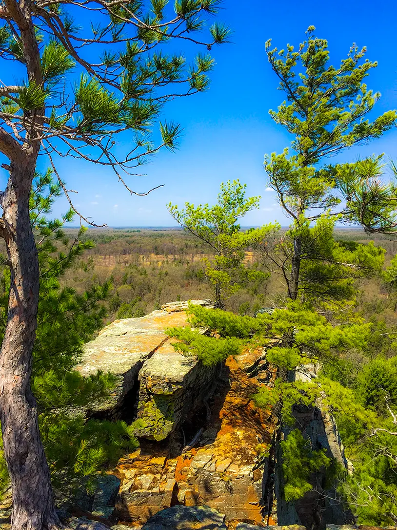
| Lone Rock at Quincy Bluff and Wetlands State Natural Area |
Seeing a gray wolf in central Wisconsin is not unlike seeing a ghost. These are animals that like their space - and while they may be around - most humans will never know exactly how close (unless you can read tracks). So, I felt very special to come into such close contact with the legendary lone wolf of Quincy Bluff.
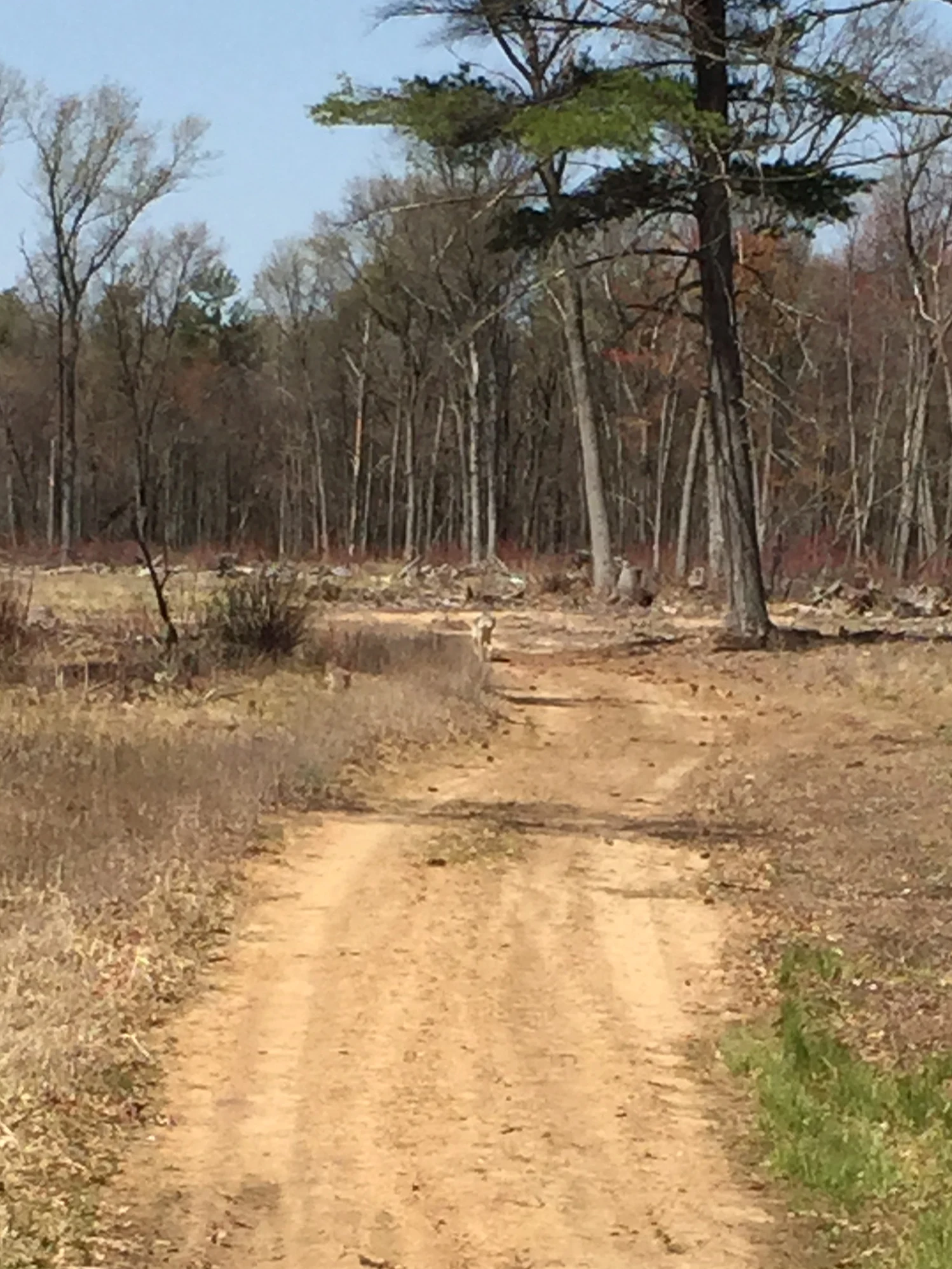
At about 1 mile into the trail (which is a sand road), I saw in the distant grasses the fluffy tail and back of a large dog. I assumed it was the pet of another hiker - and there was one other car in the parking lot, so...
But, then it rounded the corner of the road in front of me and I got a look at its face and body.
It stood taller than most dogs I have seen, had a lean body, and the unmistakeable wolf face and a jaw about the size of my forearm.
It was still far in the distance, and I still thought it could be a Siberian, but no owner was in sight. I decided to try and snap a picture in case I was lucky enough to see a wolf. But, at that distance my camera phone could not get a clear shot, and my better camera was buried in my backpack.
The animal progressed down the trail towards me at a casual cantor. It's tail was stuck out in attack arousal position which means it doesn't know what's going on but is checking things (me) out. I put the camera away and had to quickly form a strategy. I couldn't run, turn my back on it, or fight it. I would have to scare it off like one would with a bear by clapping and making noise.
It got within 200 feet and I could clearly see its eyes and face. It stopped moving as I did and we stared each other down. A tense minute passed. I whistled as I would if I was calling my dog to come, and it immediately took off into the woods on a long arc. I was able to see its huge body in full stride.
This was totally amazing.
But, I had to consider whether I would count on the wolf being solo and not part of a pack ... and also significantly uninterested in me. I was eager to scramble to the top of Lone Rock, so I continued on.
The road/trail meandered through increasingly dense areas of forest and alongside picture perfect wetlands. I could tell that this trail would be a mosquito hell from May to the end of July, and I was glad to be doing it in early spring.
Pine forests made up for the lack of a fully leafed out canopy. The trail was pleasant and soft.
I reached Lone Rock and encircled it on the trail, scouting out a potential scramble to the top. I found it on the West side. I blazed in and cut some quick switchbacks through dense undergrowth to reach the base of the rock face. From there was able to cleanly trace along until I found a suitable scramble. The one I found was a remarkably easy angle to the summit. The scramble took about 15 minutes to negotiate.
 |
| Scramble to the top of Lone Rock |
If you are a mountaineer, climber, or boulderer you may be tempted to scale one of the many cyphers or problems that present themselves on this granite and sandstone rock; but rock climbing is not permitted in the natural area. I can't say what the reason for this rule may be, but if all you are looking for is to reach the top of the rock I can assure you that there are several routes to the top that do not require climbing per se.
At the top I was greeted by a worn footpath that led from point to point on the rocky mesa. The views were more amazing than my photos can describe. It was breezy and cool at the top. There was a very easy to find geocache, and I thank the person who left the caramel candies which I enjoyed.
Overall, this trail rates highly among my hiking experiences in Wisconsin. It is perhaps the best hike I have had in this state to date. It was the perfect length. I clocked myself at just under 9 miles total. If you simply hike out to Lone Rock and turn back you will probably walk 6.5 miles.
The Lone Rock trail felt more like a mountain trail in a remote area. I enjoyed the casual and rustic nature of it immensely. And, the trailblazing to the top of Lone Rock made it all the more engaging.
I would recommend this trail to any agile adventure seeker, but I would avoid this trail if I were hiking with family. It's a little bit much compared to the typical manicured Wisconsin hiking trail. However, such a trail for hiking with family exists on the other side of the natural area at Quincy Bluff.
Overview: Lone Rock Trail at Quincy Bluff & Wetlands State Natural Area
COUNTYADAMS COUNTY
COMMUNITIES
FRIENDSHIP
TOTAL MILES
8.5-MILE LOLLIPOP
DIFFICULTY
MODERATE
LOWEST ELEVATION
910 AMSL
HIGHEST ELEVATION
1070 AMSL
TOTAL ELEVATION GAIN
850 FT
TOTAL ELEVATION LOST
-870 FT
Directions and Trail Map
Click Map Image to load the full interactive map.
If viewing on a mobile device, open the trail map above to load into Google Maps App by touching the expand rectangle in the upper right corner
Address for your GPS: 2493-2497 14th Dr, Adams, WI 53910
| coordinates: 43.906718, -89.847558 |
| From Wisconsin Dells | 25 Minutes |
| From Milwaukee | 2.5 Hours |
| From Madison | 1.5 Hours |
| From Green Bay | 2.5 Hours |
| From Wausau | 1.5 Hours |
| From Minneapolis | 3.5 Hours |
| From Chicago | 3.5 Hours |
Photos

 |
| From Lone Rock at Quincy Bluff SNA in Friendship WI |
 |
| From Lone Rock at Quincy Bluff SNA in Friendship WI |
 |
| Trail to Lone Rock at Quincy Bluff State Natural Area |
 |
| Trail to Lone Rock at Quincy Bluff State Natural Area |
 |
| Lone Rock at Quincy Bluff State Natural Area |
 |
| Lone Rock at Quincy Bluff State Natural Area |
 |
| Scramble up to Lone Rock |
 |
| Scramble up to Lone Rock |
 |
| Lone Rock at Quincy Bluff SNA in Friendship WI |
 |
| Lone Rock at Quincy Bluff SNA in Friendship WI |
 |
| From Lone Rock at Quincy Bluff SNA in Friendship WI |
 |
| From Lone Rock at Quincy Bluff SNA in Friendship WI |
 |
| From Lone Rock at Quincy Bluff SNA in Friendship WI |
 |
| From Lone Rock at Quincy Bluff SNA in Friendship WI |


