
 |
| Ice Age Trail Lodi Segment |
The Lodi Segment is one of the trail town segments of the Ice Age National Scenic Trail. Many of the miles of this trail are along sidewalks through the center of the charming town of Lodi. But, there are also a few miles of footpath through greenways and alongside the Lodi middle and high schools.
Along this trail you will get to see many of Lodi's restored Victorian homes, stop for ice cream and coffee, and contemplate on the banks of the babbling Spring Creek as it oxbows through the center of Lodi.
{tocify} $title={Table of Contents}
$ads={1}
advertisement
 |
| Ice Age Trail Lodi Segment |
Lodi is charming and quaint, with decorative Victorian homes proudly displayed along tree lined streets that are so quiet and safe that the town's children are able to play uninterrupted ballgames in them. Lodi is famous for its cherished mallard duck named Susie. In 1948 a mallard made a nest in a concrete basket set out in spring creek in town center. Ducks have continued to inhabit the stone basket since. There is an annual rubber duck race on Spring Creek in honor of Susie.
Be sure to stop in at Downtown Coffee Grounds for coffee and Chocolate Shoppe Ice Cream. Grab a coffee and a waffle cone and head across the street to Susie the Duck Park and walk along Spring Creek to Veterans Memorial Park.
The Lodi Trail connects directly to the East Lodi Marsh Segment - a more difficult and hilly section of footpath leading out of town. On the West end of Lodi there are plans to connect the trail from the high school to the Groves Pertborn Segment. Currently there is an awkward walk along the frightening county road J which has virtually no shoulder to reach Groves-Pertzborn, so a trail connection is essential and will hopefully be completed in the next few years.
 |
| Ice Age Trail Lodi Segment |
Overview: Ice Age National Trail - Lodi Segment
COUNTYCOLUMBIA COUNTY
COMMUNITIES
LODI
TOTAL MILES
4.2-MILE POINT-TO-POINT
DIFFICULTY
VERY EASY
LOWEST ELEVATION
810 AMSL
HIGHEST ELEVATION
1050 AMSL
TOTAL ELEVATION GAIN
320 FT
TOTAL ELEVATION LOST
-360 FT
CAMPING
Crystal Lake Campground 8 miles west
LODGING
Lodi Valley Suites, Victorian Dreams Bed and Breakfast2 miles north
NEXT IAT SEGMENT EASTBOUND
EAST LODI MARSH
NEXT IAT SEGMENT WESTBOUND
FERN GLEN SEGMENT
Directions and Trail Map
DOWNLOAD PRINTABLE PDF USGS TOPOGRAPHIC MAPLODI QUADRANGLE
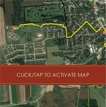
Click Map Image to load the full interactive map.
Address for your GPS: 101 Wisconsin 113, Lodi, WI 53555
| coordinates: 43.312910, -89.526563 |
| From Milwaukee | 1.5 Hours |
| From Madison | 30 Minutes |
| From Green Bay | 2.5 Hours |
| From Wausau | 2 Hours |
| From Minneapolis | 4 Hours |
| From Chicago | 2.5 Hours |
Photos
 |
| Ice Age Trail Lodi Segment |
 |
| Ice Age Trail Lodi Segment |
 |
| Ice Age Trail Lodi Segment |
 |
| Ice Age Trail Lodi Segment |
 |
| Ice Age Trail Lodi Segment |
 |
| Ice Age Trail Lodi Segment |
 |
| Ice Age Trail Lodi Segment |
 |
| Ice Age Trail Lodi Segment |
 |
| Ice Age Trail Lodi Segment |
 |
| Ice Age Trail Lodi Segment |