 |
| Ice Age Trail Cross Plains Segment |
Cross Plains is a charming small town nestled in a valley between imposing hills on the edge of the Driftless Area. It is an Ice Age Trail Town; a great place for long distance hikers to refuel, take a swim in a public pool, do laundry, and have a twisted ankle looked at by a doctor at the medical clinic.
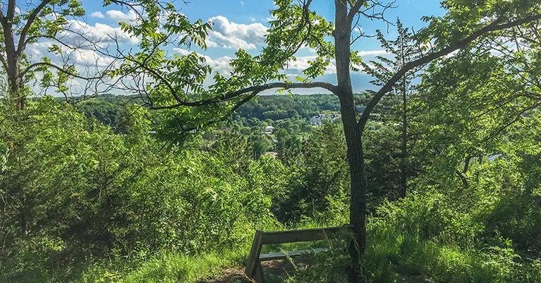
Overlooking this scene of casual rural town life is a segment of the Ice Age Trail high on a hilltop in the Andersen Preserve. The majority of this short 2.8-mile segment loops through the nature preserve, but the tail end of it passes by the local swimming pool and the Ice Age Trail Alliance Office. If you're thru hiking stop in to say hi, maybe they will have a care package for you.
{tocify} $title={Table of Contents}
$ads={1}
advertisement
 |
| Ice Age Trail - Cross Plains Segment |
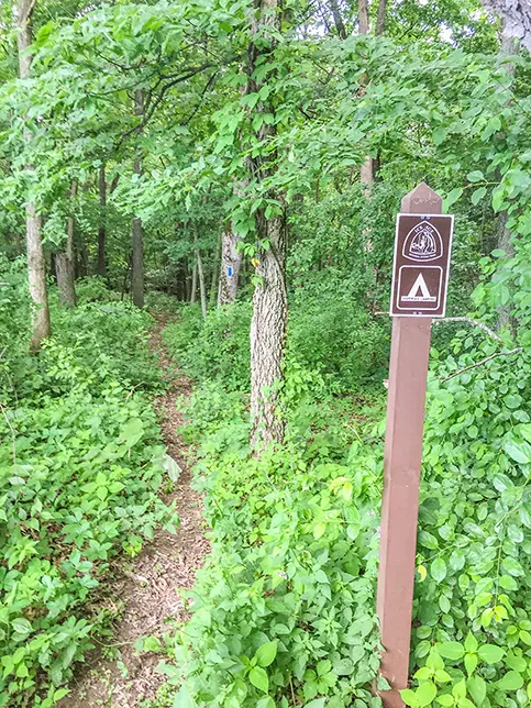
The Cross Plains Segment is short and surprisingly nice. The majority of its miles traverses a hilltop which is reached by a steep climb from Hickory Hill Street. On top the hill there is a large, restored prairie at the far end of which is a short trail to a disperse camping area. The DCA is new and not listed in the 2014 guidebook or atlas.
From the DCA the trail winds around forested ravines. The trail then crosses back across the prairie and enters a restored oak savanna. There is a good lookout spot near the end of the trail in the Andersen Preserve. From the lookout there is a quick switchback trail that leads out of the woods in between two residences in a newer residential neighborhood. You'll progress Southeast from there on Lewis Street to the public swimming pool and turn left towards the center of town.
It is another 8.5 miles on country roads to the next segment eastbound: The Valley View Segment. Going westbound, you'll find the lovely Table Bluff Segment about 2 miles from Hickory Hill Road headed westbound.
 |
| Ice Age Trail - Cross Plains Segment |
Overview: Ice Age National Scenic Trail - Cross Plains Segment
COUNTYDANE COUNTY
COMMUNITIES
CROSS PLAINS
TOTAL MILES
2.8-MILE POINT-TO-POINT
DIFFICULTY
MODERATE
LOWEST ELEVATION
870 AMSL
HIGHEST ELEVATION
1130 AMSL
TOTAL ELEVATION GAIN
510 FT
TOTAL ELEVATION LOST
-560 FT
CAMPING
Disperse Camping Area
POINTS OF INTEREST
Andersen Preserve, IATA Office
NEXT IAT SEGMENT EASTBOUND
VALLEY VIEW SEGMENT
NEXT IAT SEGMENT WESTBOUND
TABLE BLUFF SEGMENT
Directions and Trail Map
DOWNLOAD PRINTABLE PDF USGS TOPOGRAPHIC MAPCROSS PLAINS QUADRANGLE
Click Map Image to load the full interactive map.
Or Click here to open Interactive Map in Google Maps App.
Address for your GPS: 2425 Hickory Hill St, Cross Plains, WI 53528
| coordinates: 43.118319, -89.652106 |
| From Milwaukee | 2 Hours |
| From Madison | 20 Minutes |
| From Green Bay | 2.5 Hours |
| From Wausau | 2.5 Hours |
| From Minneapolis | 4 Hours |
| From Chicago | 2.75 Hours |
Photos
 |
| Ice Age Trail - Cross Plains Segment |
 |
| Ice Age Trail - Cross Plains Segment |
 |
| Ice Age Trail - Cross Plains Segment |
 |
| Ice Age Trail - Cross Plains Segment |
 |
| Ice Age Trail - Cross Plains Segment |
 |
| Ice Age Trail - Cross Plains Segment |
 |
| Ice Age Trail - Cross Plains Segment |

