|
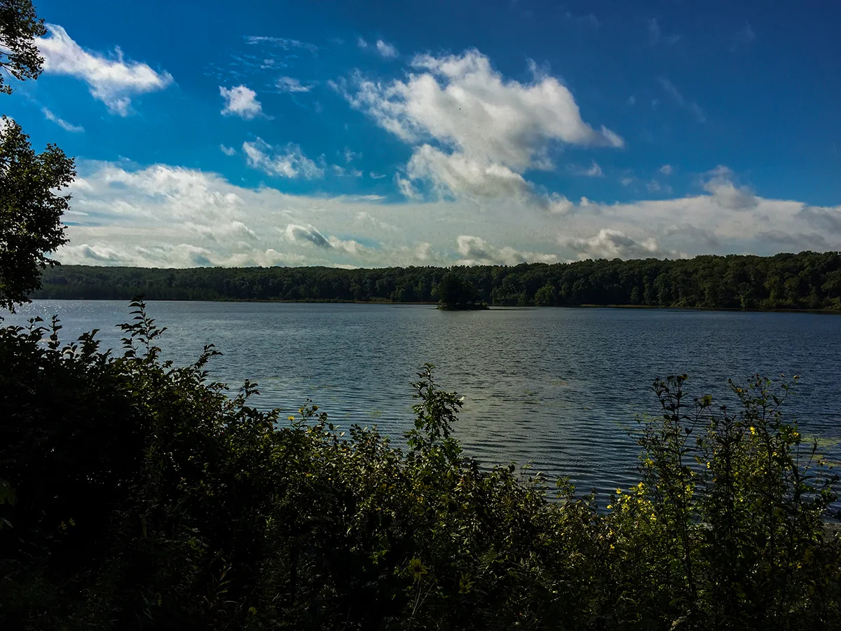
The Ice Age Trail's Straight Lake Segment is a 3.65-mile linear footpath in the northwestern Wisconsin village of Luck. Currently, this hiking trail is the only feature of Wisconsin's newest state park: Straight Lake State Park. The terrain is mild and easy going and the trail is well established and maintained. The trail offers many scenic views of the tunnel channel, Straight Lake, Rainbow Lake, and the Straight River Valley.
{tocify} $title={Table of Contents}
$ads={1}
advertisement

|
| On the Ice Age Trail Straight Lake Segment |
It is almost a shame that this secluded natural wilderness will one day be a state park bustling with activity. For now, it is our little secret. Anglers will quickly fall in love with this 107-acre lake. It is not more than 12 feet deep, but is teaming with panfish, especially bluegill according to reports. largemouth bass and northern pike have been pulled from Straight Lake. But it is the privacy and unspoiled wilderness surrounding this lake that make it a spectacular fishing site.
I even saw what I believe to be a whooping crane in the marshy area at the northeast end of the lake. If I'm not mistaken, there are less than 400 whooping cranes residing in the United States - though a true birder might correct me. It is hard to imagine that a rare, endangered bird would put up with anything less than its very own secluded lake.
In the fall of 2016, as I write this, the state DNR is installing the first developments at Straight Lake State Park. A number of rustic campsites with ready access to the lakeshore will be established along with some vault toilets, parking, boat access, and a few picnic areas. In the future the camping grounds may be expanded to include group sites and a ranger station may go in. To my knowledge, camp sites will be self-registration in the beginning. All of this will be on the south shore with access from County Highway GG.
At the same time, the Ice Age Trail Alliance will be establishing disperse camp areas along the Ice Age Trail on the northern shoreline of Straight Lake. Other improvements to the trail will include upgrades to existing boardwalks in potentially swampy areas.
The Straight Lake Segment of the IAT is well maintained and easy to follow. The trail begins at the connection with the Trade River Segment. It crosses through dense forest and then courses along the shaded high ground on the northern shore of Straight Lake. After a brief rock hop over the Straight River the trail begins to pick up in elevation. There are a few mild hill climbs, but nothing that will really get your heart racing.
The trail eventually crosses onto private grazing land - for about the last 1/2 mile of the trail. Hikers pass through a counterweighted gate to enter the grazing area. You'll notice the difference immediately as the underbrush here has been nibbled down to stumps by a herd of cattle. From the southern trailhead there is a short walk along county highways to hook up with the next segment: The Straight River Segment.
The Straight Lake Segment is a mild, easy trail that is well defined. It can be enjoyed by the whole family, people of any age, and by anyone of any athletic ability. I didn't notice any evidence of bears in the area, but it might be a good idea to pack a handy can of bear spray for this walk.

|
| On the Ice Age Trail Straight Lake Segment |
Overview: Ice Age National Scenic Trail - Straight Lake Segment
COUNTYPOLK
COMMUNITIES
LUCK
TOTAL MILES
3.65-MILE POINT-TO-POINT
DIFFICULTY
EASY-MODERATE
LOWEST ELEVATION
1200 AMSL
HIGHEST ELEVATION
1360 AMSL
TOTAL ELEVATION GAIN
770 FT
TOTAL ELEVATION LOST
-800 FT
CAMPING
Disperse Camp Areas Along the trail, Rustic Campsites at Straight Lake State Park side of Straight Lake
POINTS OF INTEREST
Straight Lake State Park, Straight Lake, Tunnel Channel Lakes, Rainbow Lake, Straight River
NEXT IAT SEGMENT EASTBOUND
STRAIGHT RIVER SEGMENT
NEXT IAT SEGMENT WESTBOUND
TRADE RIVER SEGMENT
Directions and Trail Map
DOWNLOAD PRINTABLE PDF USGS TOPOGRAPHIC MAPLUCK QUADRANGLE
Click Map Image to load the full interactive map.
Address for your GPS: 2815 130th Street, Luck, WI 54853
| coordinates: 45.612186, -92.428978 |
| From Milwaukee | 5 Hours |
| From Madison | 4 Hours |
| From Green Bay | 4 Hours |
| From Wausau | 3 Hours |
| From Minneapolis | 1 Hour |
| From Chicago | 6 Hours |
PHOTOS

|
| Straight Lake on the Ice Age Trail Straight Lake Segment |

|
| Crane On the Ice Age Trail Straight Lake Segment |

|
| On the Ice Age Trail Straight Lake Segment |

|
| On the Ice Age Trail Straight Lake Segment |

|
| On the Ice Age Trail Straight Lake Segment |

|
| On the Ice Age Trail Straight Lake Segment |
LINKS
Ice Age National Trail Alliance
Ice Age National Trail - National Parks Service
Straight Lake State Park

