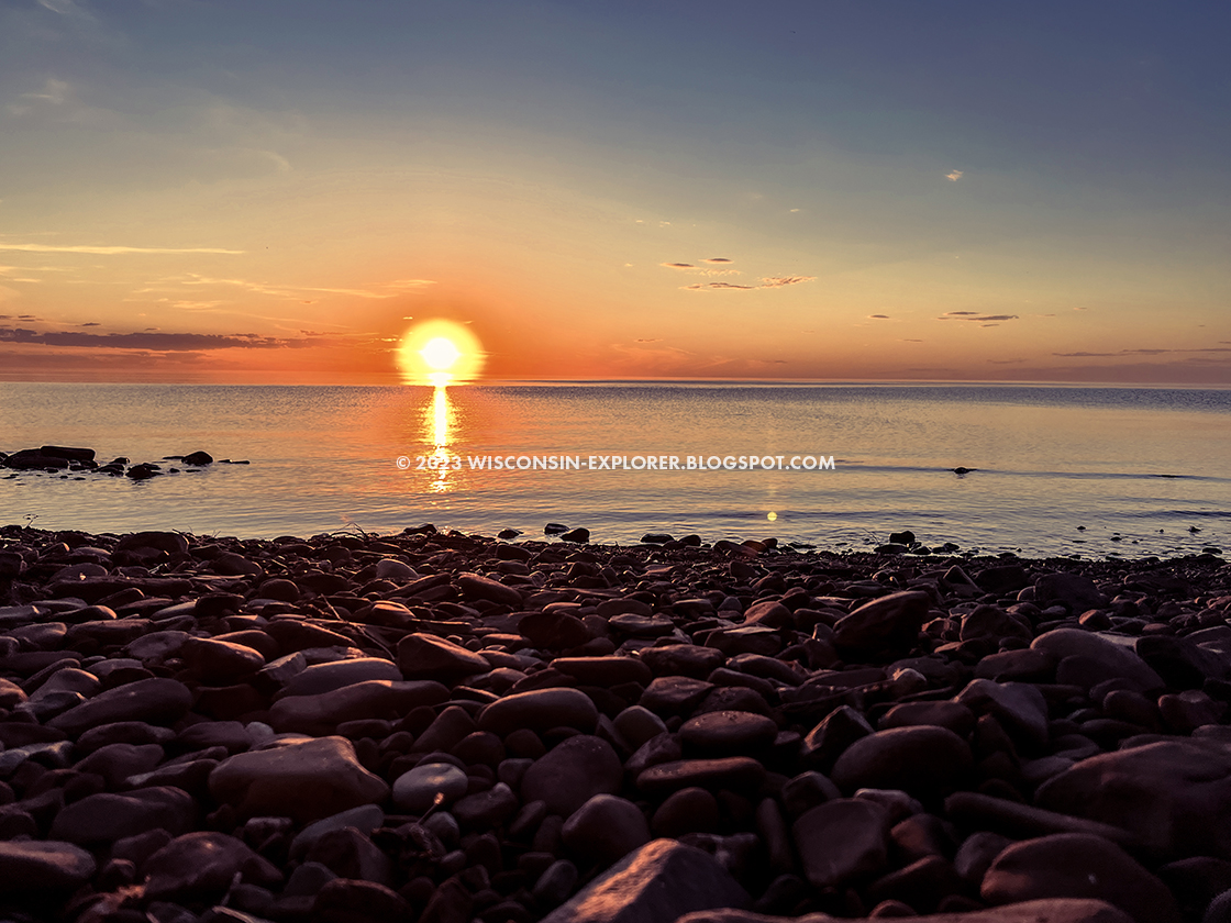
The Porcupine Mountains Wilderness State Park is a backpacker’s playground in Michigan's
Upper Peninsula. 90-Miles of looping and interconnected trails take hikers on
challenging courses from the heights of Summit Peak down to the Lake Superior
shoreline. This unique park includes 35,000 acres of old-growth forest shading
scenic rivers that bash their way through rocky valleys and spill over
waterfalls into Lake Superior. Lake Of The Clouds and Mirror Lake reflect
starry nights and streaming northern lights off their glassy surfaces. Scenic
delights in the Porkies are too many to list, and it’s all only 30-miles north
of the Wisconsin border.
There are many ways to enjoy the park, and The Porkies have all
the offerings for family camping typical of a state park, but what draws
visitors from across the nation and abroad to this northern corner of the
Midwest is its unique setup as a backpacking park. Dozens of postcard perfect
backcountry campsites are accessed directly along lengthy and challenging
hiking trails. It’s easy to make a looping multi-day trip from site to site.
And if you’d like to go ultralight, leave the tent and sleeping pad behind and
hike from rustic cabin to cabin.
{tocify} $title={Table of Contents}
$ads={1}
advertisement

|
|
Presque Isle River in the Porcupine Mountains State Park
|
Over the years so many friends pestered me about getting up to the Porcupine
Mountains that I finally relented. And, by an off chance I ended up taking two
trips to the western portion of the Porcupine Mountains in 2022, once in early
summer and again in early fall. Now I am singing with the choir about this gem
of a wilderness retreat that is just beyond the northern border of Wisconsin.
The Escarpment Trail above the Lake of the Clouds on the eastern end of the park
offers the best Instagraming, but for variety of scenic experiences the western
end of the park, anchored by the Presque Isle drive-in campground was where I
mapped out long-weekend loop routes. Now that I’ve hiked that side of the park
thoroughly and am better aware of the park terrain, I’d plan out a different
approach.
Climbing uphill on the Correction Line, Cross Trail, or up the escarpment on the
Big Carp River Trail requires sweat-drenching-effort. You can shave off some of
the steep grades by hiking the park from top-to-bottom.
Start at Summit Peak at the South Mirror Lake Trail parking area. Hit the Summit
Peak observation tower and you’ll survey the forest that you’ll spend a few days
hiking through below you. Then proceed downhill to Mirror Lake. Camp at Mirror
Lake for a Northwoods lakeside camping experience. Then breeze down the steep
and muddy Correction Line to reach the Big Carp River Trail. Take a left turn
and you’ll ford a couple streams before reaching the cascading Big Carp River
and its many picturesque waterfalls. The Lake Superior campsites are inferior to
others in the park, so instead camp at BC-7 above Shinning Cloud Falls or
continue on and see Lake Superior and turn back into the woods along the Little
Carp River Trail and camp at LC-9 overlooking Explorer Falls. Then huff it
uphill on the Little Carp River Trail to the Lily Pond Trail and back to the
parking lot.
If you prefer point-to-point hiking, you can head downhill starting at either
Summit Peak or Lake of the Clouds Overlook and then take the Big Carp River
Trail to the Lake Superior Trail and finish out at Presque Isle Campground. Just
be aware, the Lake Superior Trail is deceptive, its ups and downs and uneven
trail tread makes it among the most challenging hikes in the park.
A grand loop of the park would traditionally start at the Government Peak Trail
lot and follow counterclockwise up the Escarpment Trail, then down the Big Carp
River Trail to Lake Superior and over to the Little Carp River Trail up to
Mirror Lake and then up and over the Government Peak Trail. You can throw in a
bifurcation up to Summit Peak to get all the major points of the park into one
loop that should be spread over four nights to fully enjoy the trip without
overextending all the members of your party.
CABINS (IF YOU CAN GET ONE)
Backpacking to backcountry cabins is an amazing experience. Forget about storms
and rain, you’re protected. Tired after a full day of backpacking? Just drop
your backpack and climb into bed. Worried about bears and wolves at night? Worry
not. The cabins make backpacking easy and carefree. But, reserving one is next
to impossible.
You can reserve cabins online 6-months in advance of your trip at 8am Eastern
time / 7am Central Time. Michigan residents can reserve 6-months plus 1 week in
advance giving them a head start. So, if you know a Michigan resident have them
make the reservation for you. But, remember, the person named on the reservation
must check-in in-person to get a key from the main Visitor Center on the day of
your first reservation and the rangers will ask to see ID. … so make sure this
Michigan resident is indeed joining your group for the trip.
Don’t count on getting a cabin reservation, but try anyways because you might
just get lucky. I got cabins for both my trips in 2022, and by a stroke of luck
was able to score an extra night in a cabin by asking at check-in if anyone had
canceled their cabin reservation for a night.

|
|
Big Carp River 4 Cabin on the Cross Trail in the Porcupine Mountains
State Park State Park
|
A WORD ABOUT OVEREXERTION
The forest rangers at Porcupine Mountains make frequent trips into the
backcountry to evacuate overexerted hikers. Maybe hikers underestimate the
challenge of these hikes because this park is in the Midwest and not in the
Appalachian or Rocky Mountains. Maybe hikers overestimate their capabilities for
mileage and elevation gain. I’m guessing the main reason is because this park
draws a lot of first-time or novice backpackers who overestimate their athletic
ability.
If you’ve read about thru-hikers on the Appalachian Trail going 22-miles a day
but you personally have never backpacked before then you might think that
15-miles-a-day is a good starting pace. But, that’s still about twice the amount
of a comfortable day for a novice backpacker. New backpackers can expect to hike
at 2-mile an hour, struggle pulling their weight and backpack weight up hills,
and should instead max out at 8-miles per day. Four hours of hiking under
backpack weight is one hell of a workout for anyone and you’ll expend 4000 kcals
on an 8-mile backpacking day in the Porcupine Mountains. And that’s the calorie
spend before setting up camp and finding firewood. My advice is to keep the
miles between campsites lower than 10-miles and focus less on mileage and more
on camping in this extraordinary old-growth forest.

|
|
The Lake Superior Trail in the Procupine Mountains State Park
|
TRIP PLAN A, 23-Mile Loop, Moderate effort, Waterfalls and Lake Superior.
DAY 1, 3-miles: Start at the Mirror Lake Parking Area off S. Boundary Road. The
Summit Peak lot is crowded with day-hikers, so make some room for others by
parking at the Mirror Lake Trailhead lot instead. Hike 3-miles on the South
Mirror Lake Trail and camp at SML-3. This site is semi-private and directly
lakeside.
DAY 2, 8-miles: Follow the Little Carp River Trail north beside the shore of
Mirror Lake and turn north on the Correction Line. Hike down a steep hill for
3-miles to reach the Big Carp River Trail. Take a left turn to hike northwest on
the Big Carp River Trail for 3-miles. Along the way you will ford the Carp River
and pass Shinning Cloud Falls and Bathtub Falls. At the mouth of the Big Carp
River head southwest for 1.6-miles on the Lake Superior Trail to the mouth of
the Little Carp River. Camp at LC-14 on the shore of Lake Superior.
DAY 3, 7-miles: Head south for 5-miles on the Little Carp River Trail. You’ll
ford the Little Carp River twice as you hike uphill the entire day. You’ll also
pass Trappers Falls, Explorer Falls, and Greenstone Falls. Just after Greenstone
Falls veer left to stay on the Little Carp River Trail for 2 more miles. You’ll
hike through some mud and uphill to reach a campsite at LC3.
DAY 4, 5-miles: Hike 1.3 miles northwest on the Little Carp River trail to reach
the intersection of the Beaver Creek Trail. Take the 2.3-mile steep climb up to
Summit Peak to Summit Peak then return on 1.5 miles of the South Mirror Lake
Trail.

|
|
Campsite along the Superior Trail in the Porcupine Mountains State Park
|
TRIP PLAN B, 35-Mile Loop, Difficult, Three peaks, waterfalls, rivers and
lakes, premium campsites.
DAY 1, 5.5-miles - Moderate: Park at the Government Peak Trailhead off 107th
Engineers Memorial HWY. Head a short distance up the Government Peak Trail then
veer off to the west on the Escarpment Trail. Hike the Escarpment Trail uphill
4-miles to reach the Lake of the Clouds Overlook. Continue on to the Big Carp
River Trail and hike 1.5-miles to reach campsite BC-1.
DAY 2, 6-miles - Easy: Hike the Big Carp River Tail downhill 6-miles and camp at
BC-7 above Shining Cloud Falls.
DAY 3, 5.5-miles - Moderate: Hike 1.5-miles to the Mouth of the Big Carp River
and then head Southwest on the Lake Superior Trail for 1.8-miles. Turn south
onto the Little Carp River Trail and hike uphill 2-miles to reach campsite LC9
above Explorer Falls.
DAY 4, 10.3-miles Difficult: Hike 3-miles uphill to reach Greenstone Falls then
veer northwest to stay on the Little Carp River Trail. Hike 3-miles to reach the
Beaver Creek Trail. Hike 3-miles steeply up hill to reach Summit Peak. Then
descend the Summit Peak Trail to the South Mirror Lake Trail and hike steeply
downhill 1.3-miles to reach Mirror Lake and camp at SML-3.
DAY 5, 7-miles Difficult: Hike 1-mile northeast on the Mirror Lake Trail to
reach the Government Peak Trail, then turn right to head east on the Government
Peak Trail uphill for 2-miles to reach Government Peak. Then continue the
Government Peak Trail back to the parking lot.

|
|
Looking down at the Big Carp River from the Lake of the Clouds Overlook
|
PORCUPINE MOUNTAINS STATE PARK HIKING TRAILS
STATE
MICHIGAN
COUNTY
ONTONAGON, GOGEBIC
COMMUNITIES
ONTONAGON, WHITE
PINE, WAKEFIELD
TOTAL MILES
90-MILE NETWORK
DIFFICULTY
MODERATE-TO-DIFFICULT
LOWEST ELEVATION
600 AMSL (LAKE SUPERIOR)
HIGHEST ELEVATION
1950 AMSL (SUMMIT PEAK)
CAMPING
Backcountry wilderness campsites, Union Bay Campground, Group Camp, Union
River Outpost, Lost Creek Outpost, White Pine Extension Outpost, Presque Isle
Campground
LODGING
Backcountry Cabins, Backcountry Yurts, Kaug Wudjoo Lodge
Directions and Trail Map
If viewing on a mobile device, open the trail map above to load into Google
Maps App by touching the expand rectangle in the upper right corner.
VISITOR CENTER Address for your GPS:
33303 Headquarters Rd, Ontonagon, MI 49953
| coordinates:
46.81538874060388, -89.62497529994116
|
| From Milwaukee |
5.5 Hours |
| From Madison |
5 Hours |
| From Green Bay |
4 Hours |
| From Wausau |
3 Hours |
| From Minneapolis |
5 Hours |
| From Chicago |
7 Hours |
Related Posts
HIKING THE NORTH COUNTRY TAIL IN WISCONSIN
If you enjoyed backpacking in the Porcupine Mountains then you'll likely to
enjoy the North Country Trail in Wisconsin as well. This post is a directory
to other articles about each section of the North Country Trail in
Wisconsin
WISCONSIN BACKPACKING TRAILS
There's plenty of introductory backpacking to experience right here in
Wisconsin. This post is a directory of backpacking trails in Wisconin.