

|
The Bois Brule is a pristine 44-mile-long river in Douglas County Wisconsin. This wilderness river is a popular recreational destination for canoe-paddlers, fly-fishermen, and campers. A large portion of the river is protected from development on both sides by the Brule River State Forest. Some sections host large estates known as lodges built in the late 19th and early 20th century. Their picturesque boathouses evoke nostalgia for the Field and Stream romanticism of outdoorsmanship.
The full length of the river can be paddled to its mouth on Lake Superior. Challenging rapids create excitement and draw open-boat whitewater enthusiasts from across the Midwest. The section between Stones Bridge Landing and Winneboujou is the most popular day trip and includes many class 1 rapids as well as immersion in the storied history of this River of Presidents.
{tocify} $title={Table of Contents}
$ads={1}
advertisement

|
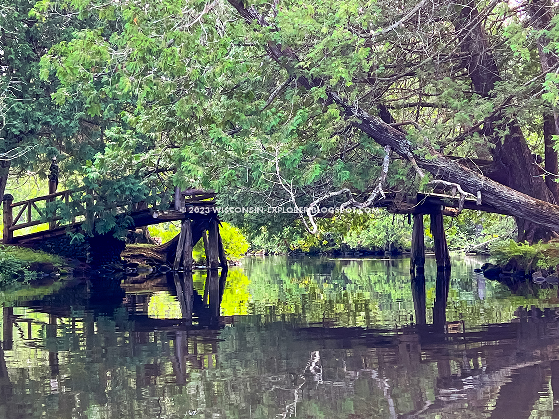
| Mays Ledges on the Bois Brule River |
Paddles dipping into the black water of the Bois Brule you can hear the Song of Hiawatha, legends whispered in the silver leaf turned by a fluttering autumn breeze. To canoe the Brule River is to bathe in nostalgia. From Winneboujou to Gitche Gummi this river is a generationally loved and sacred place. A place of lore reaching back through the centuries. It is the River of Presidents. The playground of lumber barons and tycoons. Further back it was an essential trade route, the only land impediment in a circle from New Orleans to Quebec through Sault Ste Marie to St. Louis is a two-mile portage between the Brule and the St Croix rivers, a dirt footpath remains where the voyageurs and their expeditions into the New World, dating back to 1680, are commemorated with mile stones. The river’s deep history stretches further to the Ojibwe and the Eastern Dakota before them. Legend gives that the Dakota were Lake Superior fishermen and Brule River paddlers long before they mastered the nomadic plains on horseback.
After Labor Day 2022, in the long angled late summer sun I took my first trip down the Brule … in a kayak (the traditionalists sneered at me). By the time I reached Cedar Island I already recognized the particular nostalgic potion of this place. The Brule is the authentic version of everything that Wisconsin Dells packages and sells as the Wisconsin style. From scrolling Hamm’s Beer signs to plaid throws draping Adirondack chairs on the Milwaukee River Walk, to the Friday fish fry with sweet old fashioneds, from swinging porch beds right down to moccasin shops and the 60’s vintage neon of road trip Americana, the Wisconsin style owes it origins to Wisconsin’s river cottage culture before its later incarnation of black bear rugs and lake-life cabins. The Wisconsin River, The Mississippi, the Fox, Chippewa, St Croix, Namekagon, and the Bois Brule are the original arteries of Wisconsin’s peaceful, goofy, laid-back and unpretentious recreational culture.
The Brule is not The Dells. Not by a long shot. But as I bobbed along rapids through its narrow puddle and run pinches my mind grabbed for an explanation of why this experience felt so familiar. Mixing memories of Stand Rock ceremonies, of painted totem poles, white pine trees, sap, and pine needles, and miniature souvenir birch bark canoes, and even the bobbing on an inner tube down Family Land’s lazy river. And stirred in with those curious visions were the memories of gazing at my Grandfather’s Hamm’s beer sign, the centerpiece of his basement bar clad with thin wood paneling and taxidermized trophy bucks, a musky, and a squirrel eating a nut. All those peculiar images that provoked my young imagination to run wild. The scenic Bois Brule brings into reality the luminous river and wilderness adventure daydreams my 6-year-old head conjured while I sipped RC cola from a straw in a can sheltered beneath beer drinking men who had hunted and fished the great northern Wisconsin forests.
Leaving those memories to swirl in eddies behind my paddle there is plenty to fill the senses in the present. The Brule River State Forest protects most of the stretches of the Brule River from development. The only riverfront structures are those old grand lodges and their craftsman boathouses passed down generationally.
I put in at Stone’s Bridge, shuttled to the landing by Brule River Canoe Rentals. The river is as unspoiled as I have ever seen for the first few miles. A slow current and plenty of fallen trees to get hung up on when the river is low as it often is. Just as I was forgetting the modern world, I turned a corner and the Cedar Island boathouse came into view.
Cedar Island is an old resort and the one where President Calvin Coolidge set up his summer White House in 1928. He is just one of a long number of Presidents who visited to fish the Bois Brule. The famed River of Presidents began with Ulysses S. Grant, then Grover Cleveland, Herbert Hoover, and Dwight D. Eisenhower. Their stays weren’t all about fishing. Deep pocketed and powerful elite lined the River from Cedar Island through Winneboujou with their summer lodges.
Gawking at lodges of those old powerful families is among the many unique experiences of paddling the Brule. You’ll recognize some of these old-money names that include Henry Pierce Clay, Alexander McDougall, Pabst, Schwinn, Weyerhaeuser, and Ordway.
After filling my camera with photos of Cedar Island the fun part of the river began. A few gentle rapids sped up the adventure until I reached The Falls Rapids. These rapids didn’t look like much as I approached. There was barely room for my kayak to enter the chute, but when I did, I realized the falls turned sharply. Fallen trees blocked the deeper right bank and three boulders protruded on the left. I missed the first two boulders and rode up the third. It’s the first time I’ve turned over my kayak in 30 years. I’ve become so comfortable with my kayaking and canoeing skills that I’ve become a bit too relaxed about keeping my belongings in dry bags and tied in. So, added to the insult of being sopping wet I had to fish out my cellphone and bottle of water from the calm pool at the end of this short falls.
There were more rapids in tight chutes than I could count, and each seemed to lead into slow and shallow lakes. This is what the locals call puddle and run. I could have done a better job staying on the perimeter of the lakes as the centers are shallow and I beached my kayak once and had to drag it to deeper water. I was pitifully embarrassed by my over turn at The Falls and then having to drag myself out of Big Lake so I was glad I had the river to myself on the Tuesday after Labor Day, but I still feel like the ducks and geese were laughing at me.
From Lucas Lake to Winneboujou Landing the Lodges and boathouses are on display in a parade. There is plenty of shade in this area of the river and narrow turns and gentle rapids. Just as the river guide had predicted I pulled into Winneboujou Landing after three and half hours on the water.
I left my kayak by the side of the landing to be picked up by the outfitter, changed into dry clothes and set off to see more of the Brule River’s sights. I bounced up to Lenroot Ledges on the crumbling County Highway H. A quick walk in revealed more impressive rapids, well beyond my recreational skill level, so I’d have been portaging around the Ledges had I made it this far downriver. Next stop was May’s Ledges an even more pronounced cascade leading to a brutal boulder field. There’s a path beside the river that I hiked north for a long distance in the lush State Forest.
To finish out my day trip on the river I drove up to the Mouth of the Brule at Lake Superior and enjoyed a shore lunch on the beach. Someday I’d like to canoe the whole river from the historic portage trail to Lake Superior, I can imagine how it must feel to finish your trip in the big water of a Great Lake.
After my tour I returned to my campsite, a walk-in site at the Bois Brule River Campground. I started a campfire and kicked back in my lounger beside the river and fell asleep watching the fly fishermen casting into the Bois Brule River as the sun set on another memorable day in the North Country.
Paddling this river can be a bit challenging for novice paddlers, but if there is only one river that you ever paddle in your life, make it the Bois Brule.

|
| My campsite for the week at the Bois Brule River Campground |
Bois Brule River - Canoe/Kayak
COUNTY
DOUGLAS
COMMUNITIES
LAKE NEBAGAMON, BRULE, PORT WING
TOTAL MILES
44-MILE RIVER
DIFFICULTY
INTERMEDIATE-TO-ADVANCED
Directions and Trail Map
If viewing on a mobile device, open the trail map above to load into Google Maps App by touching the expand rectangle in the upper right corner.
Address for your GPS: Winneboujou Landing, 13402 E County Rd B, Lake Nebagamon, WI 54849, WI 53937
| coordinates: 46.516695, -91.603688 |
| From Milwaukee | 6 Hours |
| From Madison | 5 Hours |
| From Green Bay | 5Hours |
| From Wausau | 3. Hours |
| From Minneapolis | 3Hours |
| From Chicago | 7 Hours |
Photos

|
| For my visit to the Brule River State Forest I camped at the Bois Brule River Campground which features a few campsites directly on the river banks. |

|
| A typical view of the Bois Brule River as seen from my campsite at the Bois Brule River Campground. |

|
| My campsite for the week at the Bois Brule River Campground |

|
| From Stones Bridge Landing the river flows through State Forest and is a seemingly untouched wilderness |

|
| The river views are typical of Northern Wisconsin rivers. |

|
| Cedar Island Lodge is where Calvin Coolidge set up his summer White House in 1928 |

|
| Cedar Island Lodge on the Bois Brule River |

|
| Bridge to Cedar Island on the Bois Brule River |
|
| Bridge to Cedar Island on the Bois Brule River |

|
| The historic Cedar Lodge on the Bois Brule River |

|
| The historic Cedar Lodge on the Bois Brule River |

|
| The historic Cedar Lodge on the Bois Brule River |

|
| A private landing on the Bois Brule River |

|
| A historic lodge on the Bois Brule River |

|
| I took out at Winneboujou Landing on the Bois Brule River |

|
| Mays Ledges on the Bois Brule River |

|
| The boulder field after Mays Ledges on the Bois Brule River |

|
| The Mouth of the Brule River at Lake Superior |
Video
Links
Bois Brule Canoe RentalsBrule River State Forest
Bois Brule River Campground / Copper Ridge Campground