 |
After crossing the Rock River on a pedestrian bridge riders and hikers meander through Palmer Park and the Green Belt towards a final connection with the Janesville to Milton Segment of the IAT. This peaceful route brings hikers past many of Janesville's top attractions including Rotary Botanical Gardens, The Rock River dam and turbine, Lion's Beach, Blackhawk's Grove, Blackhawk Golf Course, Palmer Park, and Riverside Park.
There are also connecting bike trails that include the Sports Complex Loop and the Peace Trail. This trail is well serviced with restrooms, water stations, picnic shelters (which become great places to wait out storms), and plenty of benches with views of Janesville's thriving recreational culture.
{tocify} $title={Table of Contents}
$ads={1}
advertisement
 |
| Biking Along the Ice Age Trail Janesville Segment |
Anyone who says that America isn't great anymore needs to visit Janesville Wisconsin. It's a solid Midwestern heartland town that had it not featured the Ice Age National Trail I probably wouldn't have visited. In truth, I expected Jannesville to be a shell of a city, burnt out and run down by the series of economic hits it has taken in the chin over the past decade. But I was mistaken. If this town's economy isn't thriving, you wouldn't know it from its expressive community celebrating the weekend on a gorgeous Saturday afternoon.
These people take their picnicking seriously. At the trail head in Riverside Park cars were lining up with families staking a claim for the day along the shaded shore of the Rock River. They were moving in with large buffets of grilling delights, setting up hammocks, and baiting their lines for the big catch. I saw a number of adults and children reeling in large bass and river trout along my ride.
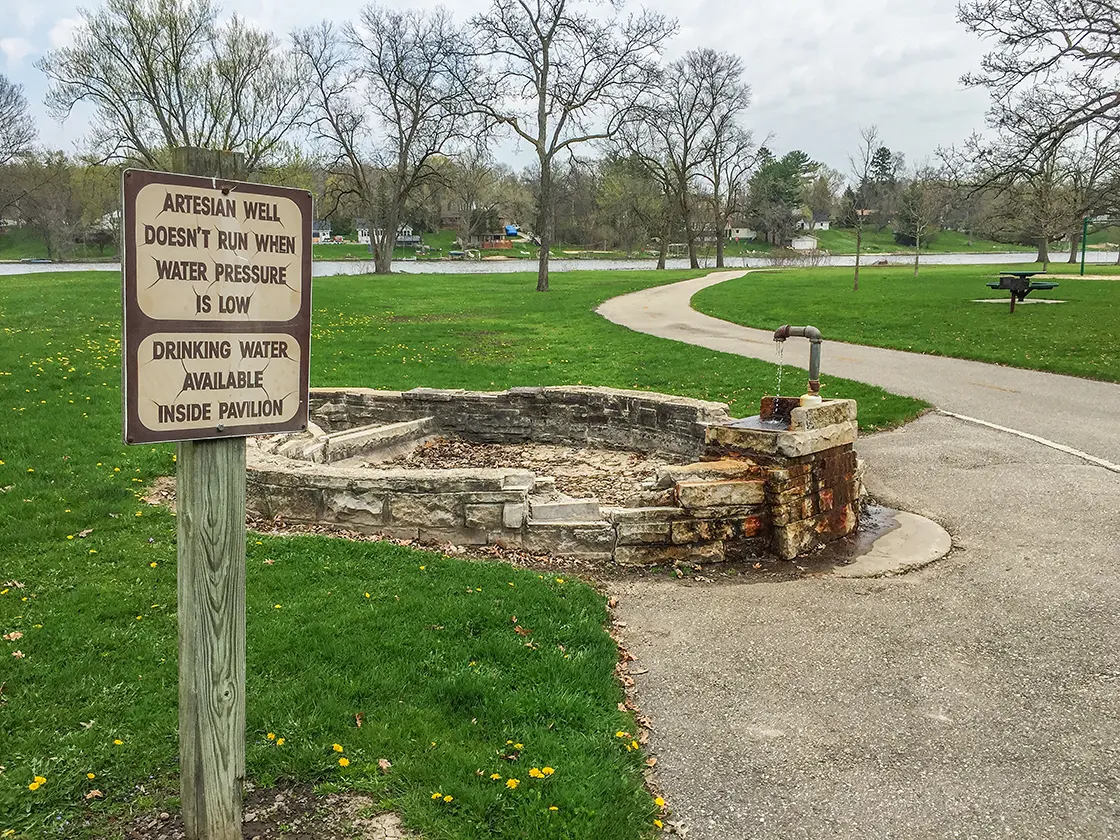
The IAT segment traditionally begins in Riverside Park between an artesian well and a sign making the Kiwanis Trail. I traded in my hiking boots and trekking poles for sandals and a bike on this section of the IAT. The route began beautifully, hugging the banks of the wide Rock River. After one small hill climb, I rolled into downtown where the trail turns to sidewalk - a traditional downtown riverwalk.
 |
| The Rock River downtown Janesville WI on the IAT |
I passed quickly through downtown. The trail does run along a couple of streets through an old industrial area for about 4 blocks. It then becomes bike trail again and crosses the Rock River on a pedestrian bridge. I biked onward past an old ballpark and a state historical marker. The next section of trail meandered through lightly forested areas alongside a stream and highway drainage.
The trail emerged from this shaded area into Palmer Park near Rotary Park Botanical Gardens. The park here was filled with families out for a day of play in the fine weather as well. Further up, the trail cuts through a series of greenways called The Green Belt. After crossing under the highway there is a short segment that skirts around the parking lot of a shopping mall and it is not much further to the Janesville to Milton Segment.
I didn't expect this trail to be as nice and enjoyable as it was. As a bike trail, it is comparable to the Capitol City Trail in Madison or the Oak Leaf Trail in Milwaukee. With a mix of urban areas and parkways there is a lot to do along the trail and access to eateries, bars, and coffee shops - but when you are on the trail it feels like being out in nature and away from it all.
I recommend this trail as a biking, walking, or running destination. Totally worth a drive to check this out.
More pictures below the trail map.
 |
| Biking Along the Ice Age Trail Janesville Segment |
Overview: Ice Age National Scenic Trail - Janesville Segment
COUNTYROCK COUNTY
COMMUNITIES
JANESVILLE
TOTAL MILES
10.4-MILE POINT-TO-POINT
DIFFICULTY
EASY
LOWEST ELEVATION
740 AMSL
HIGHEST ELEVATION
950 AMSL
TOTAL ELEVATION GAIN
1180 FT
TOTAL ELEVATION LOST
-1010 FT
POINTS OF INTEREST
Riverside Park, Rotary Gardens, The Green Belt, Palmer Park, Rock River
NEXT IAT SEGMENT EASTBOUND
JANESVILLE TO MILTON SEGMENT
NEXT IAT SEGMENT WESTBOUND
DEVIL'S STAIRCASE SEGMENT
Directions and Trail Map
DOWNLOAD PRINTABLE PDF USGS TOPOGRAPHIC MAPJANESVILLE WEST QUADRANGLE
DOWNLOAD PRINTABLE PDF USGS TOPOGRAPHIC MAP
JANESVILLE EAST QUADRANGLE
Click Map Image to load the full interactive map.
If viewing on a mobile device, open the trail map above to load into Google Maps App by touching the expand rectangle in the upper right corner
Address for your GPS: 2000 Parkside Dr Janesville, WI 53548.
| coordinates: 42.705840, -89.036439 |
| From Milwaukee | 1.5 Hours |
| From Madison | 45 Minutes |
| From Green Bay | 2.5 Hour |
| From Wausau | 2.5 hour |
| From Minneapolis | 4.5 Hours |
| From Chicago | 2 Hours |
Photos
 |
| Biking Along the Ice Age Trail Janesville Segment |
 |
| Biking Along the Ice Age Trail Janesville Segment |
 |
| The start of the Janesville Segment of the IAT in Riverside Park |
 |
| Biking Along the Ice Age Trail Janesville Segment |
 |
| pedestrian bridge across the Rock River on the Janesville Segment of the IAT |
 |
| Biking Along the Ice Age Trail Janesville Segment |
 |
| Biking Along the Ice Age Trail Janesville Segment |
 |
| Biking Along the Ice Age Trail Janesville Segment |
 |
| Biking Along the Ice Age Trail Janesville Segment |
 |
| Biking Along the Ice Age Trail Janesville Segment |
Links
Ice Age National Trail Alliance
Ice Age National Trail - National Parks Service
Janesville Bike Trails Map

