

There are hiking trails in Wisconsin Dells, and many trails a short drive away. If you use the Dells as a base camp for your vacation, you can get away into the wilderness on many hiking paths at state natural areas and parks that orbit the resort and water park capital of the world. This is true slackpacking: trouncing through the great outdoors by day and relaxing poolside at a resort in the evening.
Here is the short list of recommended scenic hiking trails near Wisconsin Dells:
{tocify} $title={Table of Contents}
$ads={1}
advertisement

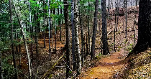
Chapel Gorge Trail at Dells of the Wisconsin SNA
DISTANCE FROM WISCONSIN DELLS5-MINUTES NORTH
COUNTY
COLUMBIA
COMMUNITIES
WISCONSIN DELLS
TOTAL MILES
2-MILES LOOP
DIFFICULTY
EASY
The Dells of The Wisconsin River State Natural Area includes a lesser-known hiking trail that is minutes away from downtown Wisconsin Dells. The trail is an easy and wide two track that makes a loop. It begins in a densely wooded area and leads to a hidden beach along the Wisconsin River where you can get a view into The Narrows.
ARTICLE (WISCONSIN-EXPLORER)

Wisconsin Dells Riverwalk
DISTANCE FROM WISCONSIN DELLSN/A
COUNTY
COLUMBIA
COMMUNITIES
WISCONSIN DELLS
TOTAL MILES
1-MILE OUT-AND-BACKP
DIFFICULTY
VERY EASY
The Wisconsin Dells Riverwalk is paved, and wide. It can accommodate bicycles side by side with walkers and joggers. The trail is ADA accessible. It leads to several scenic overlooks and includes historical monuments that tell the story of Wisconsin Dells over 10 chapters. Stop by the Riverwalk Pub for a beer and burger on the outdoor patio overlooking the River and Riverwalk.
ARTICLE (WISCONSIN-EXPLORER)

Mirror Lake State Park - Echo Rock Trail
DISTANCE FROM WISCONSIN DELLS5 MINUTES SOUTH
COUNTY
SAUK
COMMUNITIES
BARABOO
TOTAL MILES
.65-MILE LOOP
DIFFICULTY
VERY EASY
The Echo Rock hiking trail at Mirror Lake State Park is the best hiking trail in Wisconsin Dells for families with young children. The trail is very easy and paved for most of its length. But, the sights are no less exhilarating than a more difficult hike.
ARTICLE (WISCONSIN-EXPLORER)

Trails at Devil's Lake State Park
DISTANCE FROM WISCONSIN DELLS15 MINUTES SOUTH
COUNTY
SAUK
COMMUNITIES
BARABOO, MERRIMAC
TOTAL MILES
33-MILES NETWORKED TRAILS
DIFFICULTY
EASY-DIFFICULT
Devil's Lake is the crown jewel of Wisconsin parks. The mountain-like scenery and experience at Devils Lake is an anomoly in the Midwest and draws more annual visitors than all but the top four national parks. For an easy walk through scree fields beside the lake try the Tumbled Rocks Trail. For a challenging loop, climb the bluffs along the East Bluff Trail and see Devils Doorway and Balanced Rock before descending and circling the lake with another climb on the West Bluff Trail.
ARTICLE (WISCONSIN-EXPLORER)

Parfrey's Glen State Natural Area
DISTANCE FROM WISCONSIN DELLS20 MINUTES SOUTH
COUNTY
SAUK
COMMUNITIES
MERRIMAC
TOTAL MILES
1-MILE OUT AND BACK
DIFFICULTY
EASY-DIFFICULT
This incredible hidden gorge and waterfall is a spectacular sight. Most of the trail into the gorge is very easy and suitable for any age group or athletic ability. Near the end of the trail, the scene changes. Since a boardwalk washed away in a flood you will now have to walk through a stream and climb over boulders to reach the waterfall. This is a one-of-a-kind diversion for young agile adventurers. Prepare for wet feet.
ARTICLE (WISCONSIN-EXPLORER)

Pewit's Nest State Natural Area
DISTANCE FROM WISCONSIN DELLS15 MINUTES SOUTH
COUNTY
SAUK
COMMUNITIES
BARABOO
TOTAL MILES
1/4-MILE OUT AND BACK
DIFFICULTY
MODERATE
This isn't really a hike, just a short walk to one of the most awesome hidden gorges in America. It is extremely difficult to get a view of the gorge without swimming or climbing on precarious ledges.
Most people who come here will be sorely disappointed that there are no vantage points or official trails that provide even a view of the gorge - much less a way in. The only way in is to 'swim' or wade in. Pewit's Nest is Wisconsin's best hidden swimming hole.
ARTICLE (WISCONSIN-EXPLORER)

Baxter's Hollow
DISTANCE FROM WISCONSIN DELLS20 MINUTES SOUTH
COUNTY
SAUK
COMMUNITIES
NORTH FREEDOM
TOTAL MILES
2.3-MILE-POINT-TO-POINT
DIFFICULTY
EASY-MODERATE
You will feel transported out of Wisconsin on this unusual trail at Baxter Hollow. Seasoned backcountry hikers with trekking poles will make quick work of this 4.6-mile out-and-back. But, regular Wisconsin walkers will be stumbling all the way along this rocky trail which might better be described as a shallow stream bed.
ARTICLE (WISCONSIN-EXPLORER)

White Mound Lake Trail
DISTANCE FROM WISCONSIN DELLS30 MINUTES SOUTHWEST
COUNTY
SAUK COUNTY
COMMUNITIES
LOGANVILLE, PLAIN
TOTAL MILES
2.8-MILE LOOP
DIFFICULTY
EASY
A quiet retreat in a Driftless Area valley, a manmade lake is the central feature of an expansive park that includes horseback riding trails, camping, hiking, swimming, boating, and picnicking. Trails here range from very easy to challenging hill climbs.
ARTICLE (WISCONSIN-EXPLORER)

(IAT) Merrimac Segment
DISTANCE FROM WISCONSIN DELLS20 MINUTES SOUTH
COUNTY
SAUK COUNTY
COMMUNITIES
MERRIMAC
TOTAL MILES
3.6-MILE POINT-TO-POINT
DIFFICULTY
EASY
The Merrimac Segment is a 3.6-mile easy footpath in the Baraboo Hills area. As a section of the Ice Age National Scenic Trail, it connects with the Devil's Lake Segment at the northwest. On the southeast end, there are a few miles of quiet country and city roads to hike between the trailhead and the Merrimac Ferry which shuttles hikers across Lake Wisconsin fee-free; the trailhead for the Gibraltar segment is at the south ferry terminal.
ARTICLE (WISCONSIN-EXPLORER)

(IAT) Sauk Point Segment
DISTANCE FROM WISCONSIN DELLS20 MINUTES SOUTH
COUNTY
SAUK COUNTY
COMMUNITIES
MERRIMAC
TOTAL MILES
4-MILES POINT-TO-POINT
DIFFICULTY
DIFFICULT
This segment of the Ice Age National Scenic Trail connects Parfrey's Glen with Devils Lake State Park. It includes a level 4 mountaineering rated climb, a two-mile-long ascent of 775 feet. The trail meanders through shaded hardwood forests on a single track footpath. This is a favorite of trail runners in the area.
ARTICLE (WISCONSIN-EXPLORER)

Lone Rock Trail at Quincy Bluff SNA
DISTANCE FROM WISCONSIN DELLS30 MINUTES NORTH
COUNTY
ADAMS
COMMUNITIES
FRIENDSHIP
TOTAL MILES
8.5-MILES LOLLIPOP
DIFFICULTY
EASY
Quincy Bluff and Wetlands State Natural Area is a sprawling wildlife area including two hiking trails. The Lone Rock trail is long and traverses through more wild areas of the preserve. You might see a wolf or a bobcat if you are lucky. You can also try scrambling to the top of picturesque Lone Rock.
ARTICLE (WISCONSIN-EXPLORER)

Quincy Bluff SNA
DISTANCE FROM WISCONSIN DELLS30 MINUTES NORTH
COUNTY
SAUK
COMMUNITIES
FRIENDSHIP
TOTAL MILES
2.9-MILE LOOP
DIFFICULTY
MODERATE
The other hiking trail in Quincy Bluff State Natural Area is an easy two-track trail that is excellent for families and not too long. You'll get a taste of the wild side without getting too far into the wilderness. This would be an excellent place for a rustic picnic beneath the trees.
ARTICLE (WISCONSIN-EXPLORER)

Ice Age Trail - Gibraltar Segment
DISTANCE FROM WISCONSIN DELLS30 MINUTES SOUTH
COUNTY
COLUMBIA
COMMUNITIES
LODI
TOTAL MILES
4.6-MILES POINT-TO-POINT
DIFFICULTY
MODERATE
Cross Lake Wisconsin via the Merrimac Ferry. On the south side of the crossing, you can park at the Ferry landing and head out on the extremely beautiful Gibraltar Rock Segment of the Ice Age National Scenic Trail. Or, you can drive a few miles down the highway and take a short walk to the top of Gibraltar Rock State Natural Area - the highest point in Columbia County. This is a fantastic can't miss trail experience in the Wisconsin Dells area.
ARTICLE (WISCONSIN-EXPLORER)

Buck Fever Trail at Hemlock Draw SNA
DISTANCE FROM WISCONSIN DELLS30 MINUTES SOUTHWEST
COUNTY
SAUK
COMMUNITIES
NORTH FREEDOM
TOTAL MILES
1.8-MILES LOOP
DIFFICULTY
DIFFICULT
ARTICLE (WISCONSIN-EXPLORER)

Ferry Bluff State Natural Area
DISTANCE FROM WISCONSIN DELLS40 MINUTES SOUTH
COUNTY
SAUK
COMMUNITIES
SAUK CITY
TOTAL MILES
1-MILE OUT AND BACK
DIFFICULTY
DIFFICULT
This is a short walk up an established trail and stairs to a high bald rock overlooking the Wisconsin River. This amazing place is a treat for people of all fitness levels. This place should be a must-do on everyone's summer bucket list.
ARTICLE (WISCONSIN-EXPLORER)

Natural Bridge State Park
DISTANCE FROM WISCONSIN DELLS40 MINUTES SOUTHWEST
COUNTY
SAUK
COMMUNITIES
NORTH FREEDOM
TOTAL MILES
1.5-MILES LOOP
DIFFICULTY
MODERATE
A monumental sandstone arch and Paleoindian dwelling site are the star features of this easy 1.5-mile loop. The natural rock bridge found here is the largest in Wisconsin and comparable to the famous arches found in Utah. You can continue walking for up to 6 miles through woodlands and prairie.
ARTICLE (WISCONSIN-EXPLORER)
Hemlock Hardwoods Mt Pisgah State Natural Area
DISTANCE FROM WISCONSIN DELLS1-HOUR HWEST
COUNTY
VERNON COUNTY
COMMUNITIES
LA FARGE
TOTAL MILES
3-MILE LOLLIPOP
DIFFICULTY
MODERATE-DIFFICULT
The Kickapoo Valley Reserve is a bit of a drive from Wisconsin Dells, but it is a beautiful scenic drive through Wisconsin's Driftless Area. The hiking trail is worth it on all accounts and in all seasons. It's a beautiful mountain-like escape into a deep 400-year-old white pine forest and includes a level 5 mountaineering rated climb to an overlook where eagles soar.
ARTICLE (WISCONSIN-EXPLORER)
It's amazing place to go for trip & I'm really impressed to see this wonderful picture of this place.
ReplyDeleteThank's for tips. images are very nice. Thank you for this blog post! it's a very useful post. I just got into camping two years ago and absolutely love it. I stayed at Dinosaur campground for two nights the first week of September last year. My experience could not have been more perfect. I went solo with a tent. This year I would like to try Writing. Thank you.
This is a fantastic post
Great place for hiking! So love the view.
ReplyDeleteThanks for sharing.
Thanks for writing this! My family of 5 hiked into Parfrey's Glen and it was amazing! Easy at first, and adventurous at the end. Would not have found it without you!
ReplyDeleteThis comment has been removed by a blog administrator.
ReplyDeleteJust got back from the Dells. Your blog provided the most and best information on hiking opportunities in the Dells. This was our first encounter with ticks - lots of ticks. Do you have a definition of level 4 and 5 mountaineering rated climbs? I'm curious.
ReplyDelete